Anaga Park and Punta de Hidalgo – Trekking in Tenerife
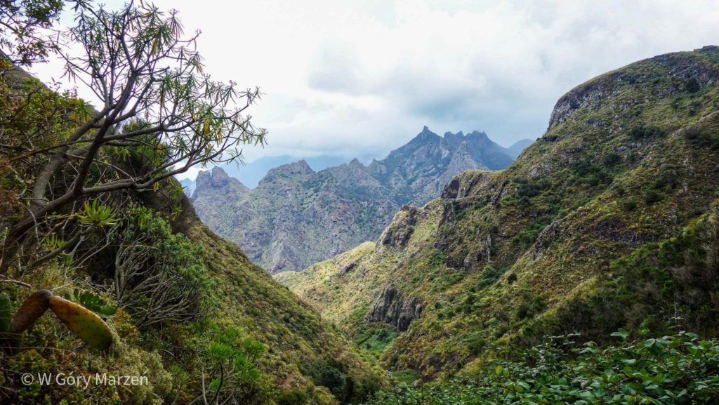
Anaga Park is a wonderful landscape area located in the north-east of Tenerife. It is an incredibly diverse and green place. Due to their location in the north of the island, the mountains retain heated evaporating water from the Atlantic Ocean, which accumulates in the mountains. Hence the heavy rainfall and wonderful greenery on the island! In addition, the Park has the largest number of endemic plant species per square kilometer in Europe. There is a lot to know 🙂
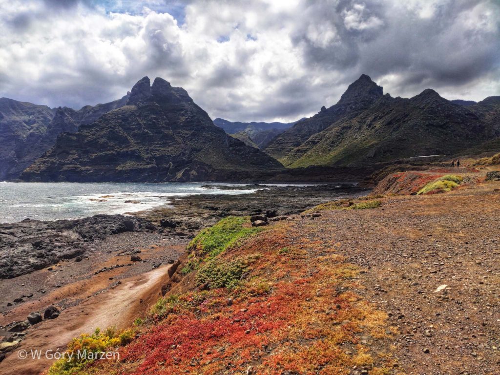
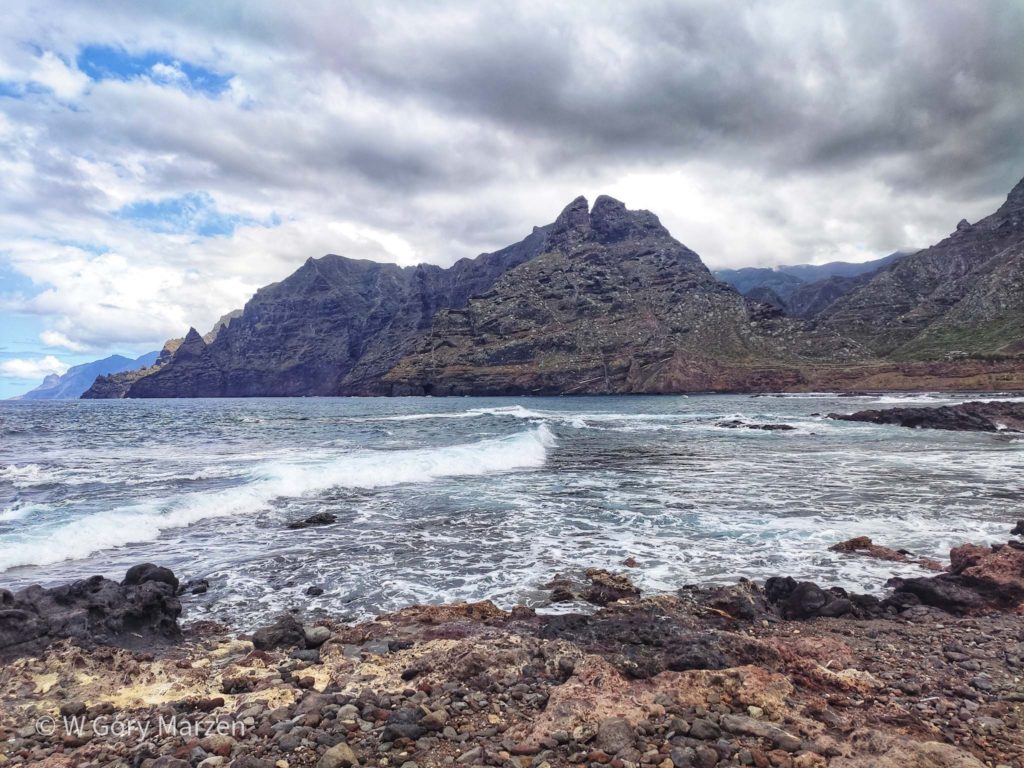
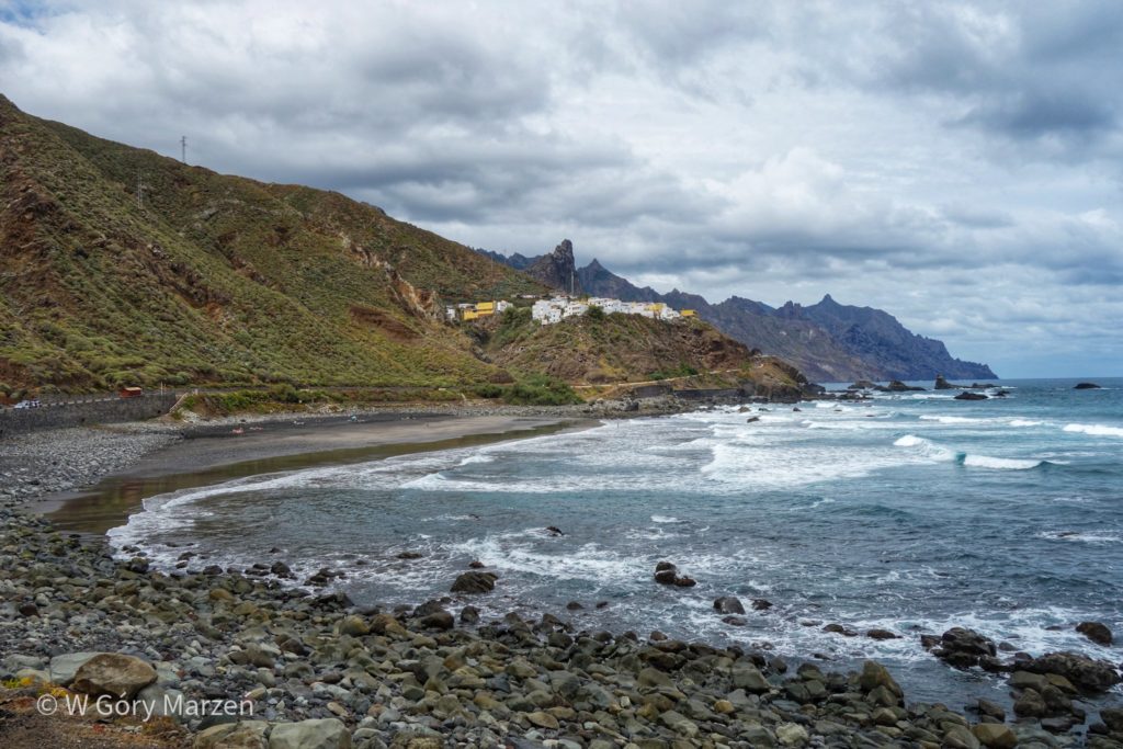
I just spent the first days in Tenerife visiting the Anaga Park. The starting point for trekking was the town of Punta de Hidalgo,which we can reach by bus 105 from Santa Cruz de Tenerife or the transfer station in the city of La Laguna. It is picturesquely located, on one side there is the Atlantic Ocean, and on the other high, green Anaga Mountains.
Trekking in Anaga Park
During the expedition I went on three trekking in the Anaga Mountains. Below is a description of each of them 🙂 During the expeditions I mainly use maps maps.me, but in the park they sometimes run along unmarked trails. It’s good to make sure we’re on the right path. There are no sources with drinking water on the trails. Sometimes, in some villages, a shop is open. That’s why it’s a good idea to prepare food and drink before you go trekking.
More marked trails in The Anaga Park and throughout Tenerife can be found on the tourism page here.
Trekking I: Punta de Hidalgo – Chinamada – Taborno – Afur
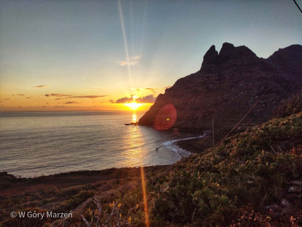
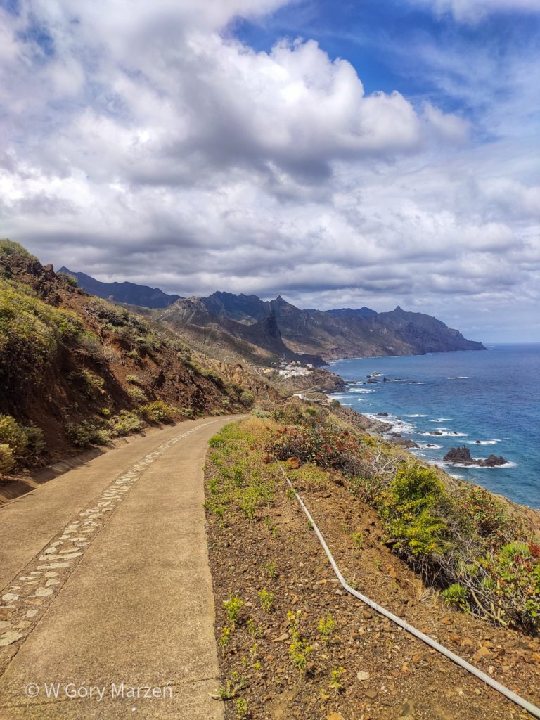
The first trekking in Tenerife that I went through was the trail leading to Afur, through the town of Chinamada. Trekking starts in Punta de Hidalgo, where we have accommodation. We head towards the last bus stop where the trail marked as the road to Chinamada begins. We set off on the trail at sunrise, which is perfectly visible from the beginning of the trail. We leave around 7 o’clock and get to the sunriseperfectly. Beautiful are such surprises on the trip!
Punta de Hidalgo – Chinamada
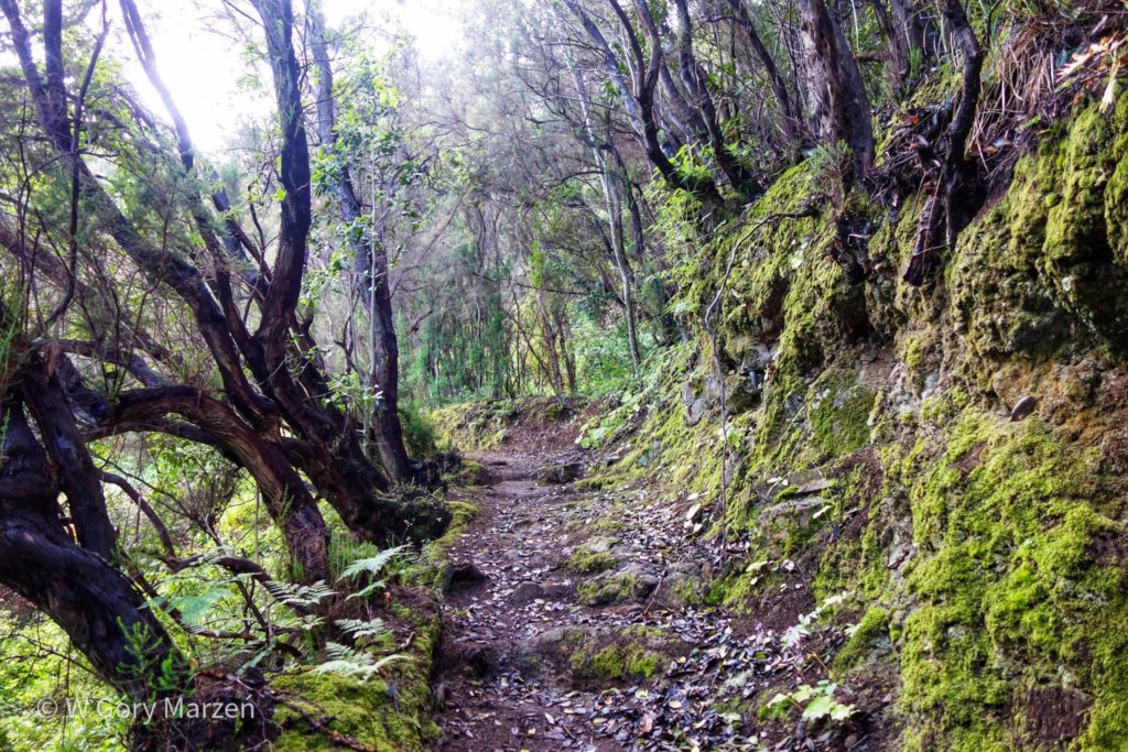
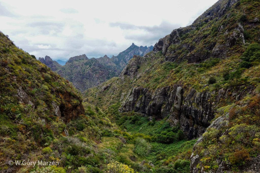
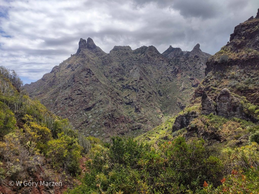
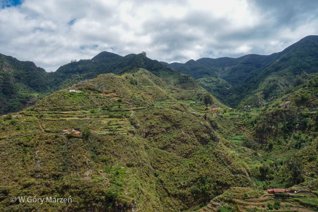
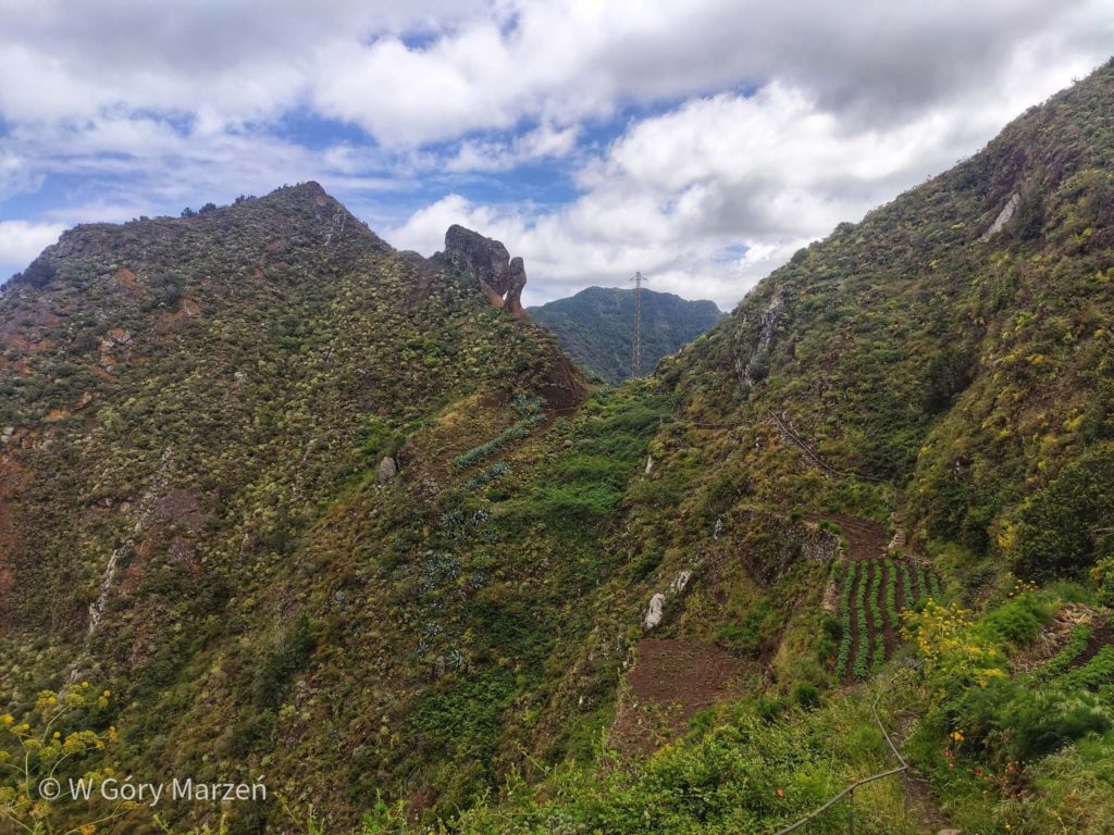
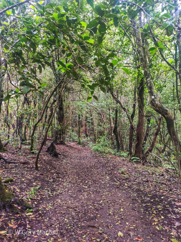
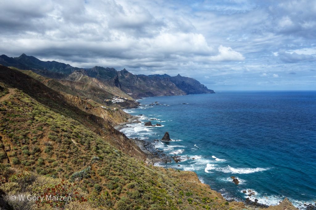
From the stop we go down towards the beach, but after reaching the water level we beat according to the yellow marking on the route. The first kilometers on the trail are quite a steady road with stairs uphill. There are a lot of cacti, prickly pears and plants completely unknown to me before. Gradually, we gain altitude by circling the best-seen mountain from Punta de Hidalgo – Dos Hermanos (which means two brothers – by the appearance of the mountain we can guess why). We come to the first viewpoint at a height of approx. 280 meters above sea through the sea. From it you can see The Dos Hermanos mountain from the other side. The sun slowly rises above the horizon and we move on.
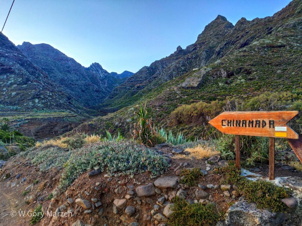
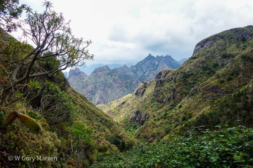
Above, the first trees appear, and on the right side there is a beautiful view of the valley of the Barranco del Río river and the peaks towering above it. After about 2 hours and walking 5 kilometers we reach Chinamada. There we retreat several dozen meters to the Mirador de Aguaide viewpoint. However, just before entering its brick part there is information about the danger and possible collapse. That is why we arranged a stop a little above. Chinamada is located at an altitude of about 580m above sea level.
Chinamada – Las Carboneras
The next stage to the town of Las Carboneras begins on an asphalt road. The whole section is about 2 kilometers, but after a while we go down to the forest path. Here nature is characterized by deciduous trees. After half an hour of walking we reach the town. At its end there is a small shop and an information sign telling where the name Las Carboneras comes from. And this is not from the type of spaghetti, but from the specific process of transformation of wood into coal to prevent fires.
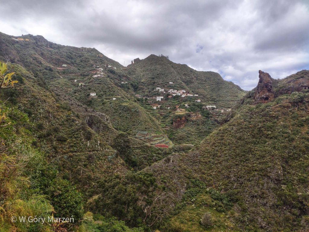
Las Carboneras – Taborno
Now we have to go downstairs to start going up again in the middle of the route. We walk through an interesting forest, the stones are overgrown with moss, and the ground is red in places. After about an hour we reach Taborno. We are happy with the open restaurant, where we can drink delicious coffee. From the town we can admire the panorama of the surrounding mountains.
Taborno – Playa de Tamodiste – Afur
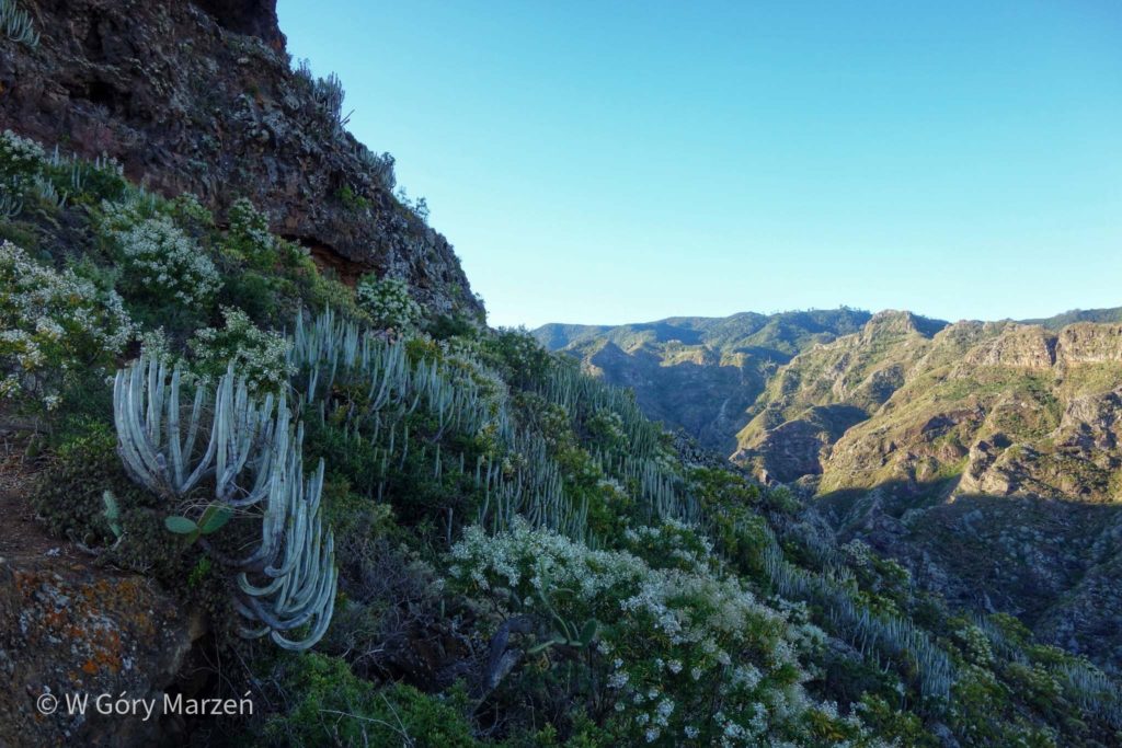
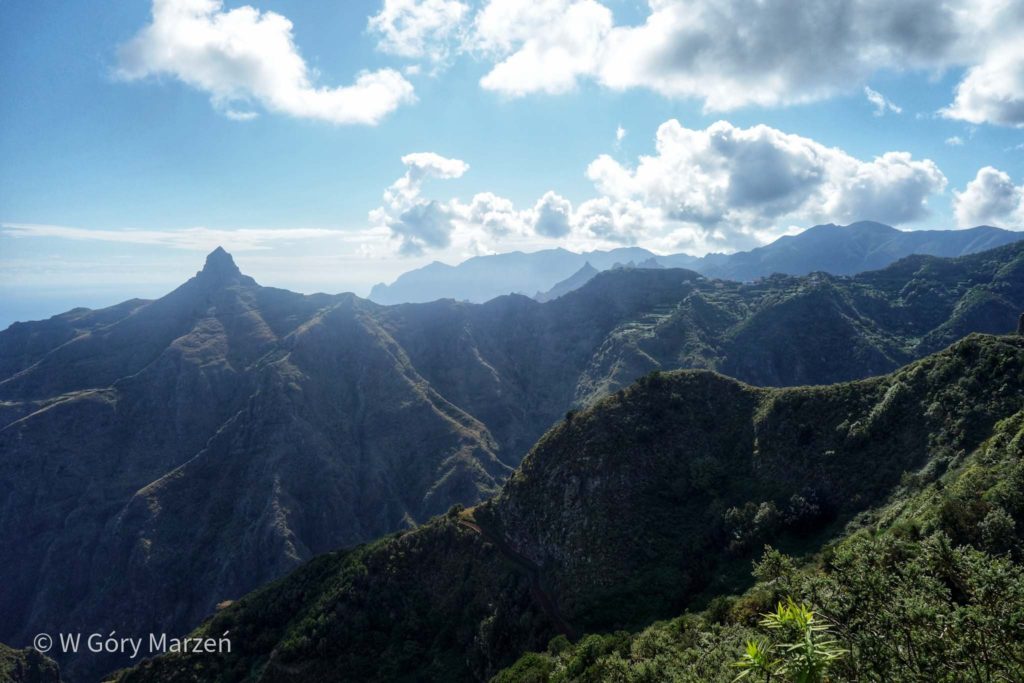
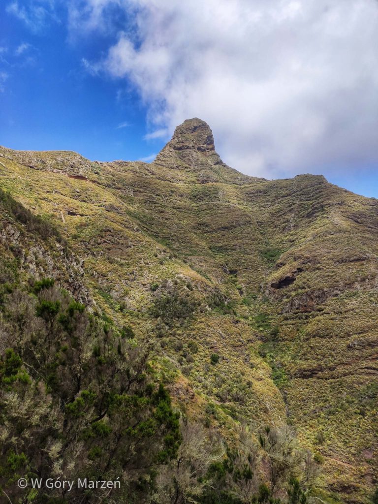
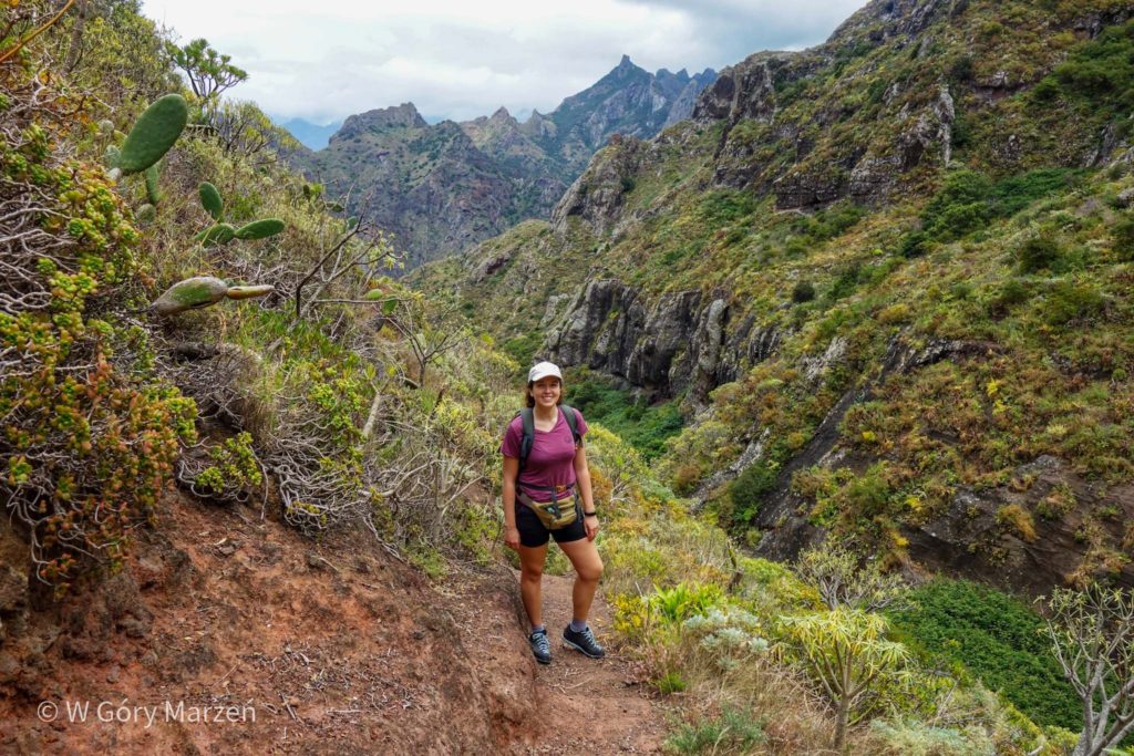
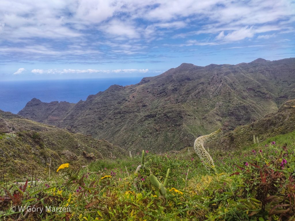
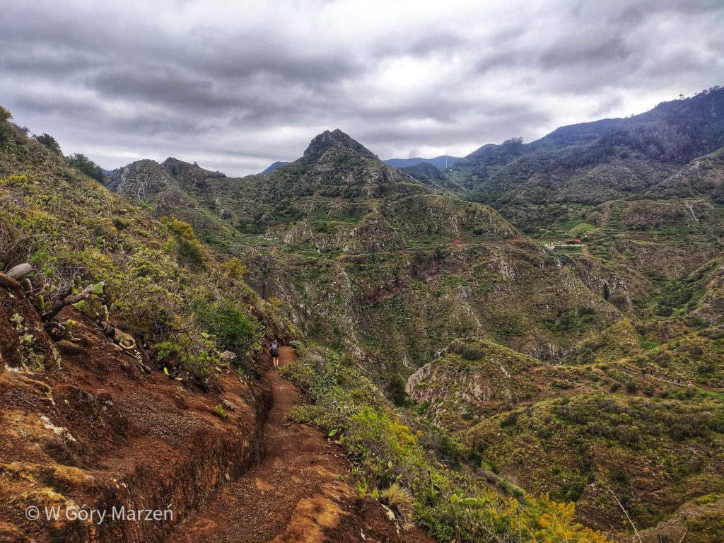
From Taborno there is an official walk to the viewpoint on Roque de Taborno or straight to the town of Afur. However, we followed the route marked out by maps.me to the beach of Playa de Tamodiste. It was quite a risky decision, especially since there was a PELIGRO sign (danger) before entering the path. Therefore, I also do not recommend walking on unmarked trails, especially when the trail may be wet.
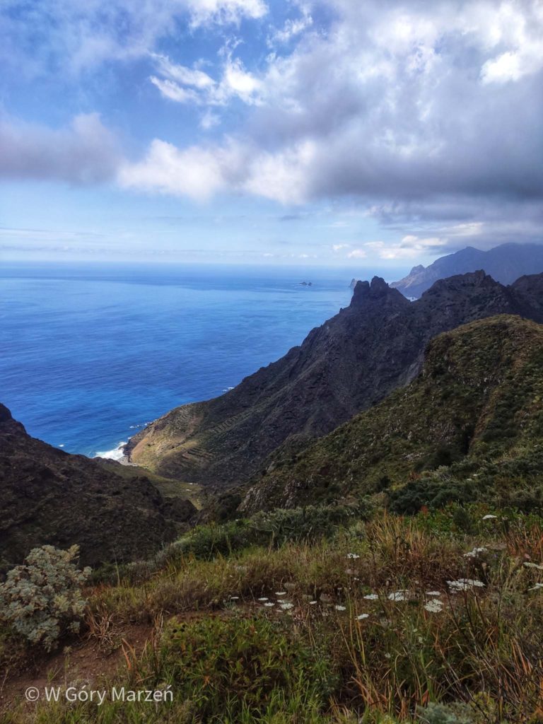
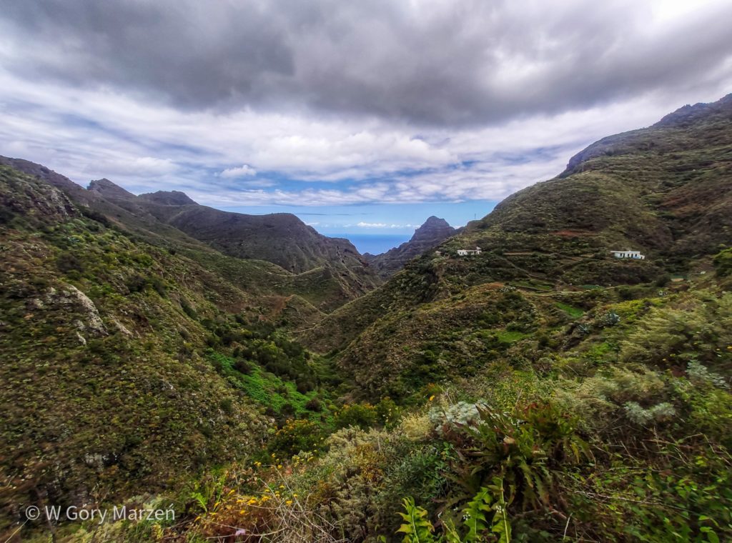
The trail was apparently very little frequented. For most of the route you had to break through meadows, bushes and bushes. Sometimes there was a hole on the path, which had to be noticed, because next to it there was a precipice. The road led about 600 meters down, sometimes really steep sections. There were 4 waterfalls marked on the map, but from my observations only the remnant of one was off the trail. Unfortunately, at the end of the descent I had a knee injury, which led to a change in the original plans from reaching the town of Taganana to approaching the closer Afur and influenced the choice of further routes in the Park.
The road to Afur starts along the river, when it rains heavily, it is also a route advised against due to the possibility of flooding. We have to overcome a road with a length of 2.5 kilometers and 200 meters up. In Afur, we are waiting for a bus in the iconic josé cañón bar, where the owner collects numerous bottles of alcohol received from tourists from all over the world. The bus to La Laguna runs only a few times a day, so it’s worth making sure that we make it to the last one. From Afur to Punta de Hidalgo we drive with a change of about 1.5-2 hours. The entire route is about 16 kilometers.
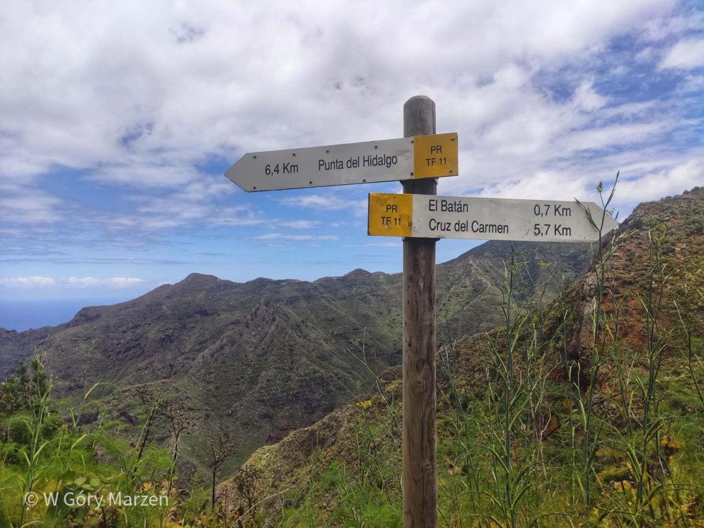
Trekking II: Punta de Hidalgo – Cruz del Carmen
The next day we go trekking to the Cruz del Carmen viewpoint. After a knee injury, I decided to take a one-way trip – just approach Cruz del Carman and return by bus. However, you can extend the route and walk to Chinamada, and from there to the starting point in Punta de Hidalgo.
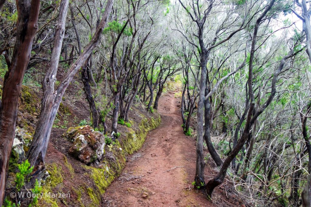
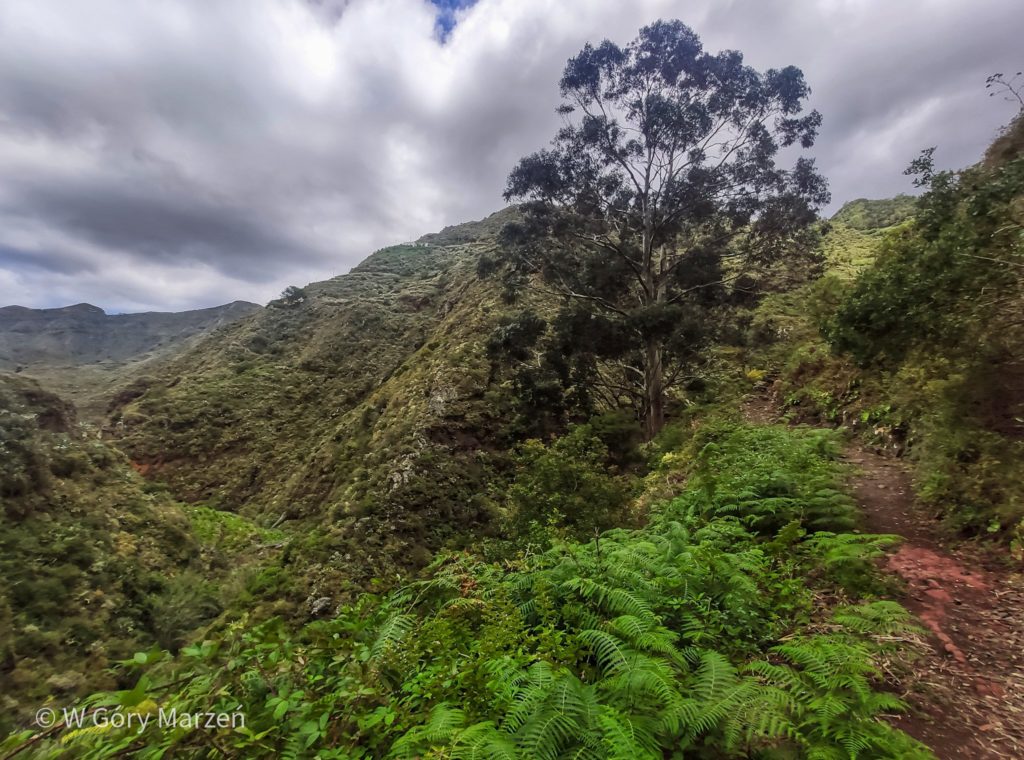
Trekking begins in Punta de Hidalgo with a very steep climb along the asphalt street Camino el Callejon. After this approach, all the others seemed quite flat 😀 We are just stopping on this street, so we go straight from the apartment to the route. The road is really steep, very quickly we gain height and view of the whole town. After a steep climb, a passage through a silver forest that grows on red earth awaits us.
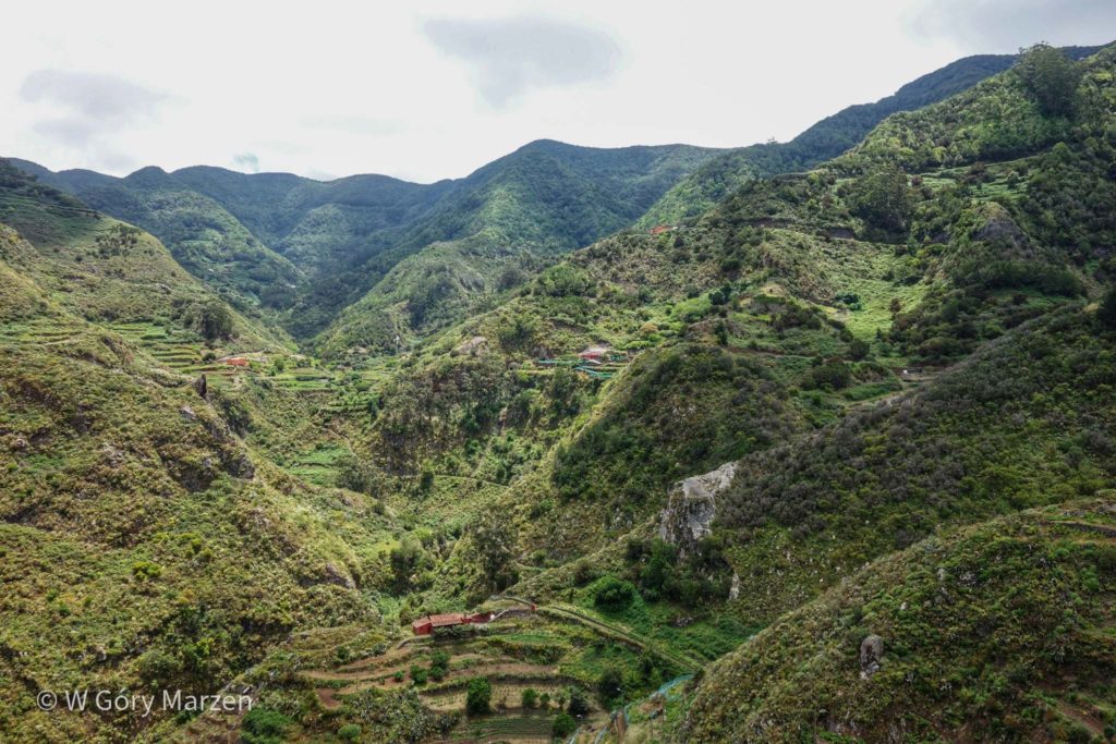
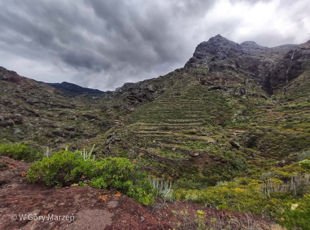
After leaving the forest, the view of the valley and the towns located on the slopes of the mountains begins. At the settlements there are picturesque potato terraces 😀 On the route we do not meet any tourists. Slowly, enjoying the views, we go up. The first town encountered on the route is Bejía,where there is another viewpoint.

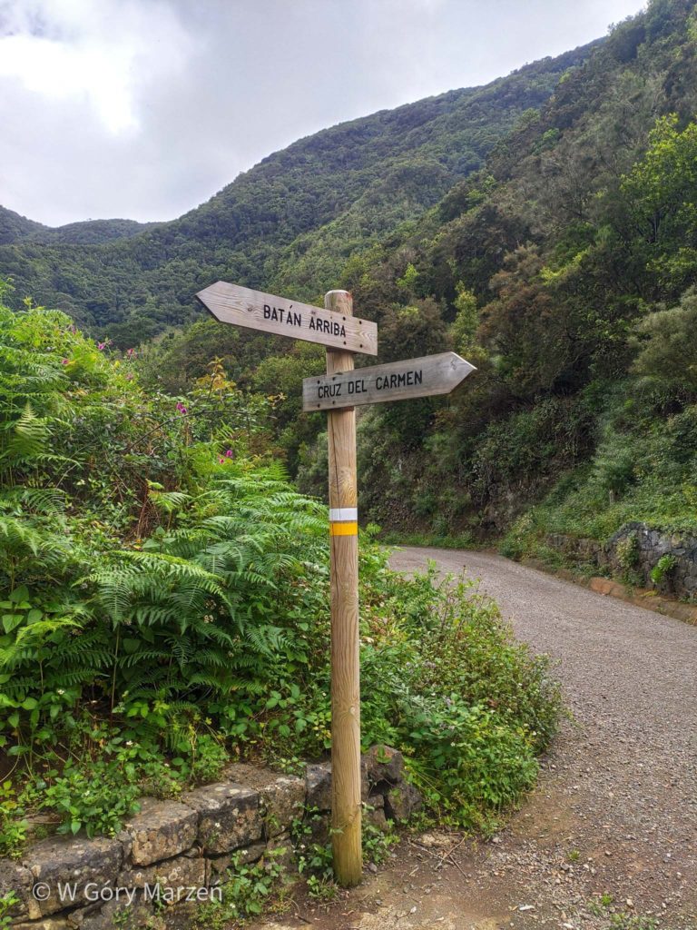
The next point on the route is the Batan de Arriba Pass. Behind the pass there is a section leading down. After passing the town of Batan, a long uphill climb awaits us, up to the end point of Cruz del Carmen.
The last section leads through a dense forest. It’s such a good fitness training for Teide 😉 At the very end of the path we have the opportunity to walk along the path “La Hija Cambada”. In Cruz del Carmen there is a viewpoint, a restaurant, tourist information and a bus stop. However, it is difficult to check the arrival time of the bus on it when we do not have access to the Internet. I recommend asking about the schedule in the restaurant 🙂
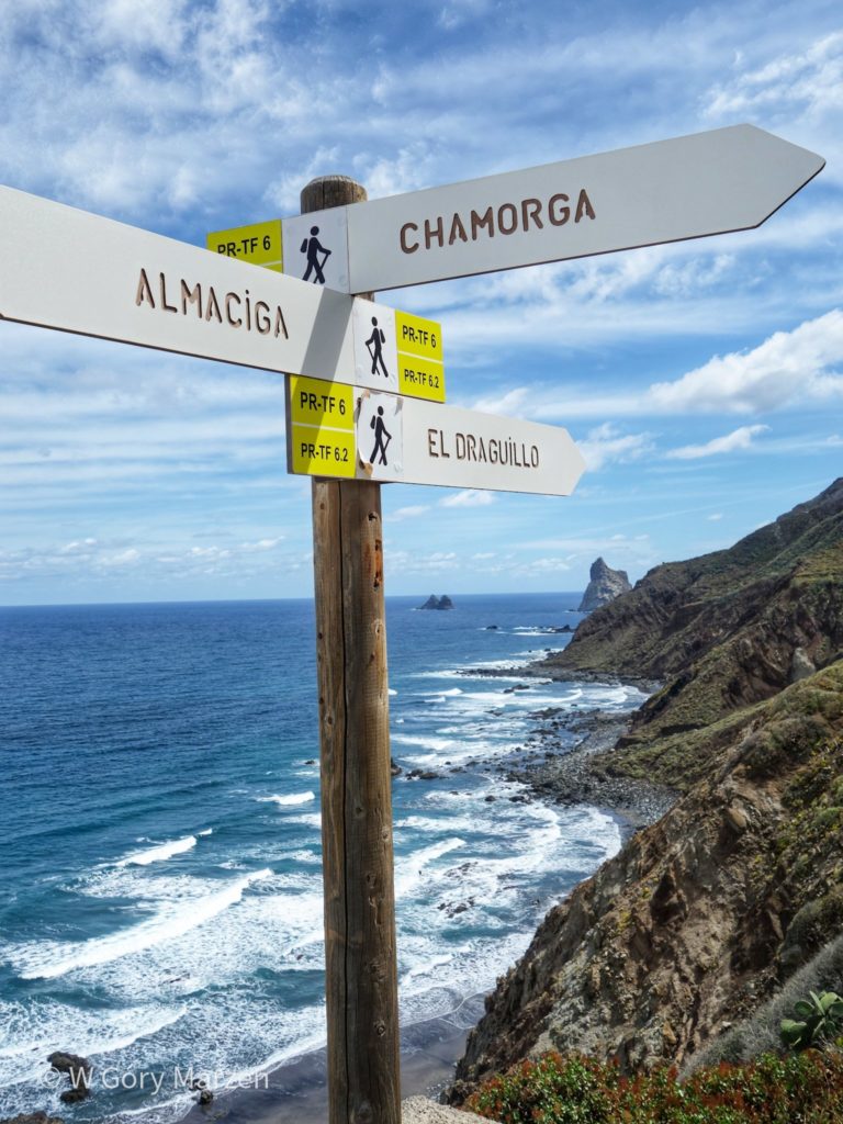
Trekking III: Almáciga – El Draguillo
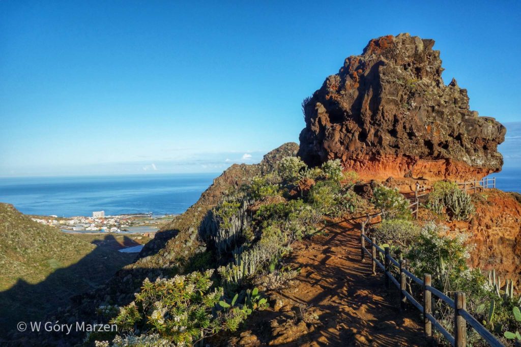
The last trekking in The Anaga Park is a short walk from the town of Almáciga to the town of El Draguillo along the route on the shore of the ocean. We reach Almáciga by bus from Santa Cruz de Tenerife.
On the way we pass the beach Playa de Almáciga, where there are quite good conditions for surfing. The road offers cool views with little effort 🙂 After reaching El Draguillo, we can go on further trekking to Chamorga. However, we are waiting for an approach about 500 meters up, so I give up and go to the beautiful beach of Playa de Almáciga.
Other trekking on the island
- In Tenerife, trekking to mount Teide is also worth a visit. You will find the whole climbing description in this post.
- Another trekking is the passage through the Barranco de Masca gorge. Description and useful information in this post.
- Other interesting places on the island in the post about the attractions of Tenerife here.
Tenerife offers many trekking opportunities, and Anaga Park is a great choice in this regard. Lots of greenery, interesting vegetation, beautiful beaches and wonderful views!
If you find this post useful and feel like supporting my activities, you can give me a coffee by clicking on the link below. Thank you!

Zuzanna
Hi! My name is Zuzanna, I am from Poland. I love traveling, hiking and doing yoga. Spain is my favorite destination, I walked several Camino de Santiago roads there. I created this blog to share my travel experiences.
You May Also Like
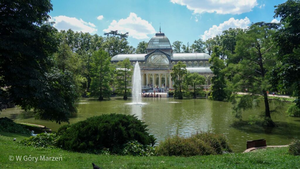
Madrid – what to see in Madrid
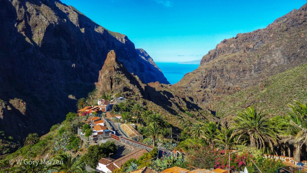
Masca – trekking through the Barranco de Masca in Tenerife