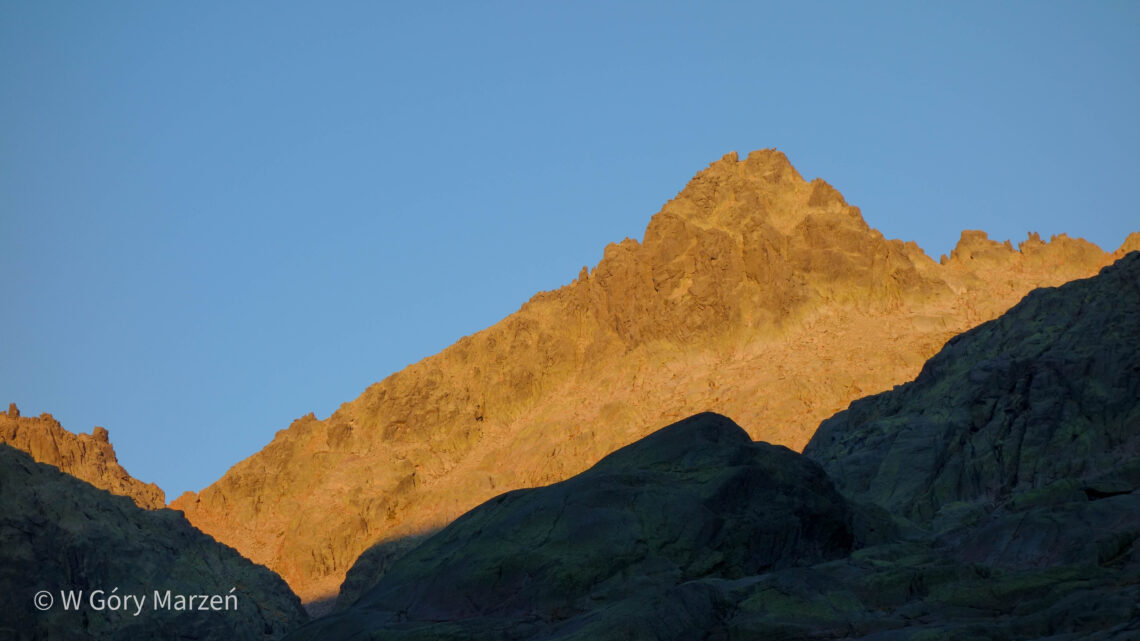
Almanzor – Sierra de Gredos, way to the highest peak of 2592m
Almanzor (2592m) is the highest peak of the Sierra de Gredos mountain range in Spain. It is located in the central massif of the Iberian Peninsula, west of Madrid, on the border of the autonomous communities of Castile and Leon and Extremadura. Beautiful rocky peaks, mountain lakes and plenty of chamois – that’s the Sierra de Gredos in a nutshell, especially the Circo de Gredos chain.
I went to Sierra de Gredos in mid-August. From my research, the best and practically the only way to get to the trail (other than a long walk) is to get to the parking area by car. Therefore, additionally wanting to try out life in a van, we rented a larger car with the necessary lodging equipment and headed into the mountains.
The total route to Almanzor measures about 18 kilometers (both ways) and 1,200 meters of elevation gain. We divided the ascent into two stages: on the first day in the evening we reached the area of the Refugio Laguna Granda refuge, and the next day we climbed to the top of Almanzor and returned to the car and to Madrid.
Below is a description of the ascent to the summit of Almanzor in the middle of summer 🙂
Start of the trail – Plataforma de Gredos parking
The trail to the summit of Almanzor begins at the Plataforma de Gredos parking. This is also the same trail that goes to the Refugio Laguna Grande hut and Laguna Grande pond. The parking lot is located 12 kilometers from the town of Hoyas de Espinos. In the middle of the trail, at kilometer 6, there are gates where we need to but a ticket. A fee (3 euros) must be paid to access further parking, but only during specific hours:
- from July to September, from 8 am to 8 pm,
- the rest of the year, from 9 am to 6 pm.
The fee is only for entry during designated hours. Since we arrived at the trail just after 8 pm, we skipped the parking fee. You can leave your car in the parking area at night. There are 150 parking spaces and a bar on the spot. If you are going to the trail in the summer, it is advisable to arrive early to ensure a parking space.
Trail to Refugio Laguna Grande
We set off on the trail at around 8:20 p.m. That day we plan to reach the area of Refugio Laguna Grande shelter and Laguna Grande and spend the night there. The trail to the shelter is wide and clearly visible. We have about 6.8 kilometers to walk to the shelter from the parking area, about 450 meters of elevation gain up and 250 meters down. It takes about 2 hours to traverse this stage.
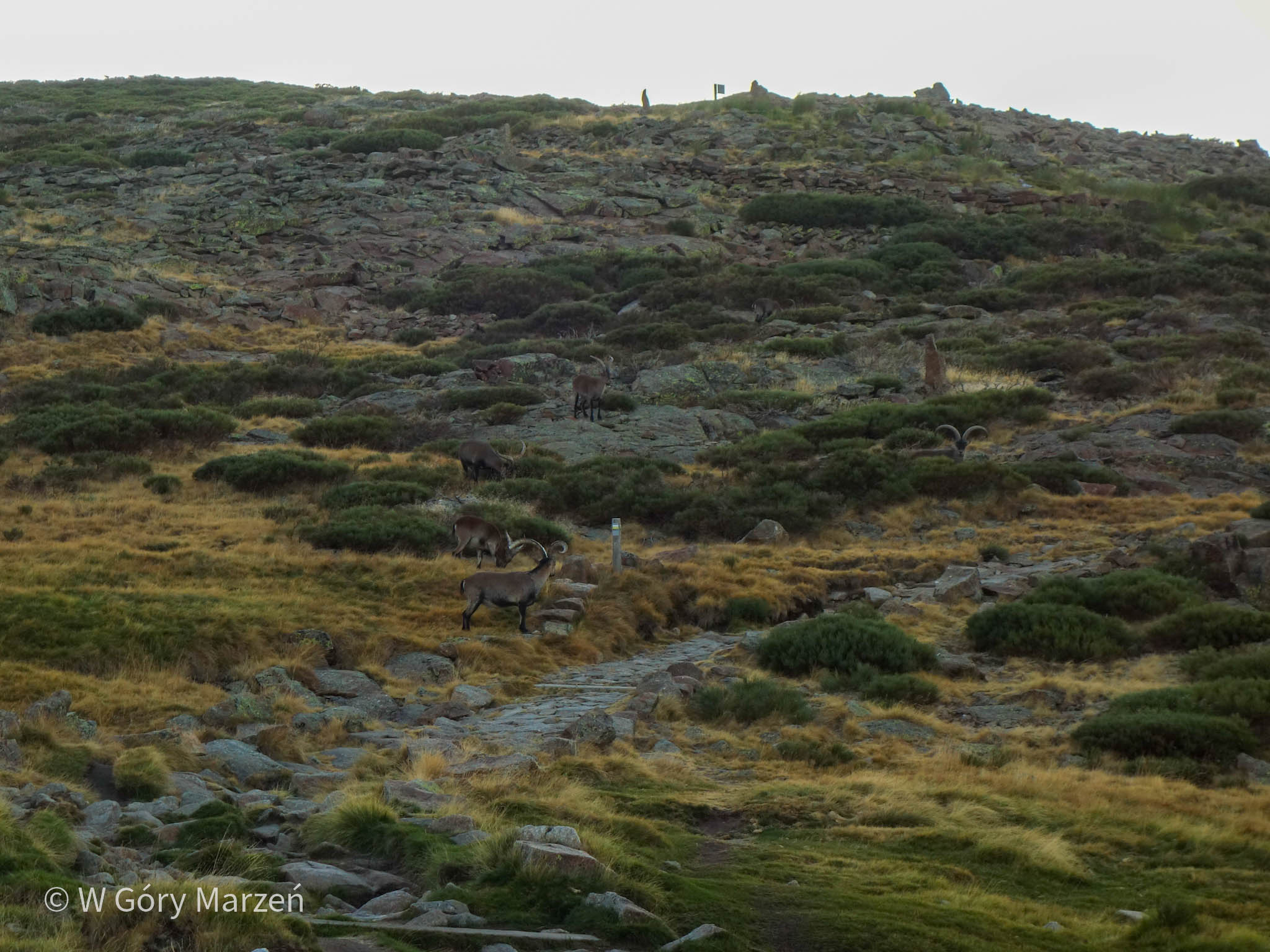
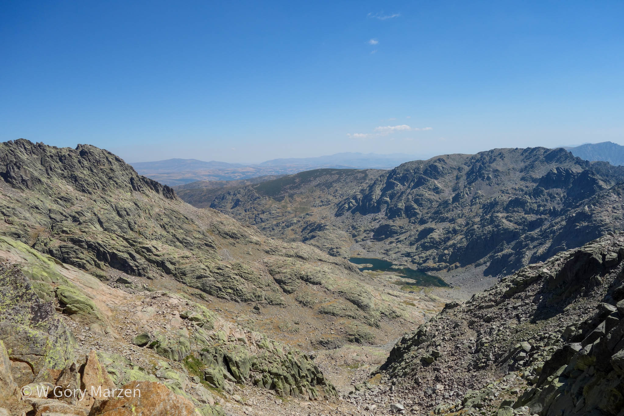
From the Plataforma de Gredos parking lot (about 1750m above sea level), we set off on a wide, rocky trail around which cows graze. After about 1.5 kilometers there is a concrete bridge over the river, after crossing which the ascent to the Mirador Circo de Gredos viewpoint begins. Along the way we pass herds of goats, including one that has approached a group of boys taking a break and eating cookies. The animals are looking for food, are not afraid of people and almost, attack the boy with the cookies. We bypass the herd with an arc and move upwards. There is a fountain in front of the peak and viewpoint.
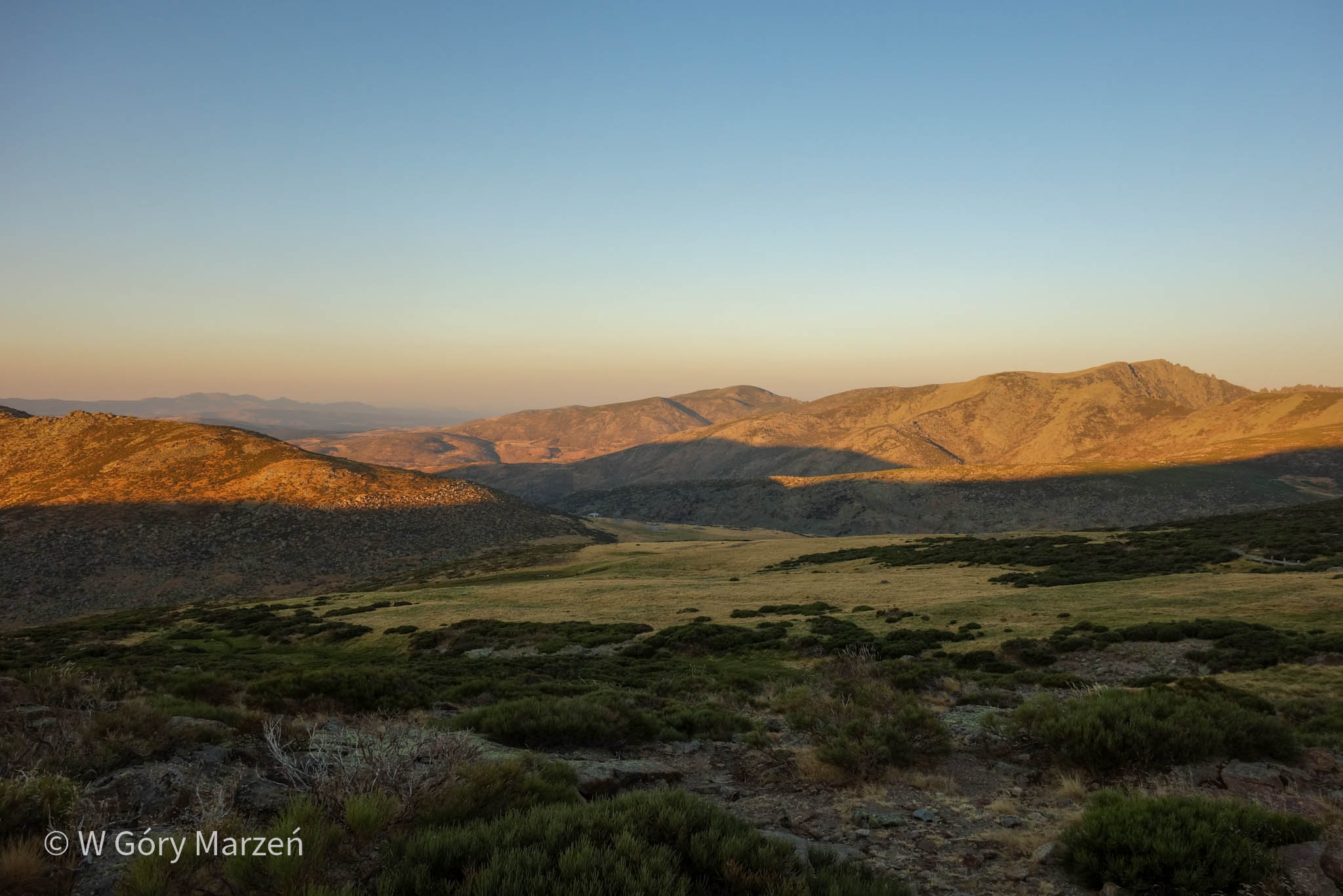
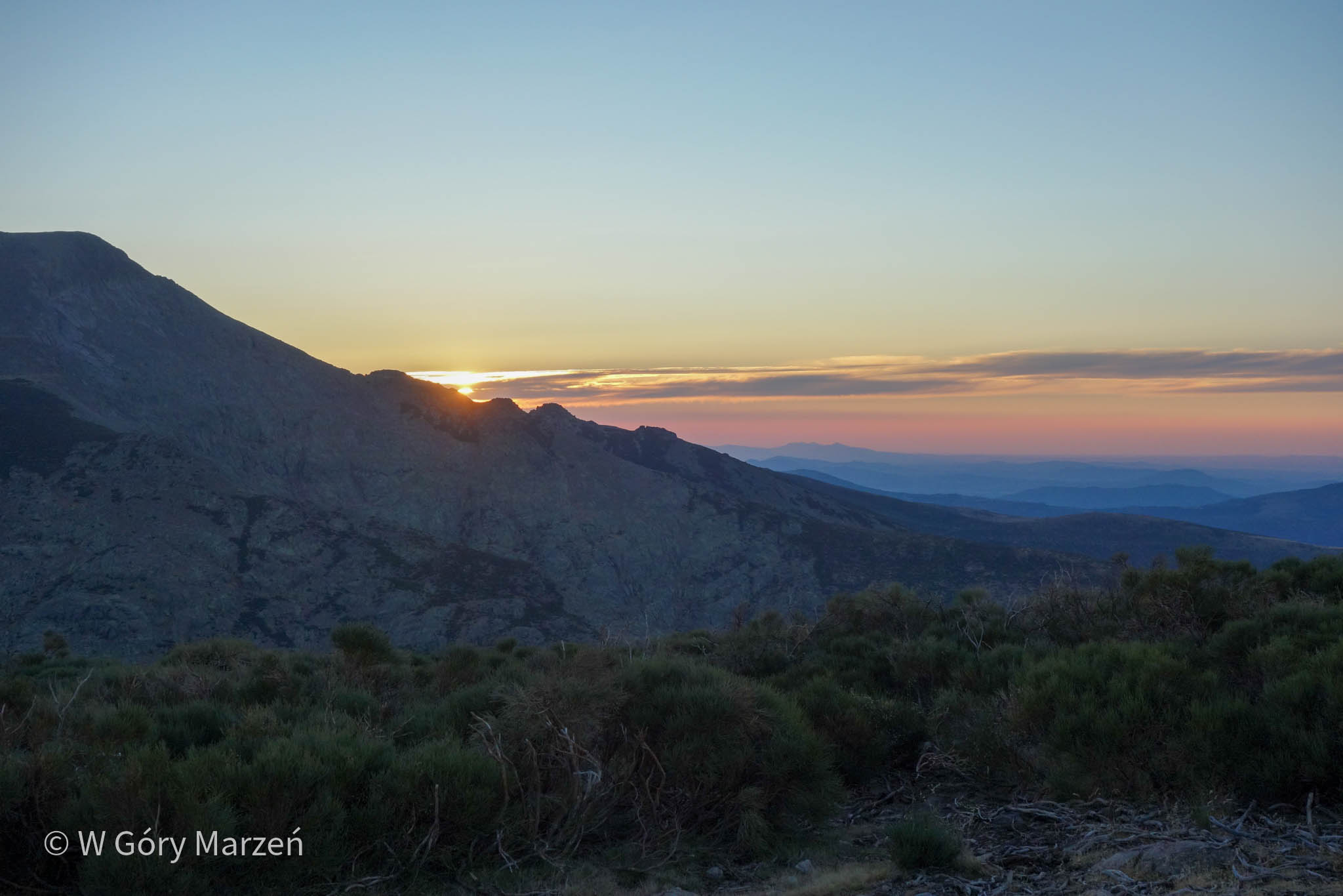
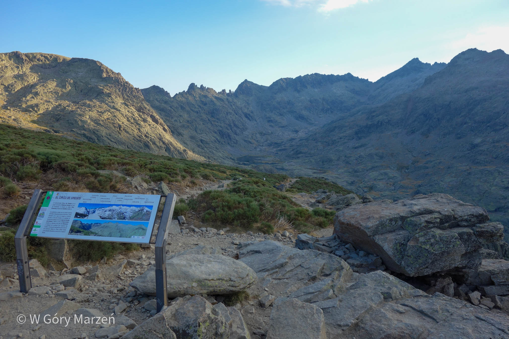
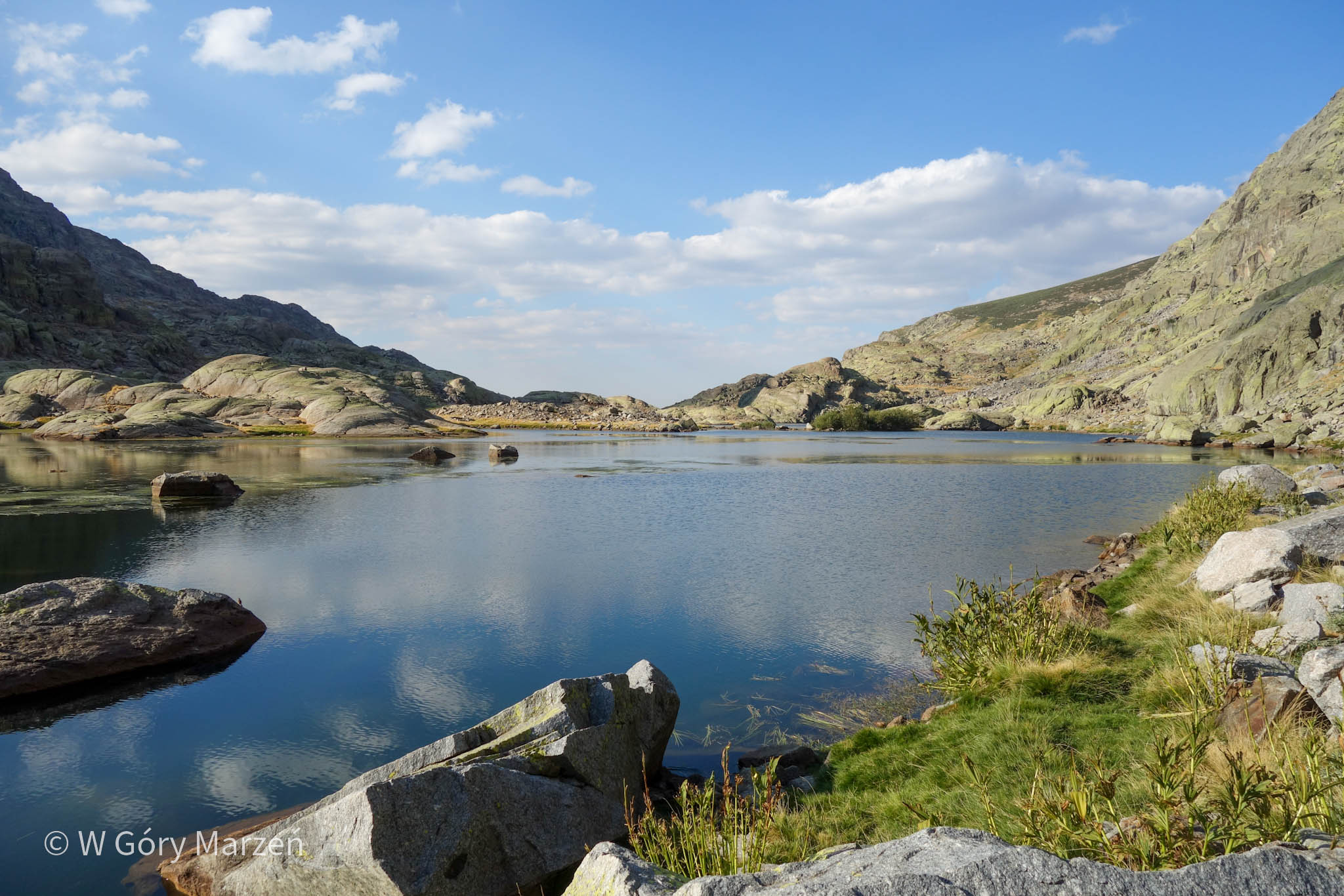
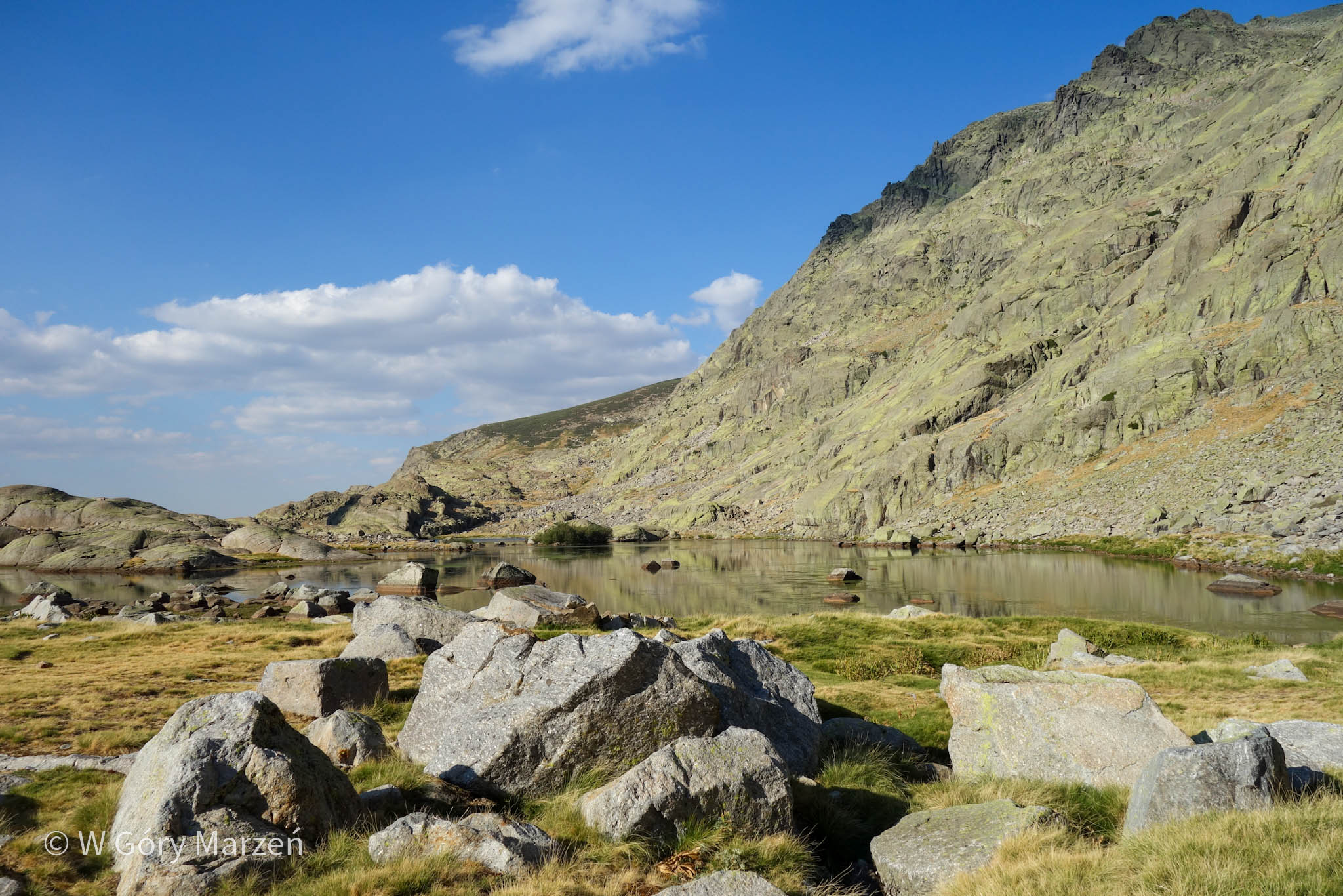
We arrive in the area of the viewpoint after about an hour, just at the moment of sunset. A beautiful view of the Circo de Gredos panorama is waiting for us – the highest peaks of the Sierra de Gredos range. We move on, as we have an hour of walking left, and it is getting darker with every minute. Behind the viewpoint there is another fountain, where we fill up with water for our evening bivouac. We descend about 200 meters down to the shelter and lake. For the last half hour we have already had to use headlamps. Fortunately, the route is straightforward and it was easy to find a good path.
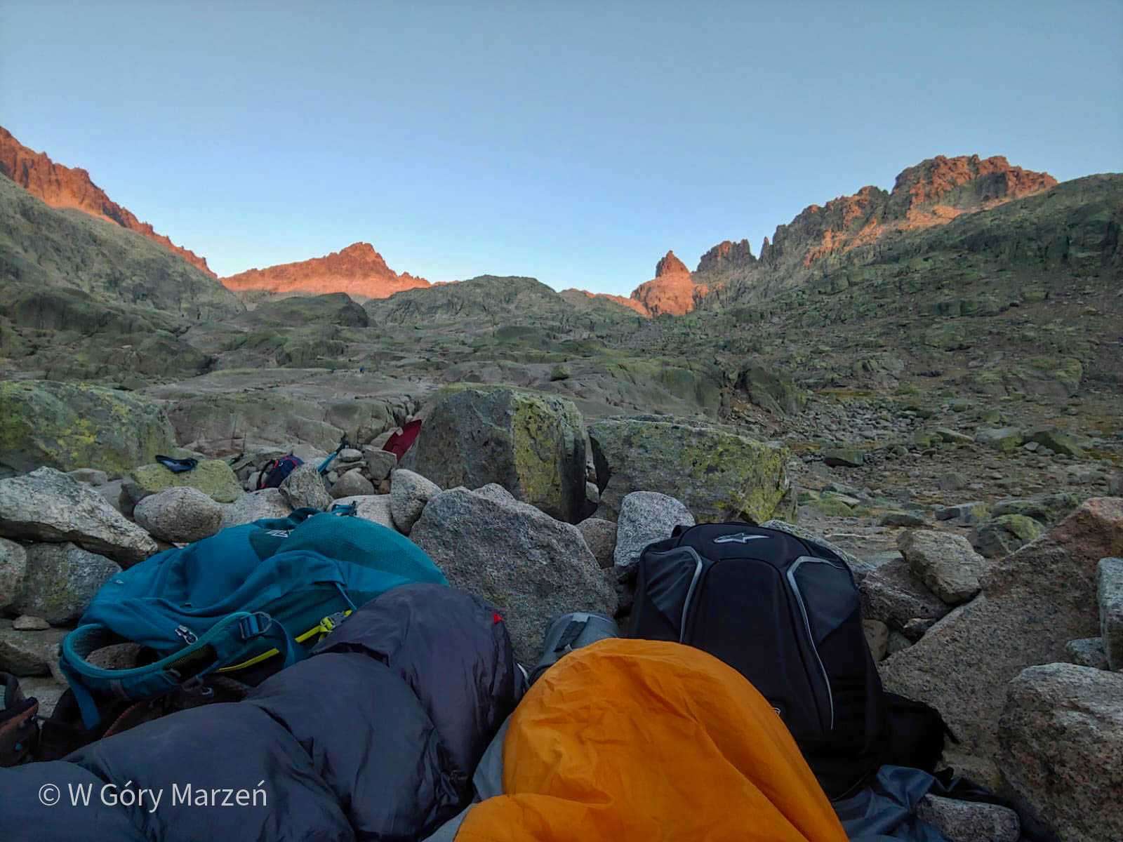
Bivouac under the stars at Laguna Grande
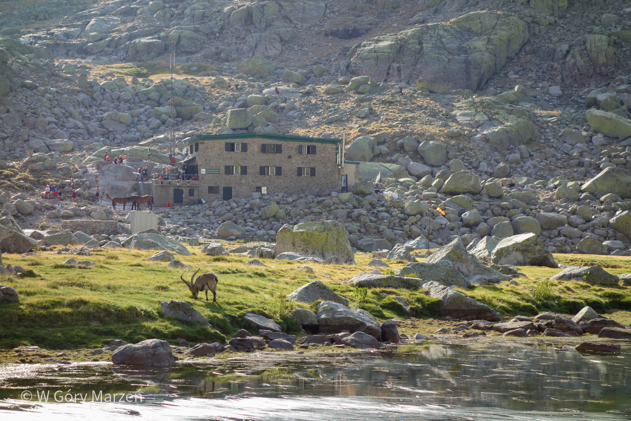
Deciding to split the ascent of Almanzor Peak into two days, we can overnight at the shelter Refugio Laguna Grande. The overnight stay also requires the purchase of breakfast and dinner. If there are no more places in the hostel or if we want to have a slightly different adventure, we can spend the night outdoors in what is known as bivouac under the stars. Circles of stones are laid out around the lake and are maid to protect us from the wind. The circles come in different sizes and we can choose the one that suits us best in terms of location and accessibility.
We came to the area around the refuge already in the dark and on the weekend, and still found a perfect circle. Officially, camping, that is, setting up tents, is not allowed in the park. In practice, we could see several tents set up.
Since we had a stove with us, we cooked ready-made dumplings with sauce for dinner. In mid-August you usually see a lot of shooting stars. We were lucky with cloudless skies and falling Perseids every few minutes.
Way the top of Almanzor
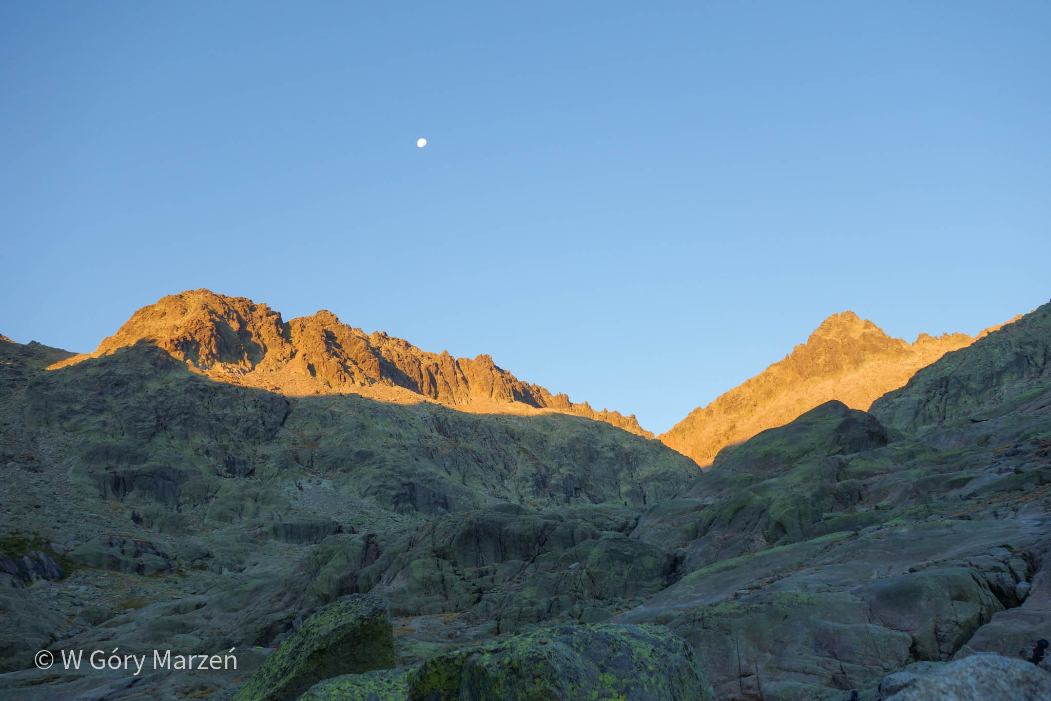
After being awakened by the rising sun with a beautiful view of the mountains, we eat breakfast prepared on the stove. We can get water at the hostel (there are no springs on the further route). There are also special lockers for luggage in the shelter, we can ask the hostel staff about their availability. The fee for one locker is 5 euros. We decide to leave our sleeping bags, mats and kitchen equipment and head lightly up the mountain.
From the hostel to the summit, the route is about 5.7 kilometers in total (both ways) and 670 meters of elevation gain.
We set out for the peak at around 10 am. We choose a route through the points: Hoya Antón, Portilla Bermeja and Portilla de Crampón. The beginning of the trail runs to the left of the refuge, along fairly smooth but tractable rocks up the mountain. The trail is marked with stone waymarks, sometimes you have to strain to find the next one. The trail to Hoya Antón (2150m above sea level) is gently inclined and runs on comfortable grass in places. Hoya Antón is a small valley between the rather steep walls of the Circo de Gredos massif. From this point we have a choice of two routes to the summit: from the south or from the north. We choose the most popular route from the south and head up.
Portilla Bermeja
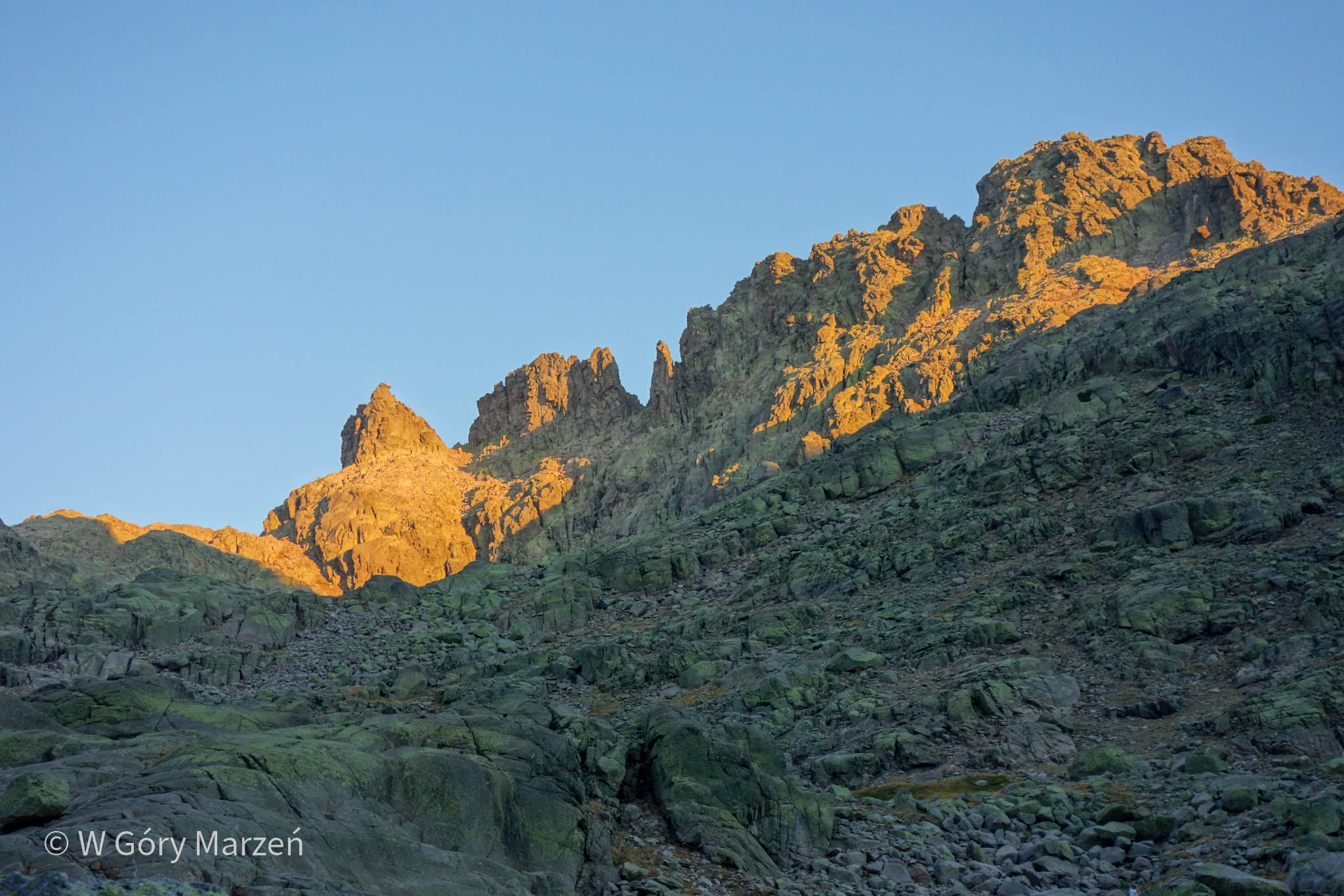
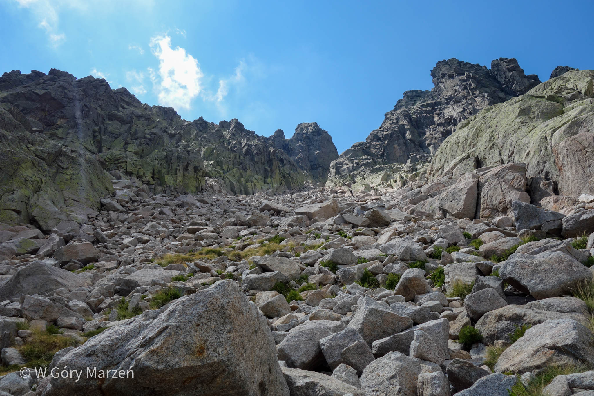
From Hoya de Anton the trail is very rocky and very steep, in many places it is good to help yourself with your hands. When we see the profile of the route in front of us, a practically vertical wall appears. Fortunately, it’s dry and the rocks are completely unglued. We approach from the top via the Canál de Portilla Bermeja, until we reach a bifurcation. We have a choice of two routes: left through the viewpoint – the Portilla Bermeja Pass, or right through the Canál de Crampón (directly to the summit of Almanzor). We choose to go left through the Portilla Bermeja.
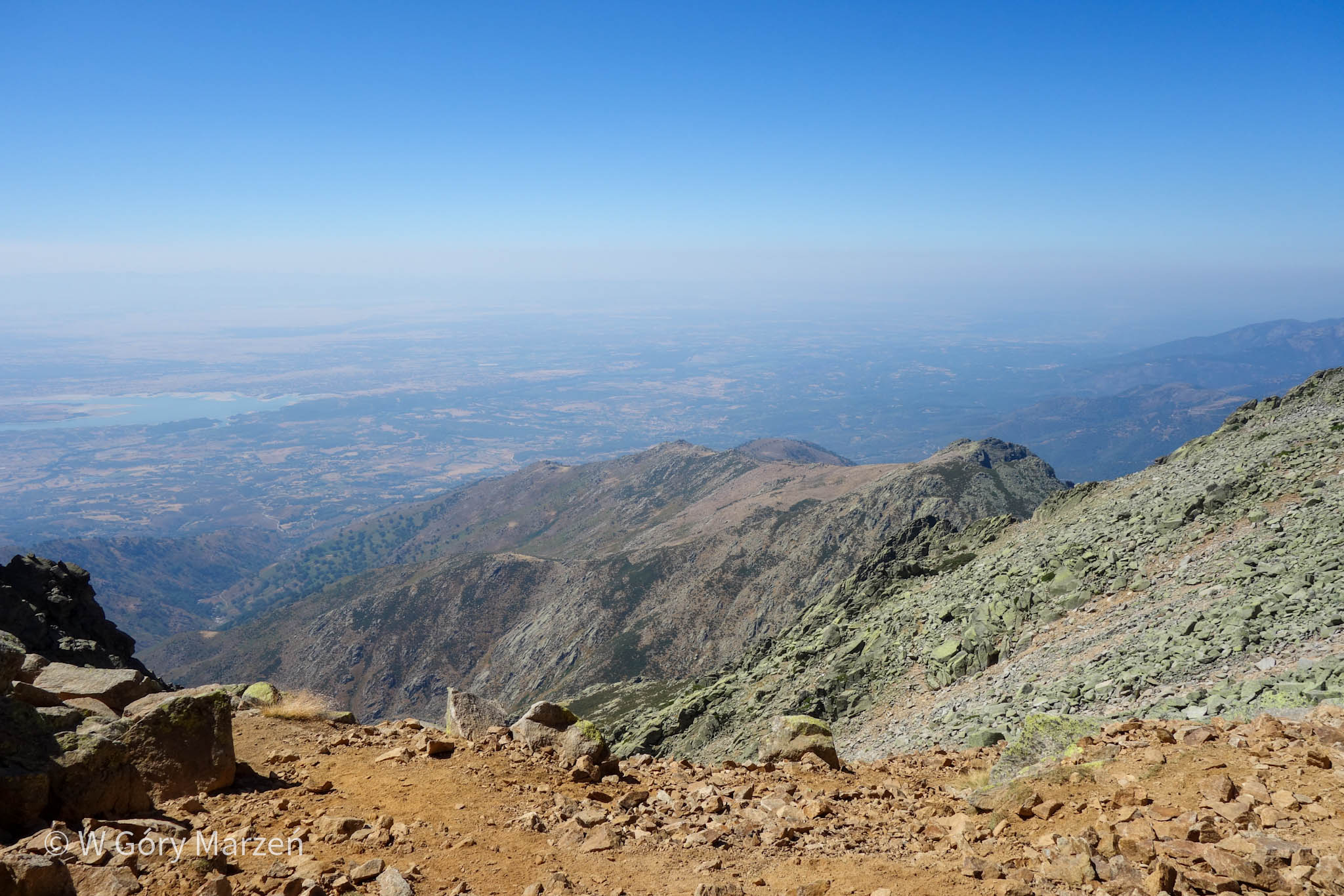
The trail continues to be very rocky, sometimes we have large stones to cross. We reach the Portilla Bermeja (2410m above sea level) around 12:30 p.m. At the pass there is another stone circle, maybe for those looking for really extreme overnight 🙂 From there we get a beautiful view of the eastern and southern parts of the Sierra de Gredos and the highlands to the west of Spain. Here we take a break for a second breakfast and move on.
Climbing to the top of Almanzor
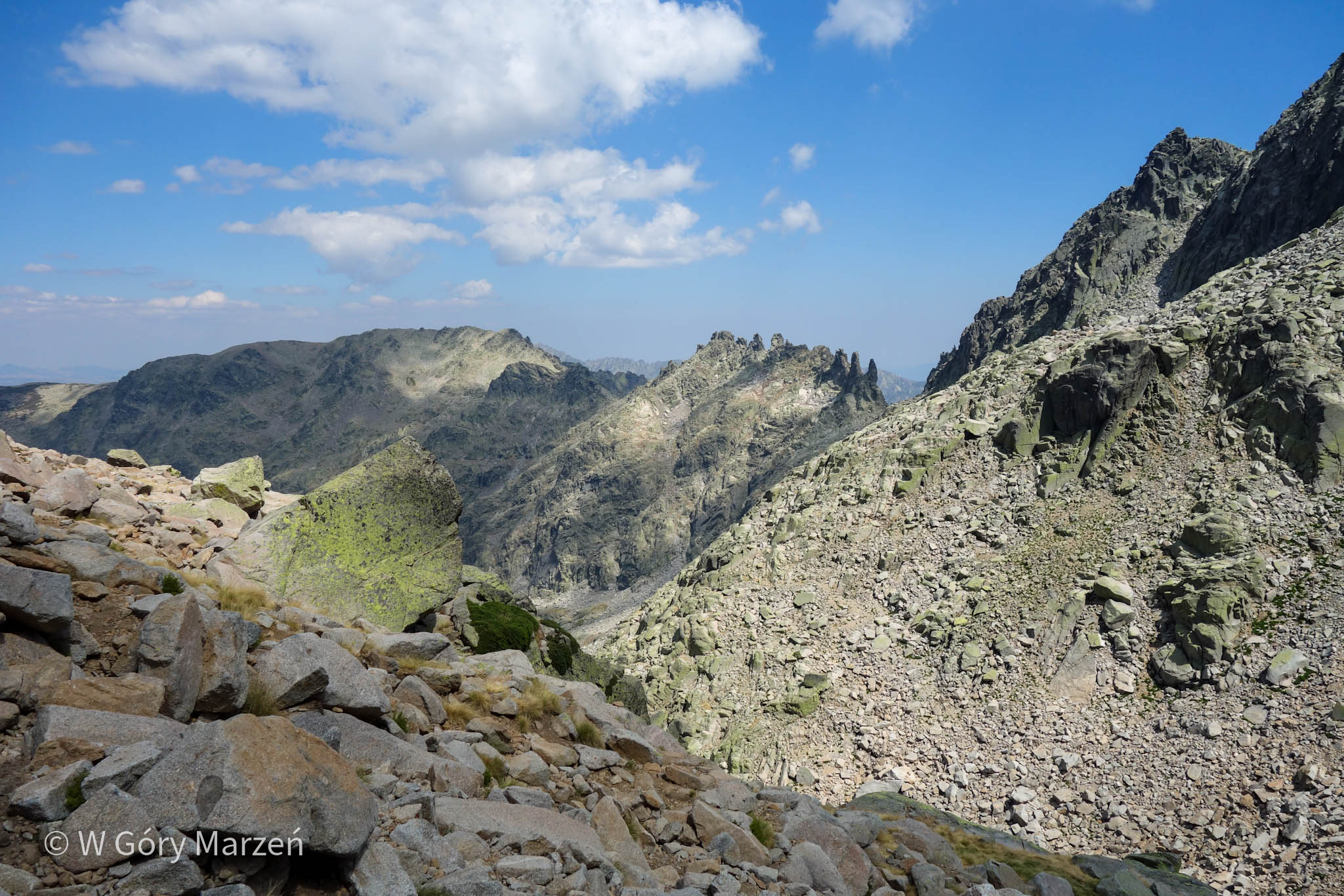
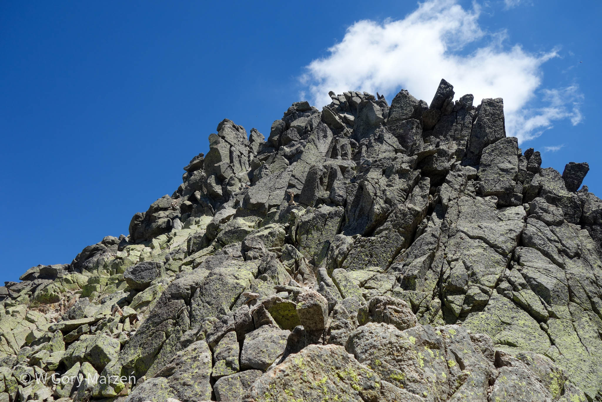
From Portilla Bermeja to the summit there is about 350m left and about 180m of vertical approach. The trail here is practically vertical. To Portilla Crampón (2564m above sea level) you ascend with big rocks, here it is good to stick to the mound-marked path. Just before Portilla Crampón, the trail leads quite steeply downhill. We arrive at Portilla Crampón around 1:40 p.m. There we meet mountain goats jumping over rocks literally 2 meters away from us.
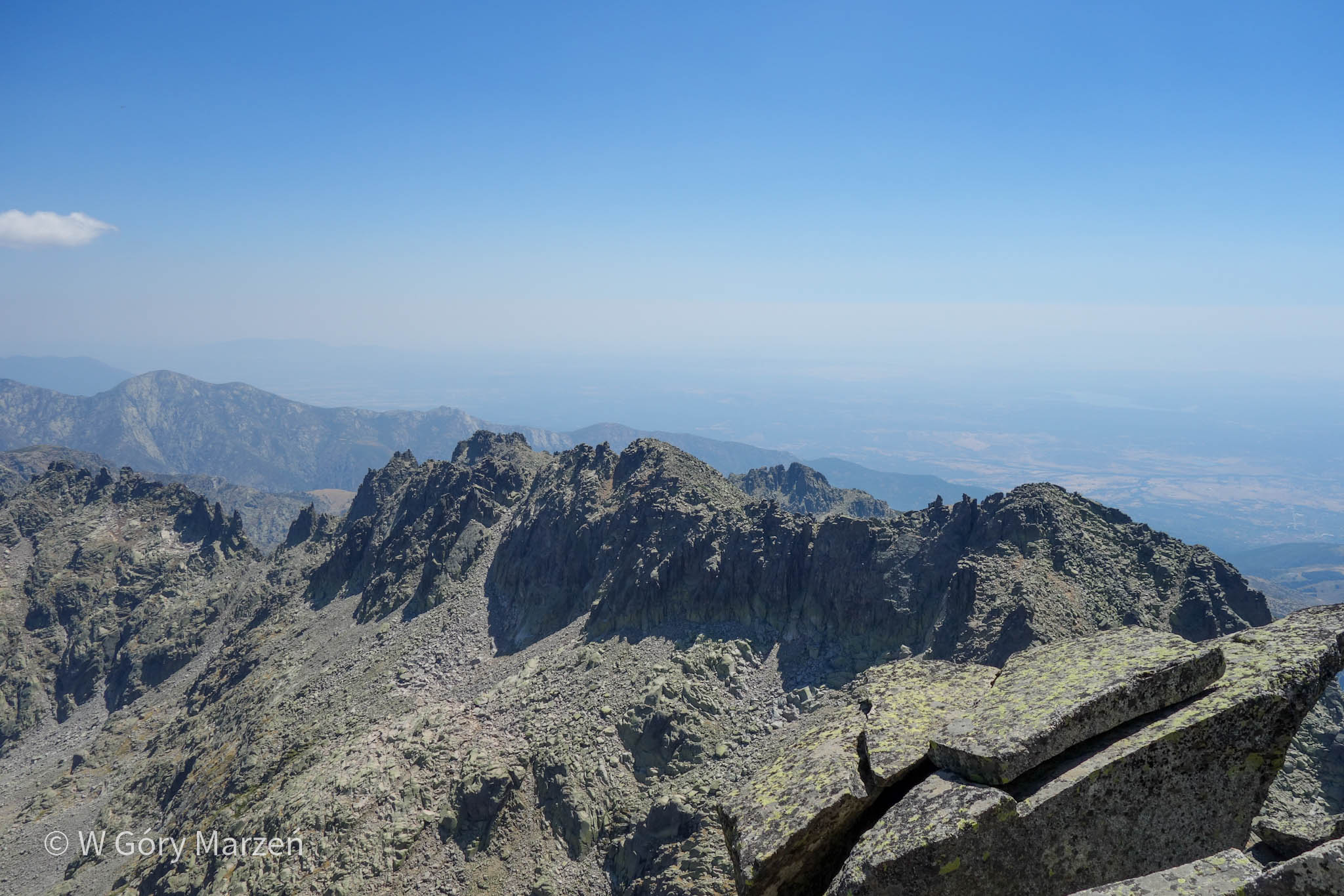
The last stage is a climb to the top. The route is practically vertical, but fortunately there is no exposure. We move up using our arms and legs. The route is challenging, but not impossible to climb. I found information that the difficulty level according to the climbing scale is II+. We reach the summit of Almanzor (2592m above sea level) around 2:10 p.m. There we take another break. Somewhere in between taking pictures I hide my phone in my jacket (it was quite windy, despite the burning sun). And so while leaning over, the phone slips out of my pocket and crashes into the steep rocks. Unfortunately, immediately the screen stops working, and I lose contact with the online world for the next few days, as well as photos from the trip. On the ther side, fortunately, I have my camera with me and some photos taken with it 🙂
Descent and return
From the summit we descend through the Canál de Crampón canal. The descent is long, steep and tiring. We have about 670 meters to go down the steep trail (to the hostel and the lake), and then another more than 450 meters down to the parking area. We arrive at the refuge at around 6 p.m. In Spain, unfortunately, even in the refuges, we don’t get anything hot to eat outside of official meal times. We order a cold pasta salad (the only thing available besides sandwiches) and take a rest for some time.
After about an hour we set off for the parking lot. I am feeling quite tired after a full day of hiking in the sun. When we get to the first fountain, one of the goats is waiting there. We are filling the bottles with water when some couple with a dog appears. The dog is not on a leash and when he saw the goat he took off chasing it toward the precipice. The owner ran after it, and after a few minutes of fright we saw him return together with a tired, but safe and sound, dog.
Once again, we observe the colors of the setting sun and arrive at the parking lot around 9:30 p.m. There we quickly embrace the car and set off in the direction of Madrid.
If you found this post useful and feel like supporting my efforts, you can buy me a coffee by clicking on the link below. Thank you!

Zuzanna
Hi! My name is Zuzanna, I am from Poland. I love traveling, hiking and doing yoga. Spain is my favorite destination, I walked several Camino de Santiago roads there. I created this blog to share my travel experiences.

You May Also Like
Camino Primitivo – the most beautiful and the most forgotten Camino de Santiago
Iceland – what to see in south-west Iceland, Golden Circle