-
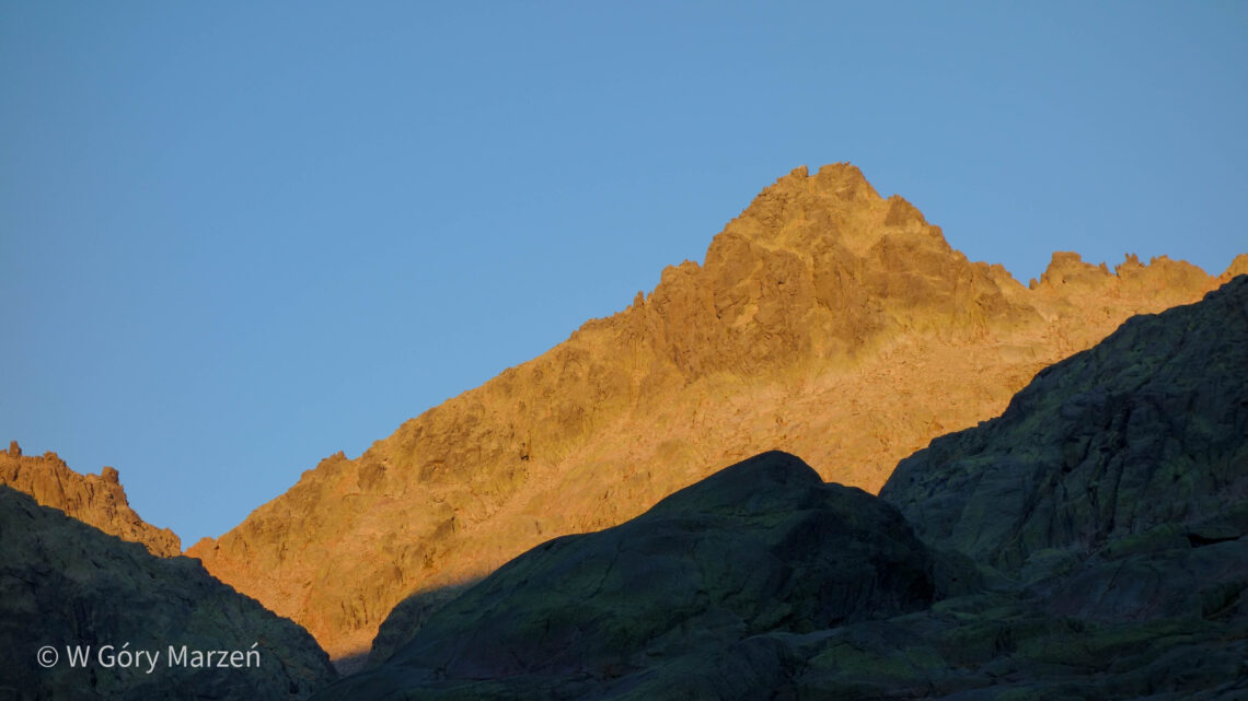
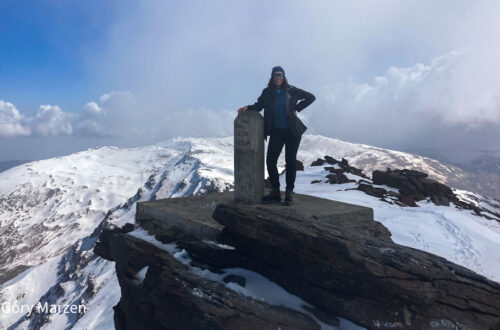
Almanzor – Sierra de Gredos, way to the highest peak of 2592m
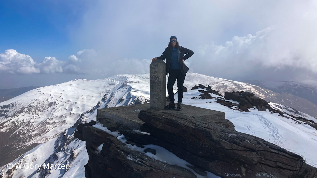
Almanzor (2592m) is the highest peak of the Sierra de Gredos mountain range in Spain. It is located in the central massif of the Iberian Peninsula, west of Madrid, on the border of the autonomous communities of Castile and Leon and Extremadura. Beautiful rocky peaks, mountain lakes and plenty of chamois – that’s the Sierra de Gredos in a nutshell, especially the Circo de Gredos chain. I went to Sierra de Gredos in mid-August. From my research, the best and practically the only way to get to the trail (other than a long walk) is to get to the parking area by car. Therefore, additionally wanting to try out life…
-
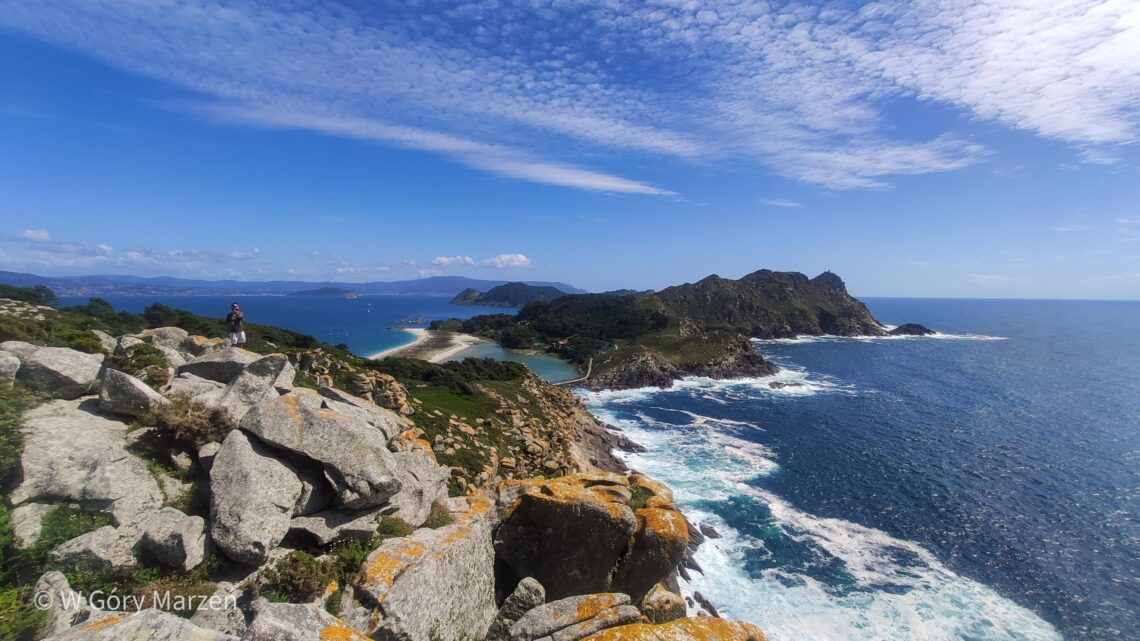
Islas Cíes – Rodas beach, access, camping, best places to see
Islas Cíes are beautiful islands located near the city of Vigo, in Galicia, northwestern Spain. Islas Cíes is an archipelago of three islands: the northern Monteagudo, the central to Faro and the southern San Martiño. The central and northern islands are connected by the Playa de Roda beach, which was named the world’s most beautiful beach (!) by The Guardian magazine in 2007. The Islas Cíes are part of the National Park of the Atlantic Islands of Galicia (Parque Nacional Marítimo-Terrestre de las Islas Atlánticas de Galicia). It also includes the nearby islands of Isla de Ons, Isla de Sálvora and Isla de Cortegada. This adds to their splendor, as…
-
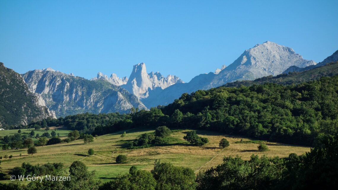
El Anillo de Picos de Europa – itinerary, accommodation, description
The Picos de Europa are some of Spain’s most beautiful mountains, located in the Cantabrian Mountains. They are located in the north of the countries, on the border of three autonomous communities: Asturias, Cantabria and Castile and Leon. El Anillo de Picos de Europa, or the loop around the Picos de Europa In the Picos de Europa National Park, we can do a multi-day trek called El Anillo de Picos de Europa (the Picos de Europa ring), choosing the length of the route according to the amount of time and our condition. There are 3 main routes to choose from: Vindio (west-central route, 4 stages, 63 kilometers, total elevation gain…
-
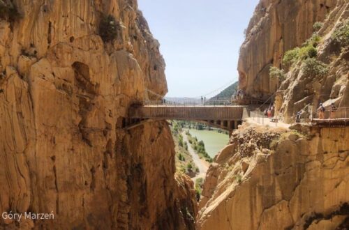
Caminito del Rey – itinerary, tickets, route description, access
Caminito del Rey is a very spectacular path in Andalusia, in southern Spain. Caminito del Rey is 7.7 kilometers long and takes about 2 hours to complete. The trail begins in the town of Ardales and ends in Álora, at the El Chorro Dam. On the route you pass between two walls, canyons and a large valley, partly on trails and partly on footbridges. I went on the trail on a weekend in June with my friends from work. Caminito was the highlight of our trip and we stopped in the pretty town of Ronda. The history of the Caminito del Rey trail Caminito del Rey dates back to 1901-1905,…
You May Also Like
Mulhacén – access from Capileira, practical information
-
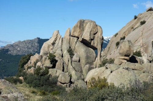
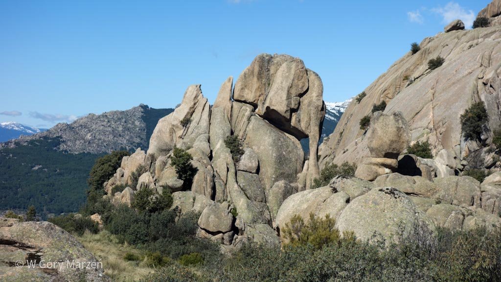
La Pedriza – Manzanares el Real, one day hiking route from Madrid
La Pedriza is one of the most curious and interesting mountain ranges in Spain. It attracts with its extremely sculpted by nature shapes of rocks. Some resemble people, other animals, and some give the impression that they are about to fall apart at the slightest gust of wind. La Pedriza belongs to the Sierra de Guadarrama National Park, which is located near Madrid. The closest town is Manzanares el Real. This is where the bus from Madrid goes and many routes start here. I went to La Pedriza with my friends in mid-April. There was still some snow in the highest parts at this time of year. We took the…
-
Mulhacén – access from Capileira, practical information
Mulhacén is 3,482 meters above sea level and is located in Sierra Nevada, near Granada. It is the second highest peak in Spain, right after Teide, which is located in the Canary Islands (you can read about climbing Teide in this post). Mulhacén is also the highest peak of the Iberian Peninsula. Mulhacén – Getting there and practical information I started my journey by coming to Granada from Madrid. The journey takes approximately 5.5-6 hours. Then, from Granada, I took a bus to the town of Capileira. The Alsa bus takes around 2.5 hours, costs around 7-8 euros and departs from the Granada bus station. As I left Granada at…
You May Also Like
Caminito del Rey – itinerary, tickets, route description, access
-
Camino Frances part 2 – from Burgos to Santiago de Compostela
Camino Frances is the most popular and famous trail of the Camino de Santiago. I went on a pilgrimage at the turn of August and September 2021. I wrote about the initial stage of Camino Frances from Saint-Jean-Pied-de-Port to Burgos and the journey to Camino Frances from Poland in my previous post here. After a few months from Camino, after rest and integration of what happened on the trail, I come back with a description of the rest of the trail: the road from Burgos to Santiago de Compostela. After two weeks on the trail, I move on, about 510 kilometers to my destination. Burgos – León – a path…
-
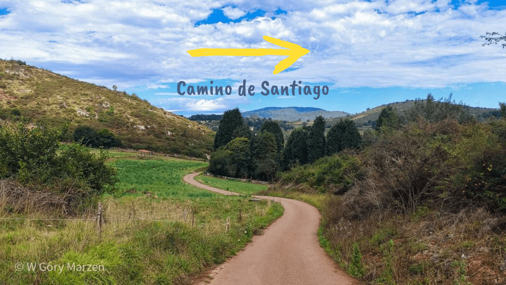
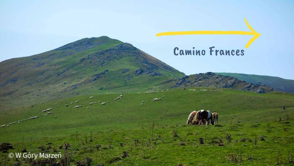
Camino Francés – Camino de Santiago route description
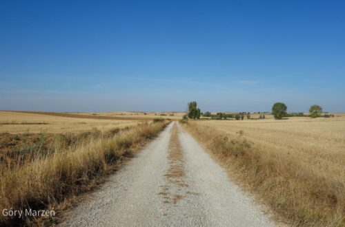
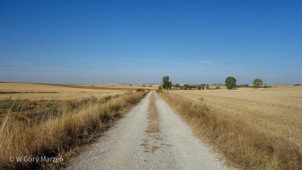
Camino Frances is the most popular variant of the pilgrimage route to Santiago de Compostela. The route begins in the French Pyrenees in the town of Saint-Jean-Pied-De-Port (SJPDP). The length of the route to Santiago de Compostela is approximately 779 kilometers (the official distance is given by the Pilgrim’s Office in Santiago, for the remaining distances I am based on the distances provided on the gronze.com website). Camino Frances runs through 4 provinces of Spain: Navarre, La Rioja, Castile and Leon and Galicia, where Santiago de Compostela is located. Each region is distinguished by something different. In Navarre, with its capital Pamplona, the route passes through beautiful mountains and forests.…
-
Madrid – what to see in Madrid
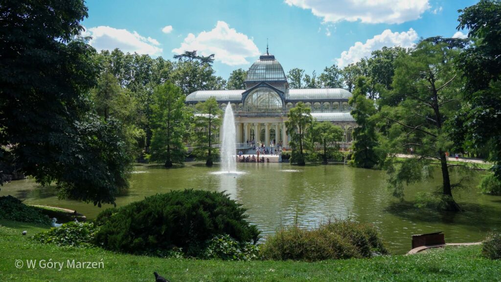
Madrid – the bustling capital of Spain, and which I totally fell in love with. It is not without reason that there is a saying “Life as in Madrid”. It is said that these are cities that never fall asleep. Any time is good to visit Madrid. I went here in the middle of summer, initially for a week, and stayed for over a month, which allowed me to get to know the city and the surrounding area quite well. In summer, it is hot and dry during the day, and the sun burns the skin. However, shelter can be sought in numerous museums and parks or narrow streets that…
-
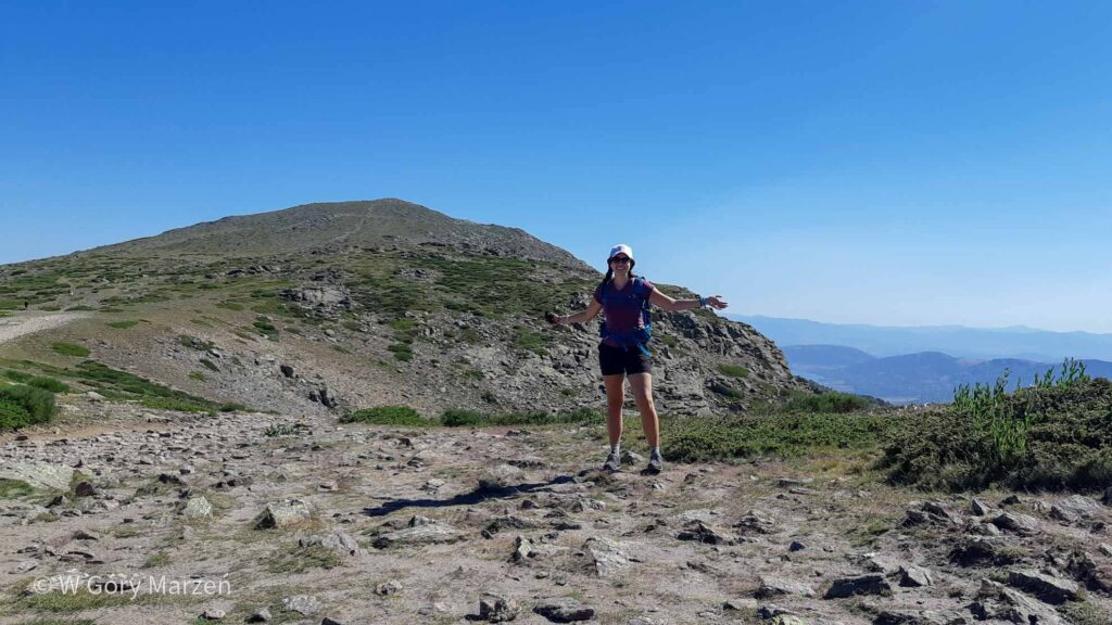
Peñalara – the highest peak in the vicinity of Madrid. Sierra de Guadarrama
Peñalara is the highest peak in the vicinity of Madrid. It is located in the Sierra de Guadarrama mountain range and measures 2428m above seam. In Spain there are plenty of mountain ranges and peaks easily accessible to tourists. The Guadarrama range is only 1.5 hours away by bus or 1 hour by car from Madrid. I went on the trail by road from the Puerto de Cotos stop, going through the summit to the laguna de los Pájaros lake, and then by the road at the laguna de Claveles and Peñalara lakes. The whole route is about 13 kilometers, and the sum of the hills is about 675m. I…