Everest Base Camp and Gokyo Ri Nepal trekking description
Everest Base Camp and Gokyo Ri trekking is the icon of the Himalaya trekking routes. I first heard about trekking in Nepal at a presentation in Warsaw’s Meridian Zero café at the end of 2017. There was a sentence that went something like this: The Himalayas are not so inaccessible, you just need to want and prepare well. I returned home full of enthusiasm, thinking about the Himalayas. A few days later, on one of the travel groups, I noticed an announcement about going to the Himalayas for trekking to the base under Mount Everest, or Everest Base Camp (EBC) through Lake Gokyo and the peak of Gokyo Ri. Without thinking for a long time, I applied, although the trip was to take place only in 10 months. And among other things, it was as part of the preparations that I started to go to the Tatra Mountains more often and totally loved mountain hiking.
This is the first part of the EBC trekking and Gokyo Ri trekking description (days 1- 7). Second part the post can be find here (days 8 -15).
Everest Base Camp and Himalaya trekking basics
I went to Nepal in October 2018. It was my first trip to Asia. Autumn and spring are the best time for trekking in the Himalayas. In summer, the monsoon can make it difficult for us to hike, and in winter, snow. Trekking takes place in Sagarmatha National Park. I went on the expedition in a group of 8 people together with a guide and 4 porters (each of the porters carried the luggage of 2 people about 10 kilograms). In addition, my backpack weighed about 5-6 kilograms.
Trekking to the base under Mount Everest via Gokyo Ri lasted 15 days (including 2 days breaks for regeneration in the mountains). In the mountains we sleep in lodgs (hostels or hotels for tourists),usually in 2-bed rooms. In most places, you can buy a warm shower, hot water to drink or tea, access to Wi-Fi or access to contactto reload the electronics. Each hostel also has a dining room where we can eat breakfast and lunch / dinner. We can also warm up there by the stove, read or, for example, play cards with travel companions.
Below is a description of the individual days of trek.
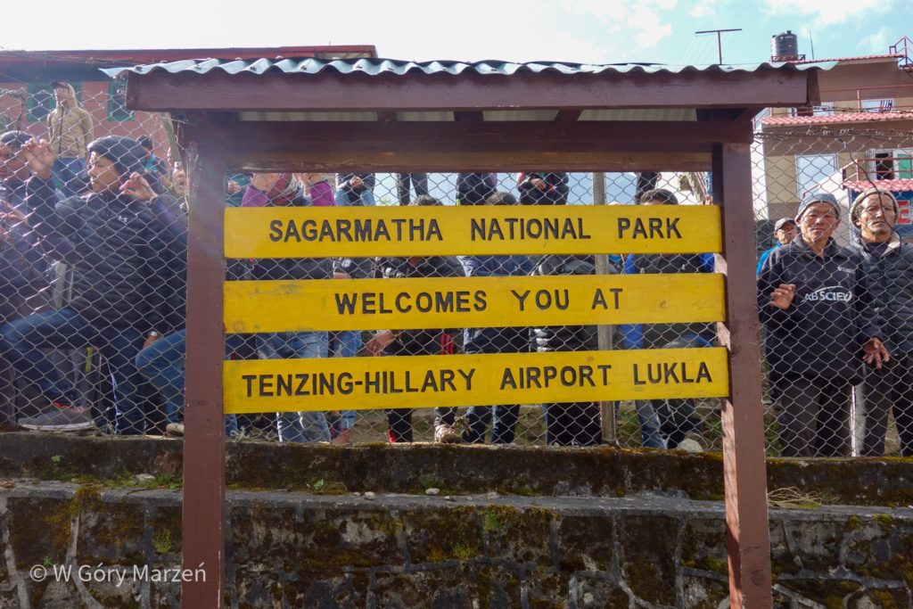
Day 1: flight to Lukla and trekking to Phakding
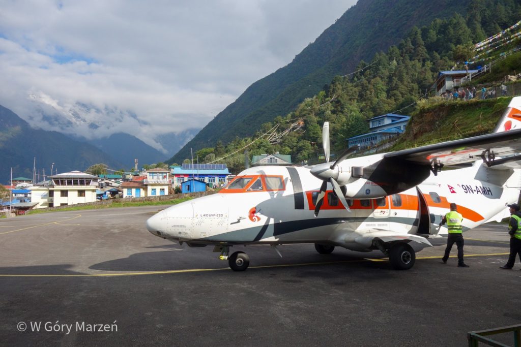
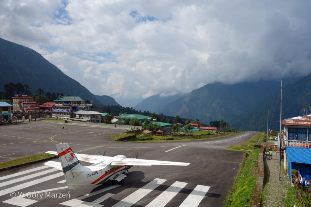
On the first day of trekking we fly from Kathmandu (1340m) to Lukla (2840m) located in the mountains. There is one of the most dangerous airports in the world, because the runway is very short and ends with a clius. The flight takes about half an hour. The most exciting is, of course, the landing combined with prayers for survival. In addition, from the plane we can admire a wonderful view of the Himalayas from a bird’s eye view.
We go to the airport in the morning, when the conditions are the most stable. The flight takes place in a small plane of a dozen or so people. After a happy landing, we are waiting for the arrival of the second part of the team, which had planned to fly another plane. And we go to explore the village. There are many shops in Lukla, where we can buy the necessary equipment if we have forgotten something. The waiting time is prolonged due to deteriorating weather conditions. We start to worry about whether our friends will join us that day. After all, we still have 4 hours of trekking left. Only in the afternoon, after a few hours of waiting, the plane received the green light for take-off. Our team reunimes and can set off on the Himalayan trail. However, it gets later and later and most of the route is covered in the world, so the headlamps are very useful. After reaching the lodgy, we enjoy a joint dinner and stay in the Himalayas.
Day 2: Phakding – Namche Bazaar
On the second day we have to overcome a large difference in altitude, because Namche Bazaar lies at the level of 3440m. This means an elevation gain of 640m, and the recommended daily height increase is 400m. We move around 8 o’clock, when the sun is already coming out from behind the mountains and the air begins to warm up.
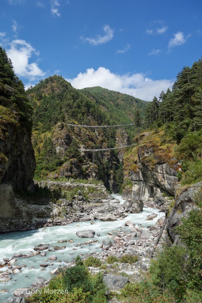
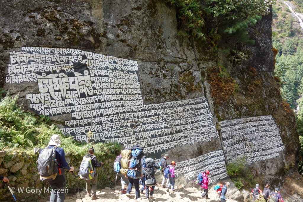
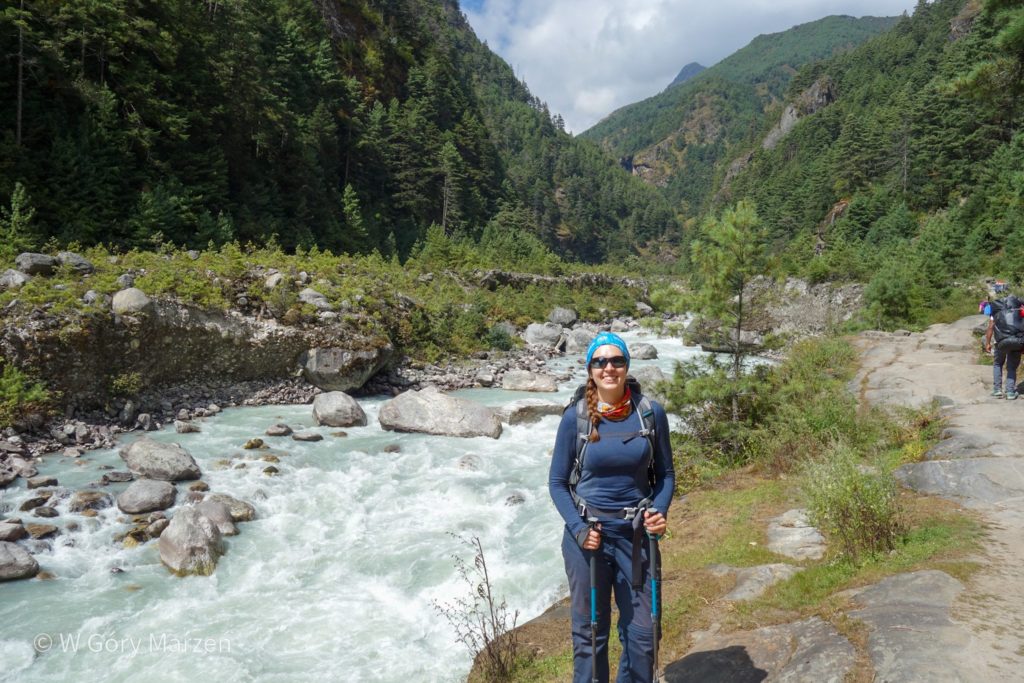
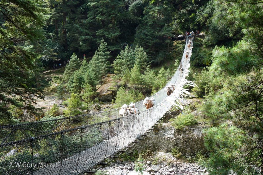
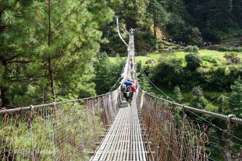
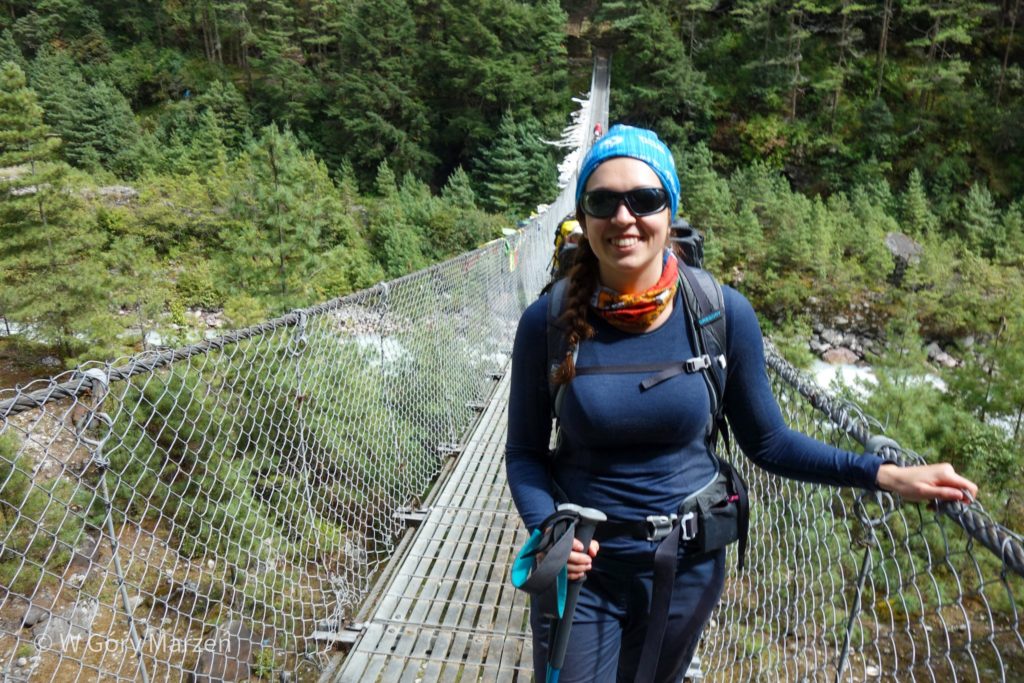
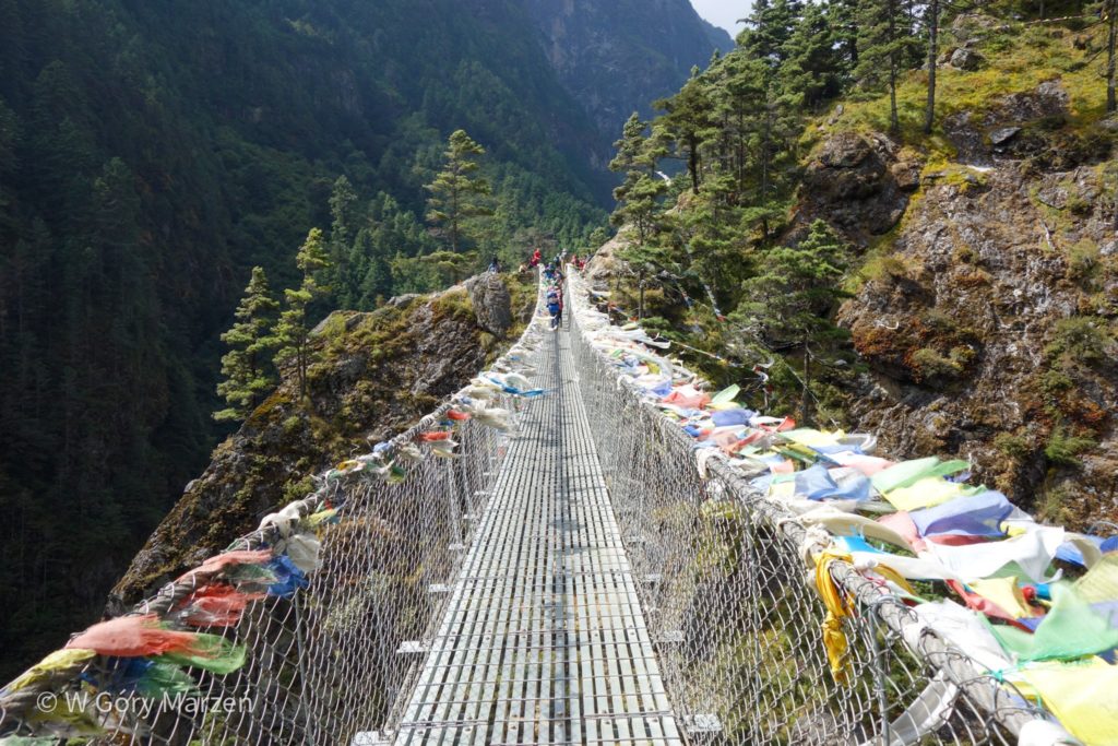
First, the road leads along the mountain stream Dudh Koshi. The landscape is juicy, green. Water clean, rushing. To get to the other side of the creek we have to cross a small hanging bridge suspended several dozen meters above the ground. The first time it is hard, the construction does not look very stable and rocks a lot. However, each subsequent happy overcoming of an obstacle strengthens me in the belief that I will be able to pass.
On the way we pass small villages, in each there are several restaurants and small shops where you can buy a snack or a bottle of water or drink. The sun shines strongly. In the middle of the march, we stop for a break in one of the restaurants to drink the popular Ginger Lemon Honey Tea (tea with a large addition of ginger, honey and lemon), which helps our bodies get used to the increasing height.
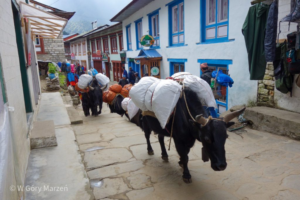
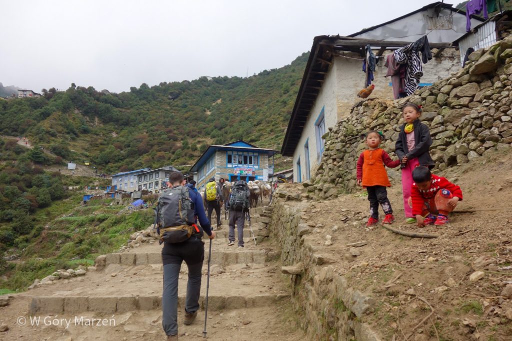
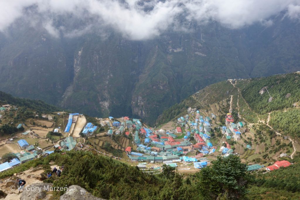
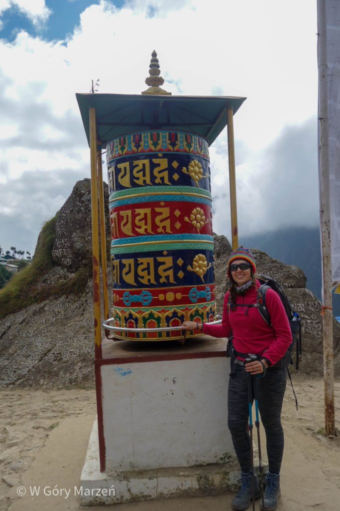
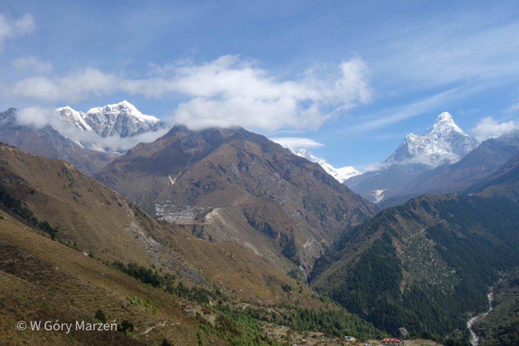
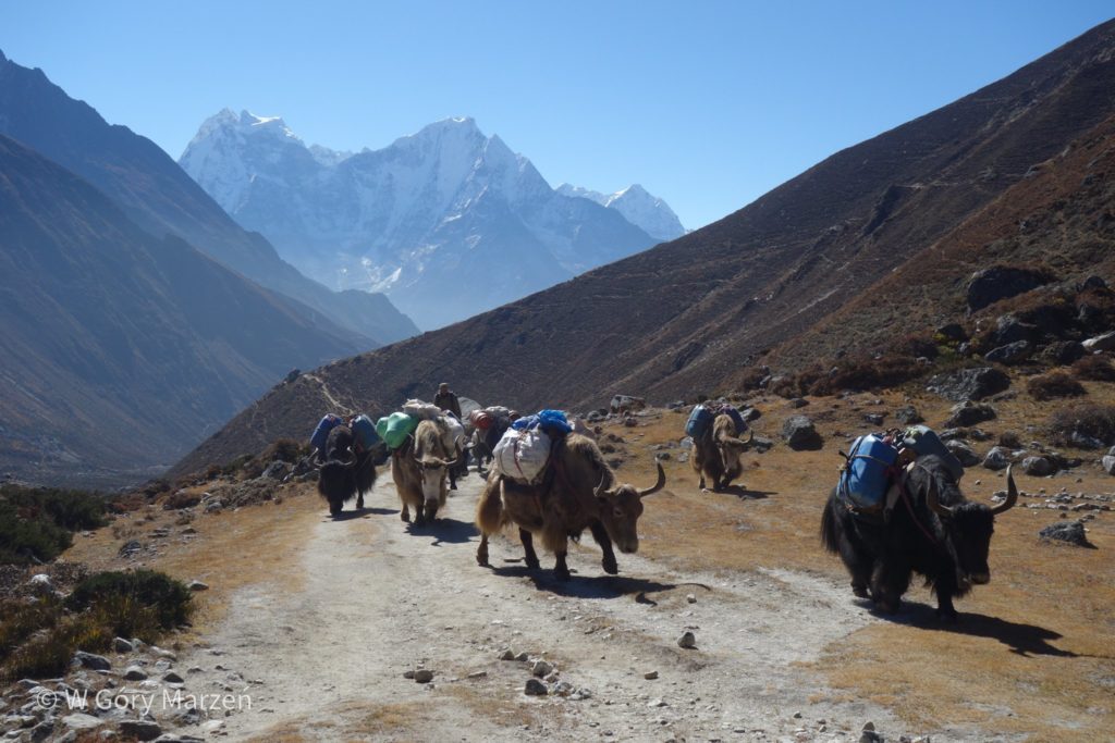
On the way we pass a large number of tourists, porters, yaweeks and donkeys carrying luggage and supplies to shelters. October is the peak of the autumn season, the easiest time is to get beautiful weather and cloudless sky. And so in a great procession we go all the way to Namche Bazaar. Just before entering the town, together with a friend, we separate from the group and get lost. After a few dozen minutes of wandering, one of the porters finds us and safely escorts us to the selected hotel.
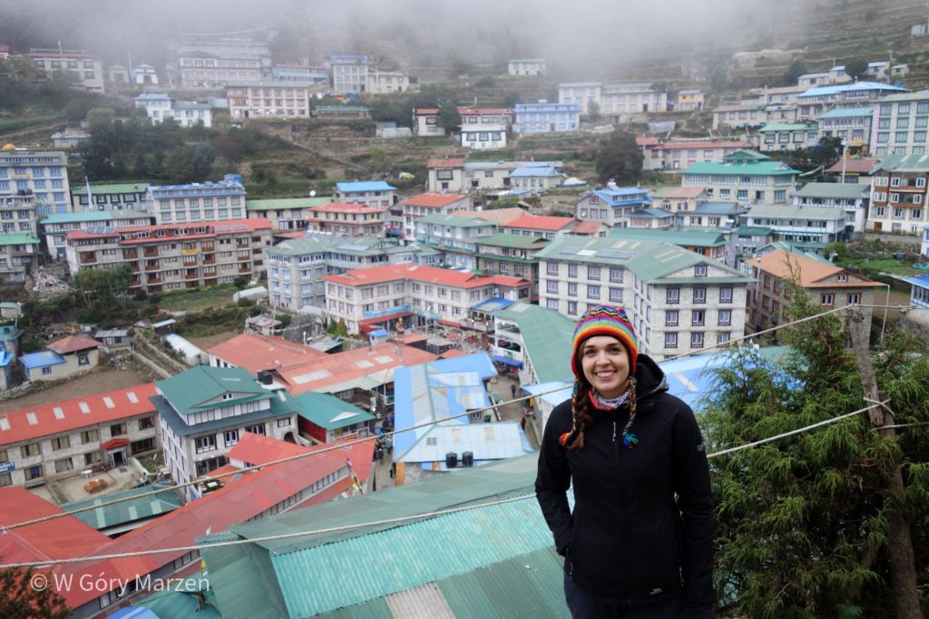
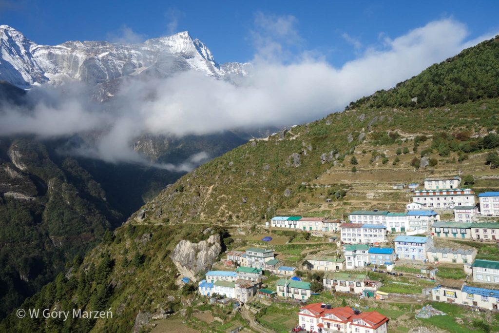
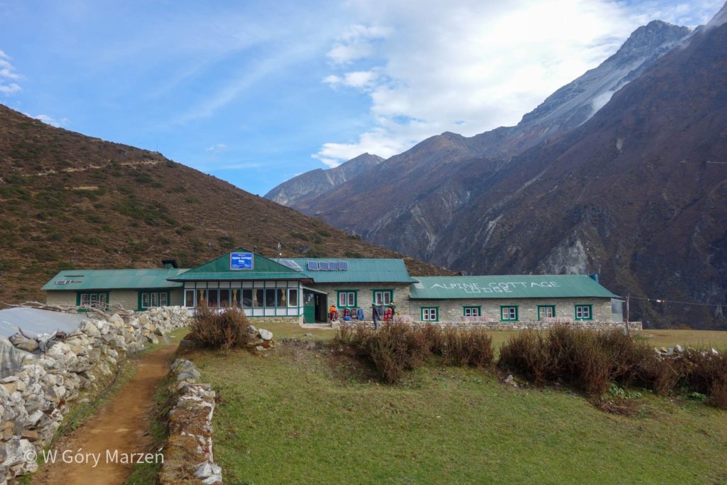
In Namche Bazaar we stay 2 nights so that the body slowly acclimatizes to the height. Due to the size of the town, Namche is also called the capital of sherpas. It is here that we can make the last purchases of missing equipment, buy fresh buns, medicines or go to a real pub.

Day 3: rest in Namche Bazaar
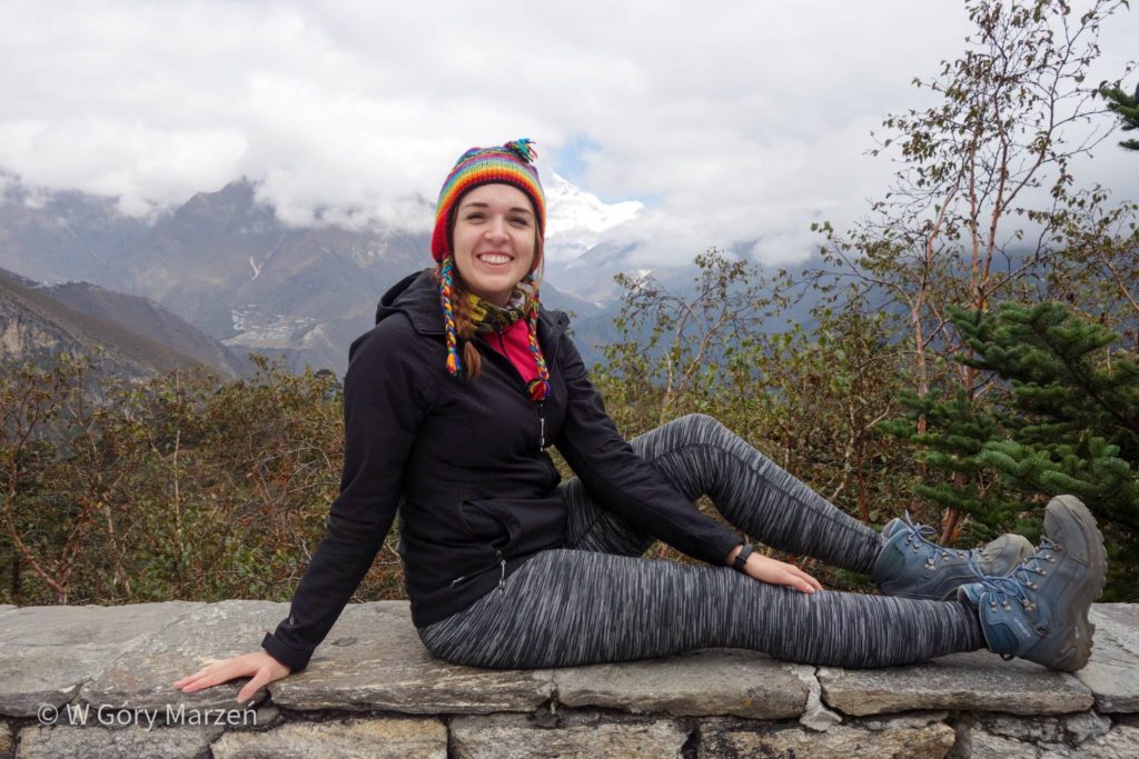
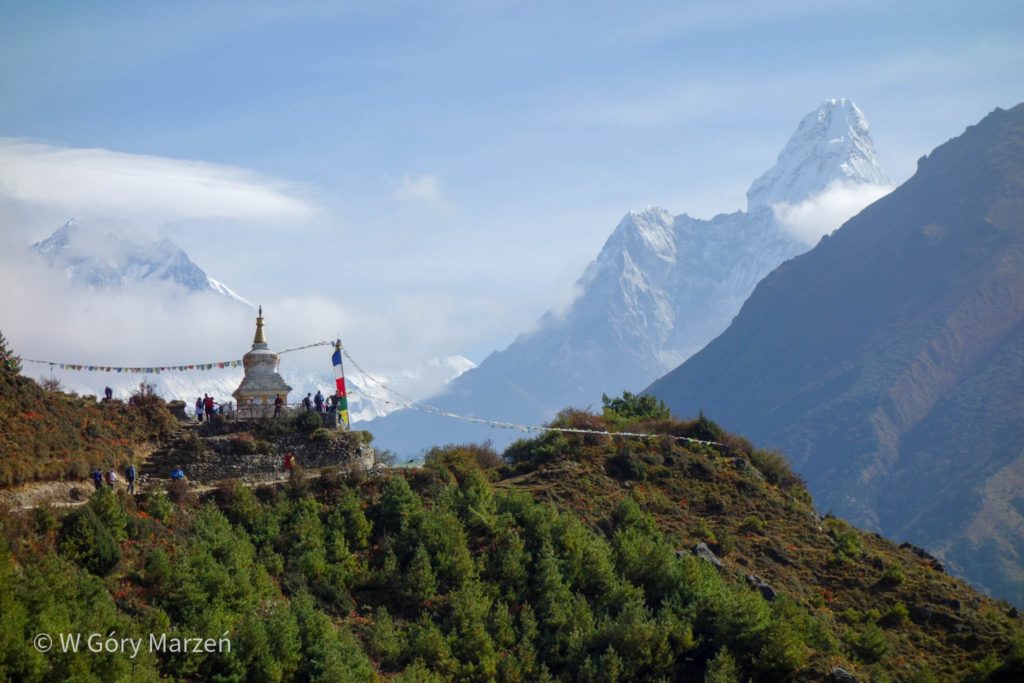
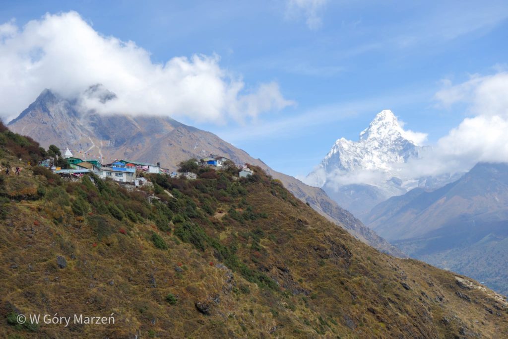
The next day is devoted to the expedition to the Mount Everest viewpoint. Already the first steps from Namche Bazaar give us the feeling that we are far from sea level. Shortness of breath begins, the pace of the march slows down.
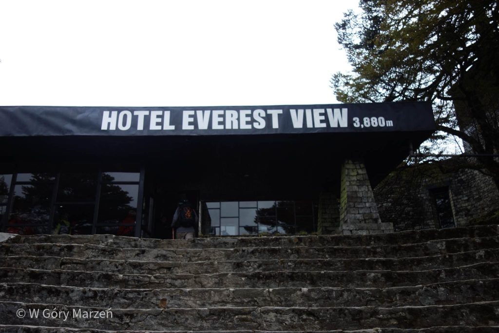
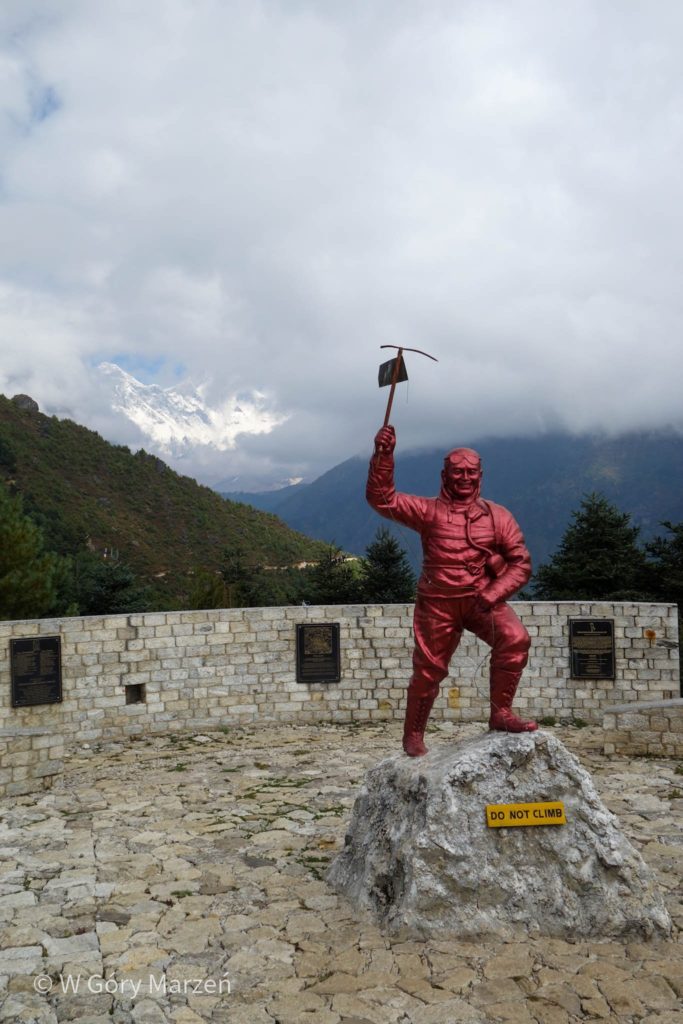
The viewpoint is located in the Everest View Hotel at an altitude of 3880m above sea level. We can drink hot tea there while admiring the highest peak in the world. However, we are not so lucky, because the high mountains are covered with clouds. We are waiting for some clearances, but this time we return to Namche Bazaar without seeing Mount Everest. On the way back we pass the monument of Tenzing Norgay – a Nepalese climber who, together with Edmund Hillary, was the first to reach the highest peak in the world.
Day 4: Namche Bazaar – Dole
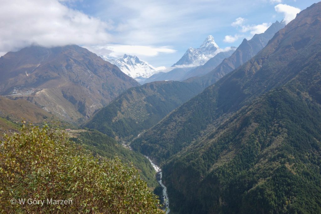
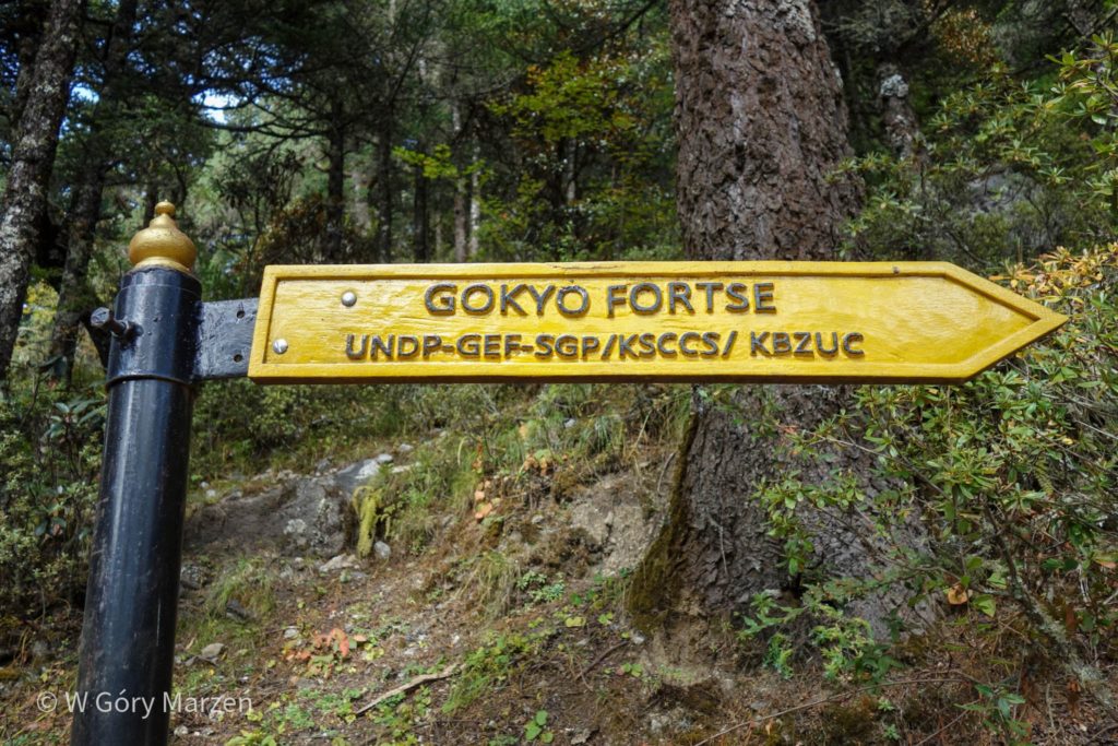
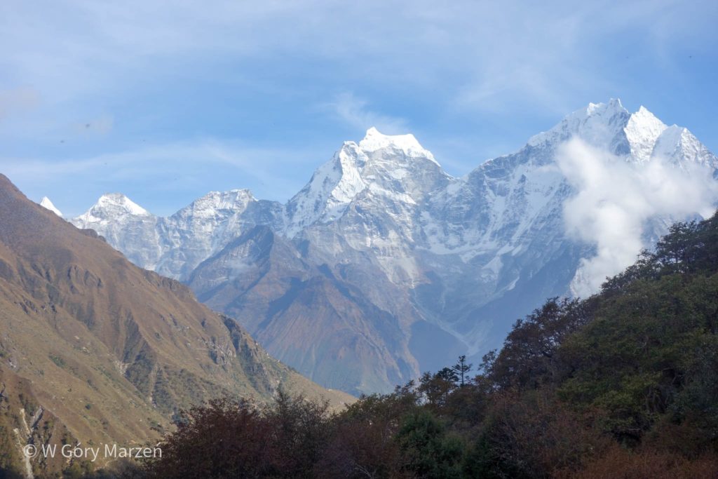
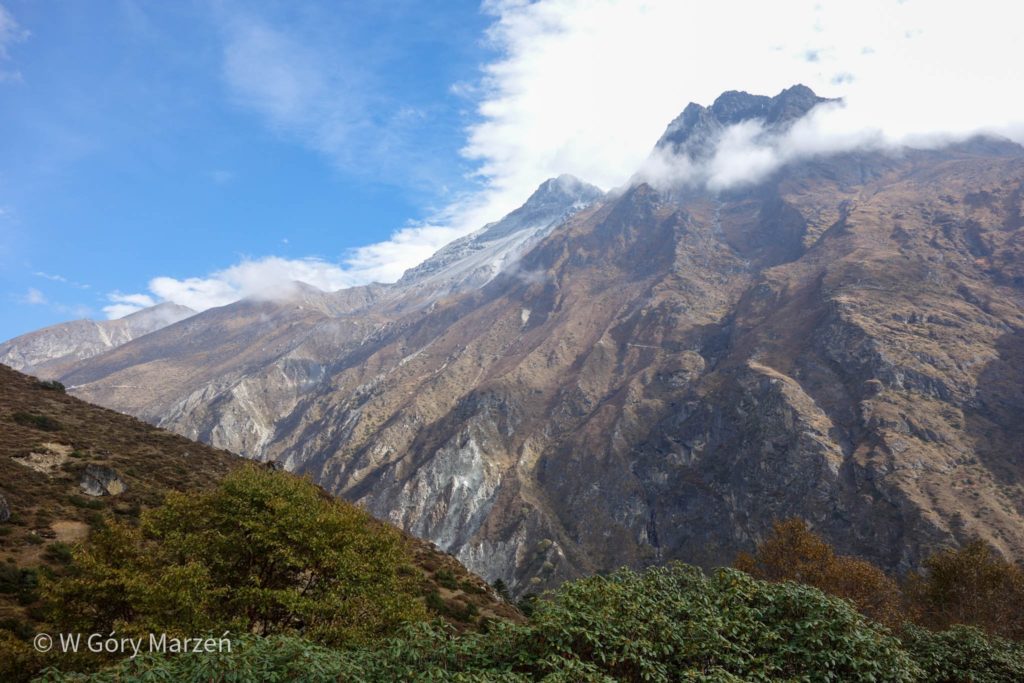
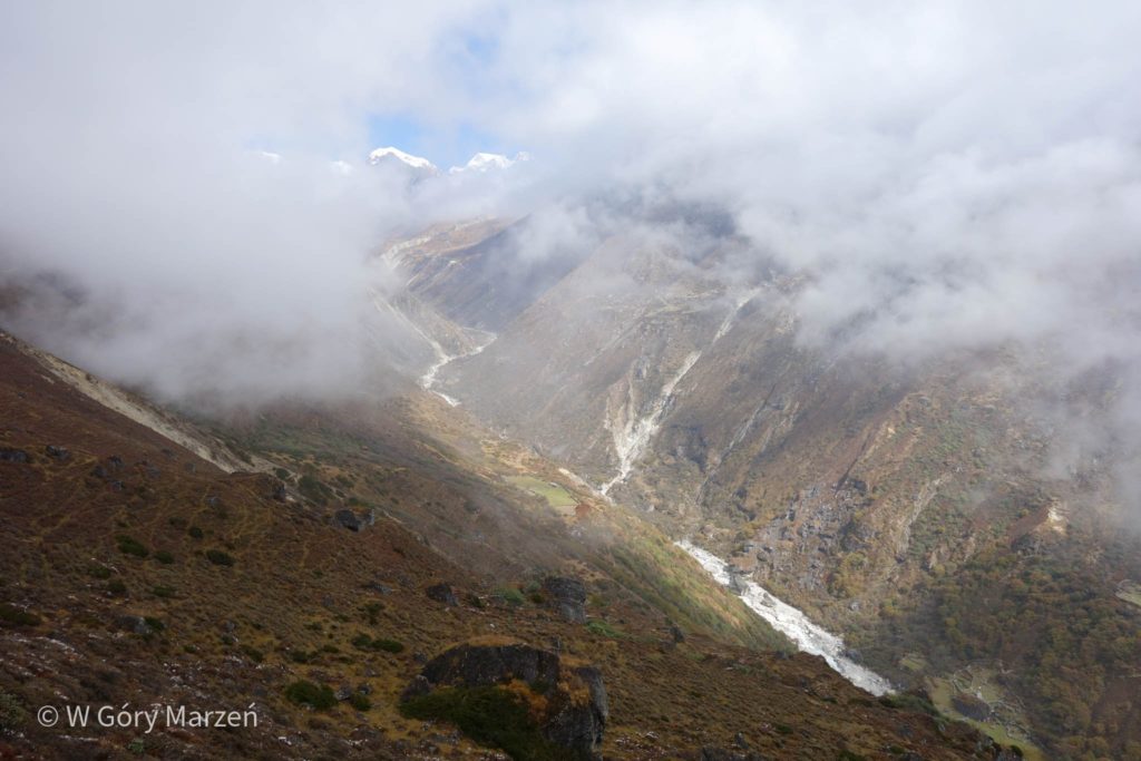
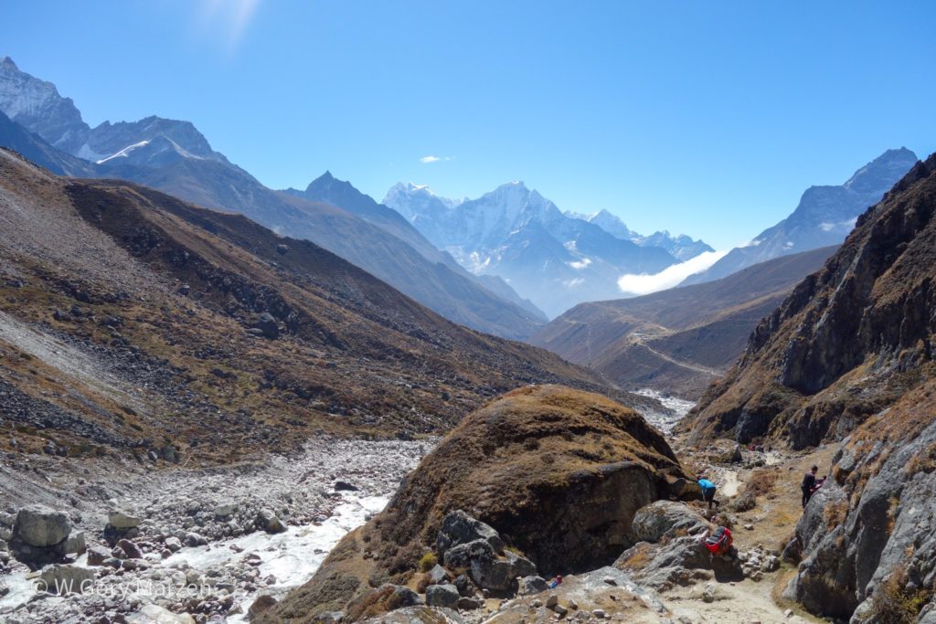
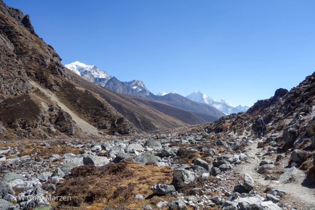
The next day we disconnect from the main trail to Everest Base Camp and head towards Lake Gokyo. For us, this means leaving the crowds of tourists and calmly enjoying our own company for the next days. The day is very demanding and the route is long. The bottom is located at an altitude of 4110m. However, this time we are lucky and we have a view of the nearest mountains, and sometimes you can even see Mount Everest. The biggest impression on me is Ama Dablam (6812m) – a beautiful mountain with a characteristic shape.
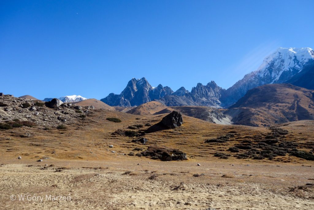
With each increase in height, the landscape changes to a more severe one. There are fewer and fewer trees and shrubs. Over time, they turn into large lawns. We are also getting closer to 5 and 6 thousand people. The mountains are literally intimidating with their closeness, power and severity.
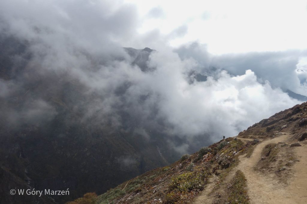
We reach the tiny village after long hours of walking. The weather begins to deteriorate and clouds appear. With the altitude it is also getting colder.
Day 5: Dole – Machhermo
This night we spend above 4000m, which means that the altitude is a problem. The head starts to hurt, it is getting harder to breathe. In the morning we go to Machhermo, located at an altitude of 4470m above sea level, which means 400 meters of elevation. On this day, most of the mountains are covered with clouds. We are slowly moving forward. The temperature drops a lot in the evenings, so the only salvation is either to hide in a warm sleeping bag or play cards in the dining room by the burner (of course, there are no trees here, so yak droppings are used as fuel).
Day 6: Machermo – Gokyo
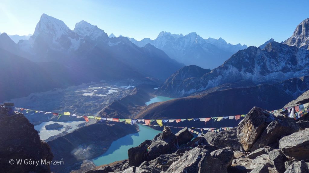
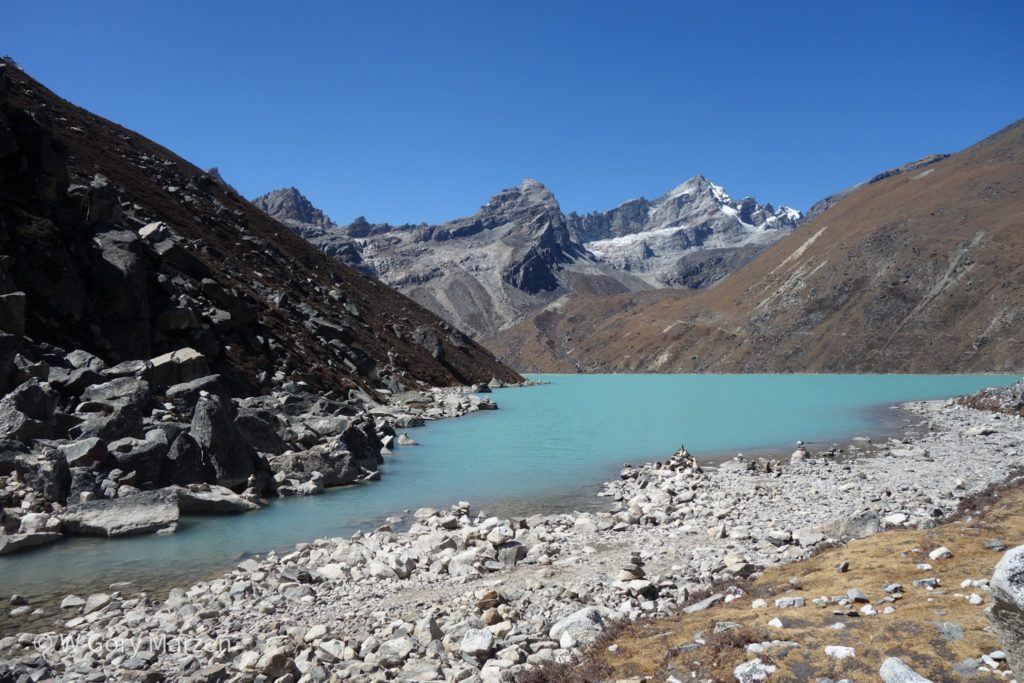
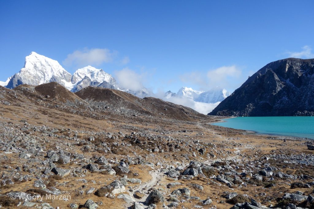
On this cold morning, after digging out of sleeping bags and a solid breakfast, we set off to one of the trekking destinations, i.e. Lake Gokyo Tsho (4750m) over which the Gokyo Ri peak dominates. The landscape is becoming more and more delightful by the minute. Nature is becoming more and more harsh and there are no more green areas here.
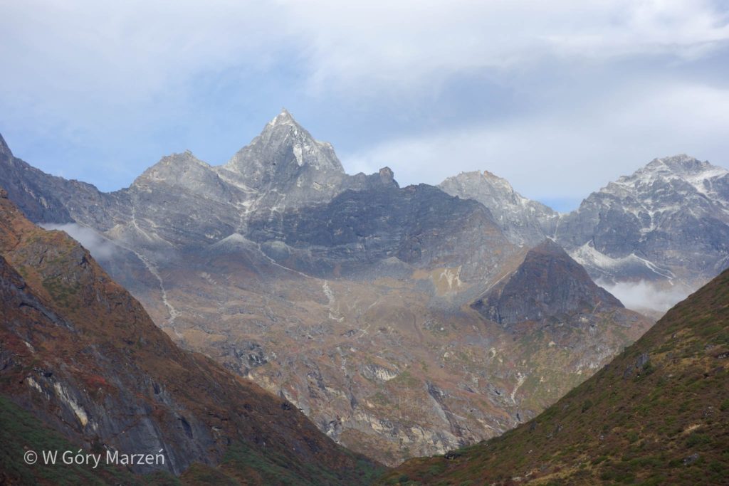
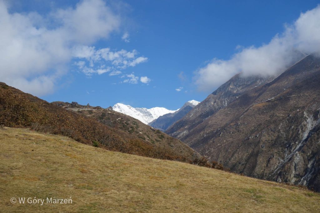
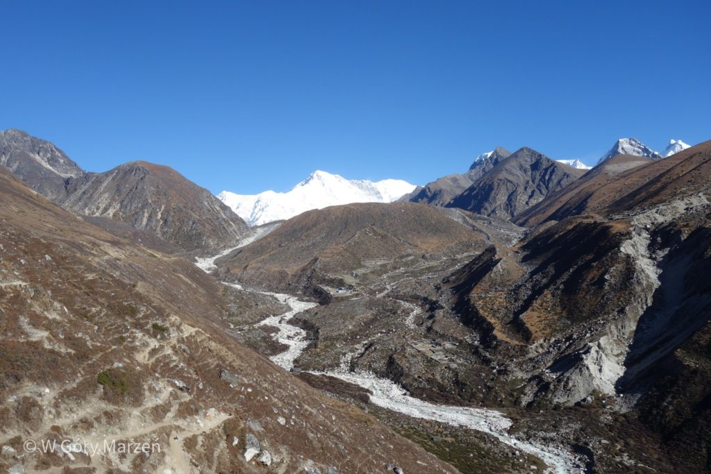
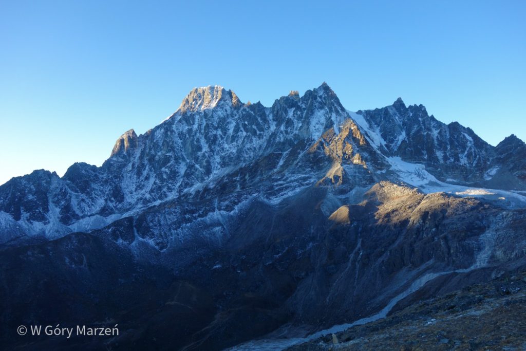
On this day, we have the opportunity to see for the first time with such clarity the 8-thousander Cho Oju (8188m). It is the sixth highest peak in the world in terms of height. Its powerful white ice cap clearly stands out in the landscape.
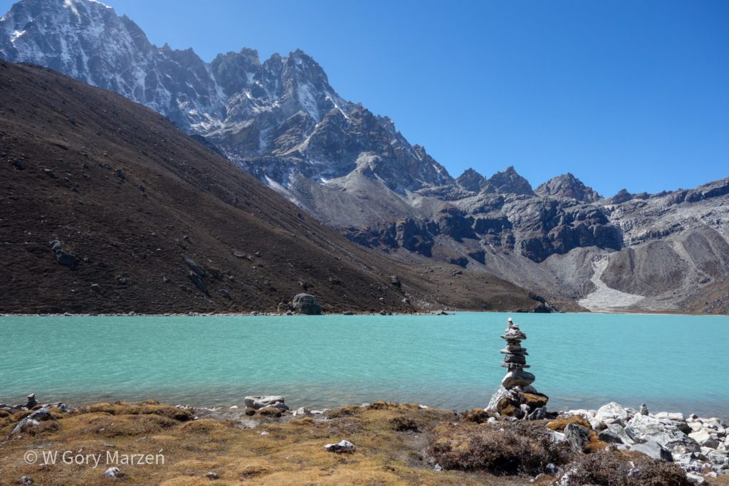
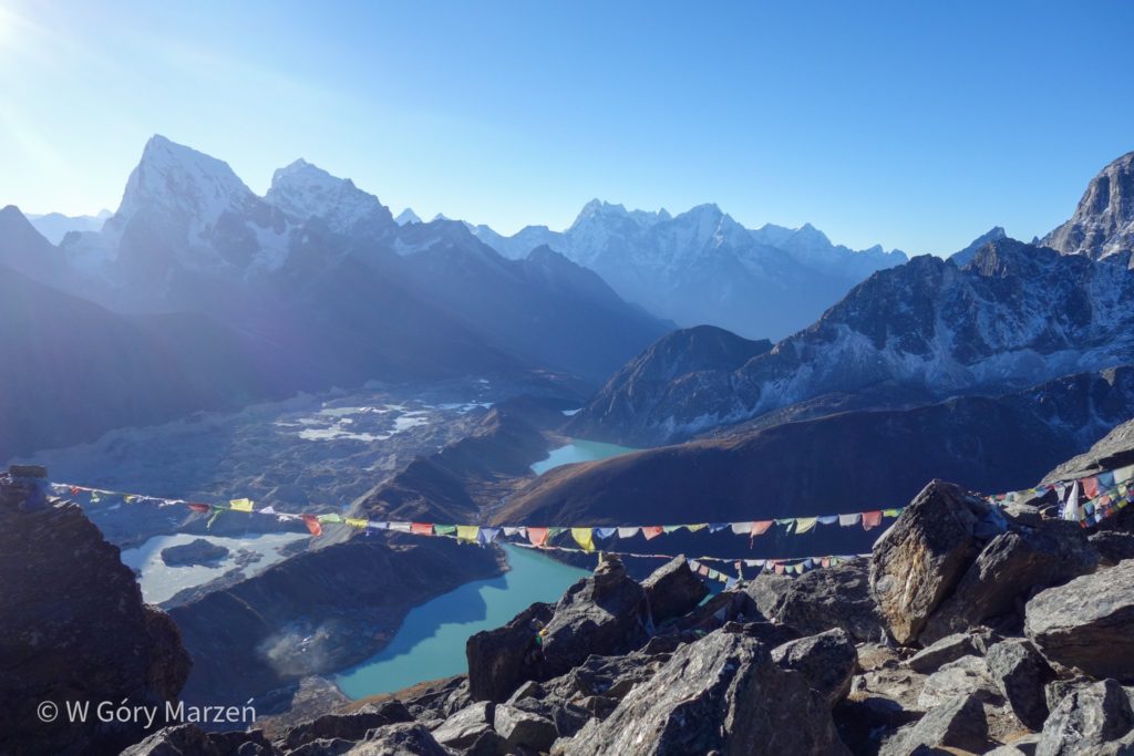
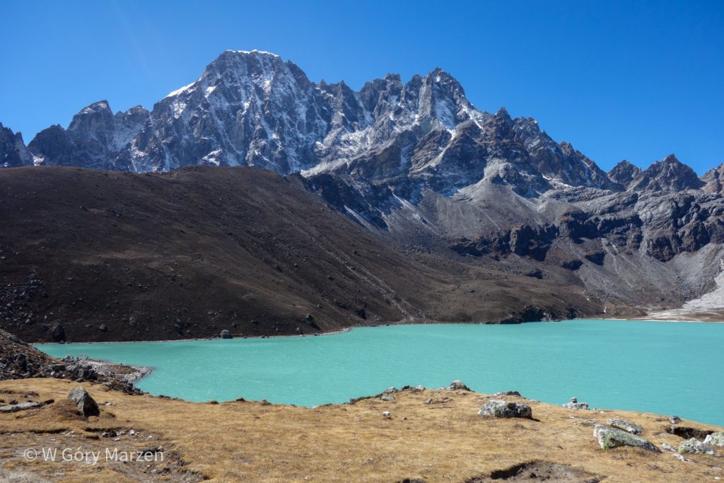
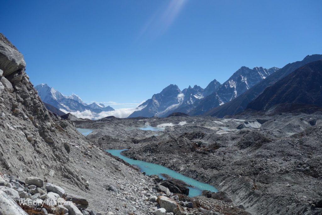
During the trekking we pass by 3 lakes. At the first smallest lake Longpong Tsho (4650m) ends the moraine of the Ngozumpa Glacier. It is one of the longest glaciers in Nepal, which begins 20 kilometers away, under the slopes of Cho Oju. We pass the second lake Taujung Tsho (4730m) and come to another lake Gokyo Tsho (or Dudh Pokhari – 4750m). The color of the water is amazing. The lake is dominated by 6-thousanders. At the end of the lake there is a small village of Gokyo, behind which we can admire Cho Oju. To the left of the 8-thousander we can also see the target for the next day – Gokyo Ri.
Conditions in the village are much more comfortable than anywhere since leaving Namche Bazaar. There is a café where they sell fresh buns and cakes. I also happily take a warm shower. These little things must be enough for the regeneration of the body, because tomorrow morning I set off to conquer my first 5-thousander.


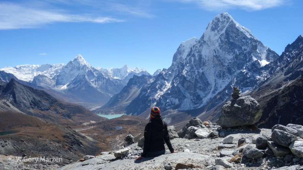
Day 7: Gokyo Ri and Tagnag
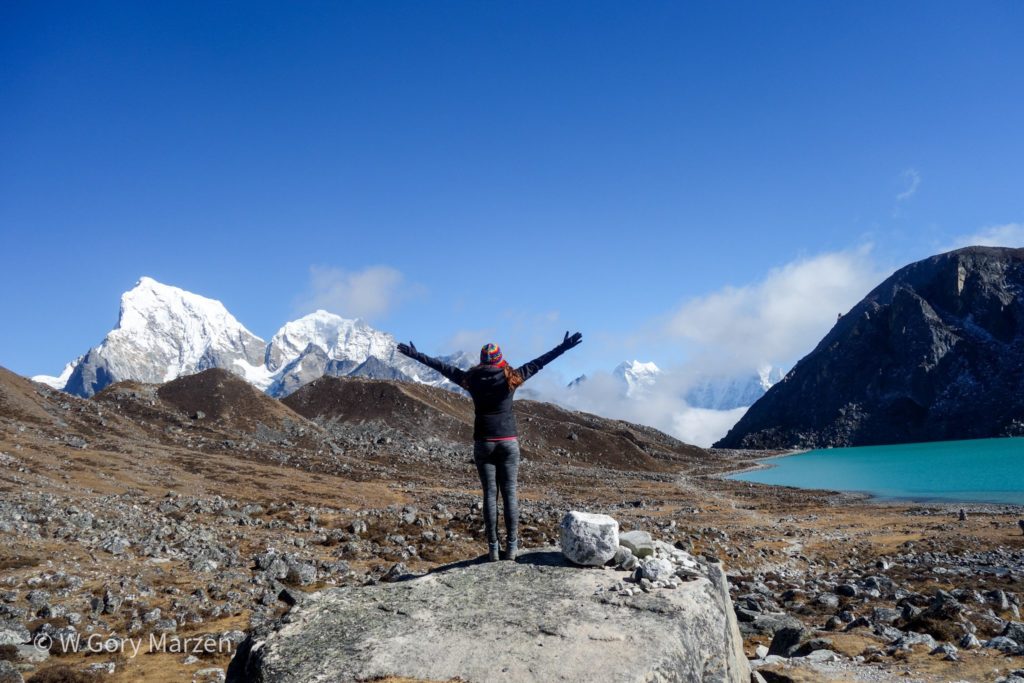
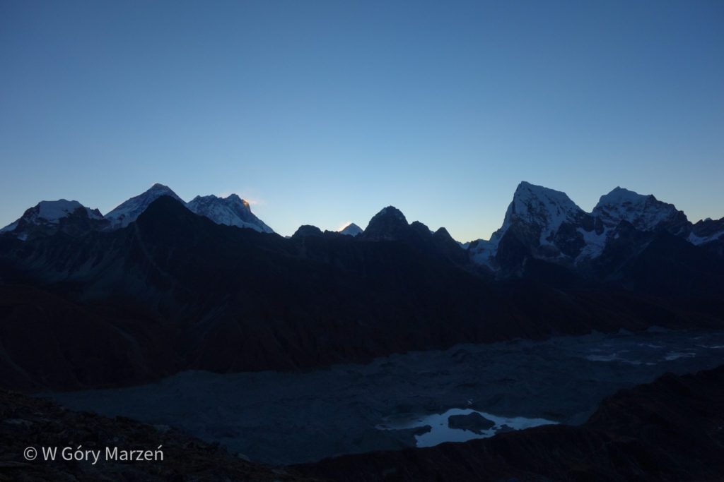
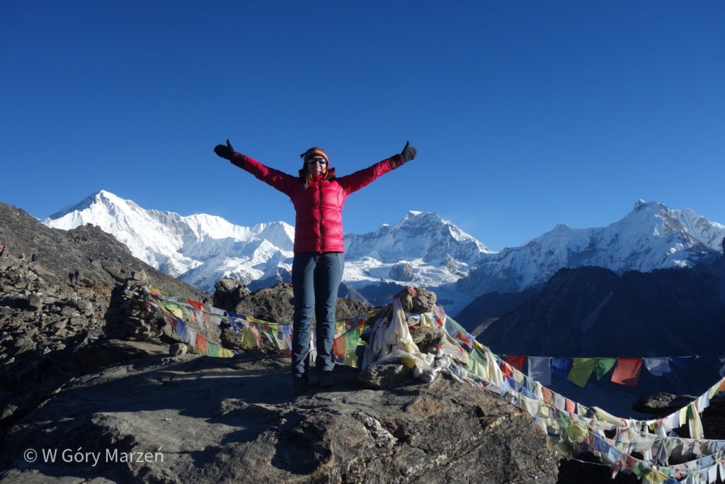
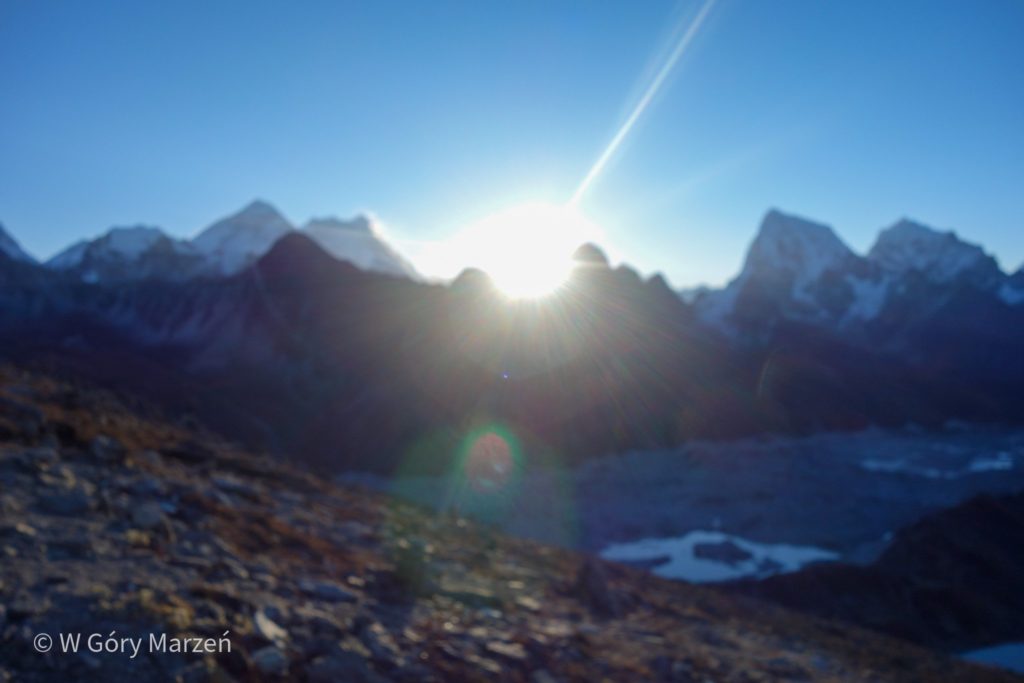
We start the day by waking up around 4 am. We plan to climb to the top of Gokyo Ri (5375m) and see the sunrise there. The road leads through the sway uphill. The height is doing its job and my pace slows down significantly. So much so that I watch the east slightly below the peak. However, the view is also beautiful.
The first rays fall on the highest peak of the earth. From this perspective, it is clearly visible that it is Mount Everest (8850m) in the shape of a pyramid. Immediately afterwards, the tops of other 8-thousanders are highlighted: Lhotse (8516m) and Makalu (8463m). All three of them look like they are burning with fire. Only after a dozen or so minutes the sun reaches other mountains. I am already coming to the top, from which you can see the beautiful lakes of Gokyo. And so from one point on earth we have the opportunity to observe four 8-thousanders.
Such a hike on a 5-thousander makes itself felt. At the top, after moments of joy, comes great fatigue. I move down, but the longer I go down, the harder it is. I get to the lodgy in poor shape. There I eat garlic soup to help with altitude sickness and acclimatization, and then go for a 2-hour nap.
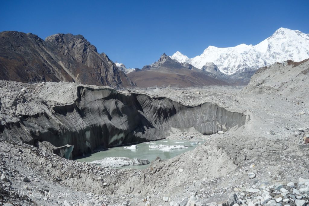
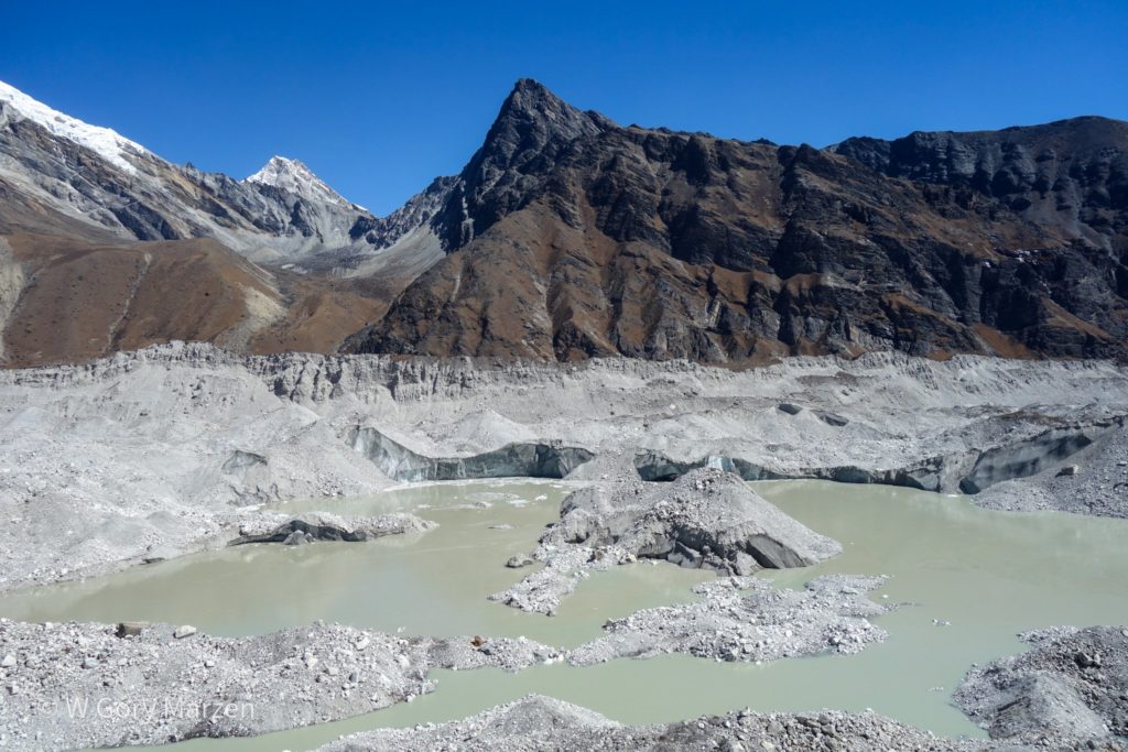
After resting, we go to the small village of Tagnag (or Dragnag – 4700m). To get there we have to go through the Ngozumpa glacier. Fortunately, we do not need any specialized equipment. The glacier is covered with a thick layer of stones, sometimes you can see the rocks under which there is water. From time to time you can also hear the roar of a moving glacier. The passage of the glacier takes about 3-4 hours. Fortunately, we reach our lodgy.
In Tagnag we stay for 2 nights. Originally, we were supposed to stay for an extra night in Gokyo, but by voting (before reaching Gokyo) we decided to go further. However, our psychophysical state required rest. And unfortunately for us in Tagnag there was no longer such an extensive infrastructure (there were only a few cottages in the village).
For the further part of the report from trekking in the Himalayas describing the passage through the Chola Pass (5420m) and the access to Everest Base Camp (5364m) I invite you to part two of the post here.
If you find this post useful and feel like supporting my activities, you can give me a coffee by clicking on the link below. Thank you!

Zuzanna
Hi! My name is Zuzanna, I am from Poland. I love traveling, hiking and doing yoga. Spain is my favorite destination, I walked several Camino de Santiago roads there. I created this blog to share my travel experiences.
You May Also Like
Great Wall of China in 1 day from Beijing – Jinshanling
Hpa An in Myanmar, Mount Zwegabin and Taung Wine