TMB – Tour du Mont Blanc – route, description, campings
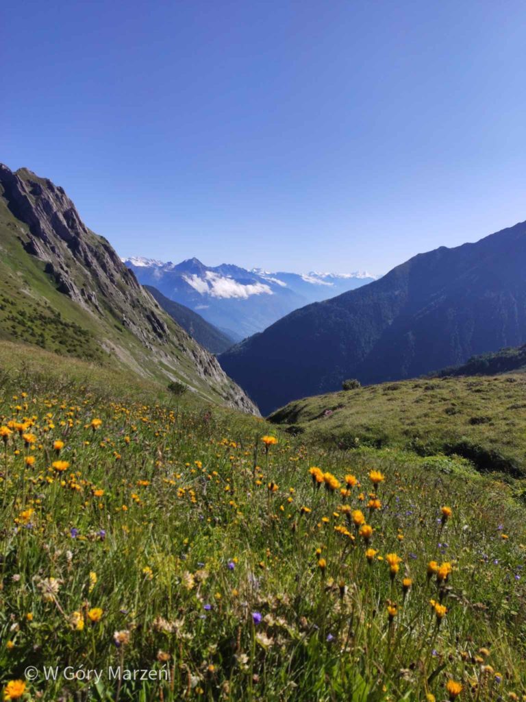
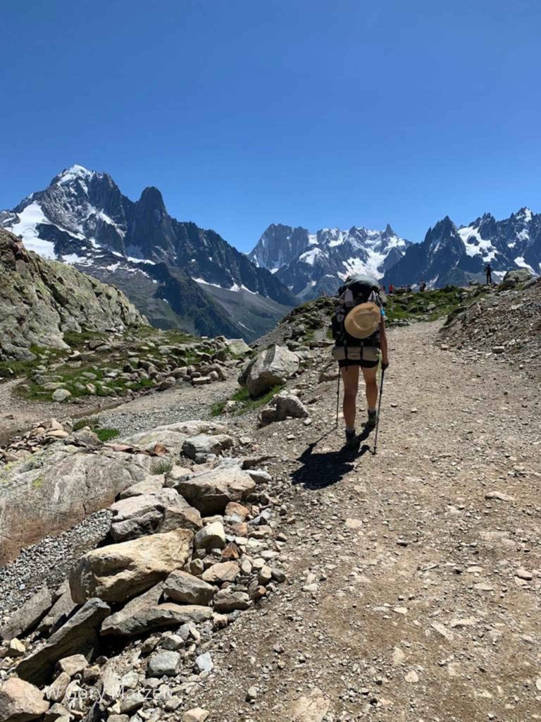
Tour de Mont Blanc (TMB) is a trekking around the Mont Blanc massif. The route leads through 3 countries – Italy, France and Switzerland, is about 170 kilometers long, and the sum of elevations reaches 10,000m. Trekking can start at any point and do it clockwise or counterclockwise. I went to TMB together with Agata, a companion for mountain trips. We decided to go this more classic way, i.e. counterclockwise. We went trekking at the beginning of August 2020. For me it was a continuation of the journey between the trip to the Dolomites and the Camino de Santiago. However, when going into the middle of summer, you need to keep in mind the high temperatures and the scorching sun.
TMB we started in Italy in Courmayer. The town is easy to get to, for example, due to the Flixbus connection with Turin, Milan and Bergamo Airport. The same bus also reaches Chamonix, from where it is close to Les Houches – the most popular starting point of TMB.
All the tips, the total cost and a packing list I described in this TMB post.
All prices below are for trekking in 2020 for two people and one tent.
Arrival and overnight stay in Courmayeur
We arrived in Courmayer around 18 Flixbus from Bergamo. Behind us was already a week-long trip to the Dolomites. Also on the same day we reached the Grandes Jorasses campsite located about 6 kilometers from the center of Courmayeur. The campsite can also be reached by a free bus from the center. Most of the route ran through the town and asphalt road.
Route: Courmayour –> camping Grandes Jorasses
Distance : 6,3km
Elevation: 393m
Accommodation: Camping Grandes Jorasses
Price : 20 euro
Shop: a lot of shops in Courmayeur
Day 1: Camping Grandes Jorasses –> La Fouly
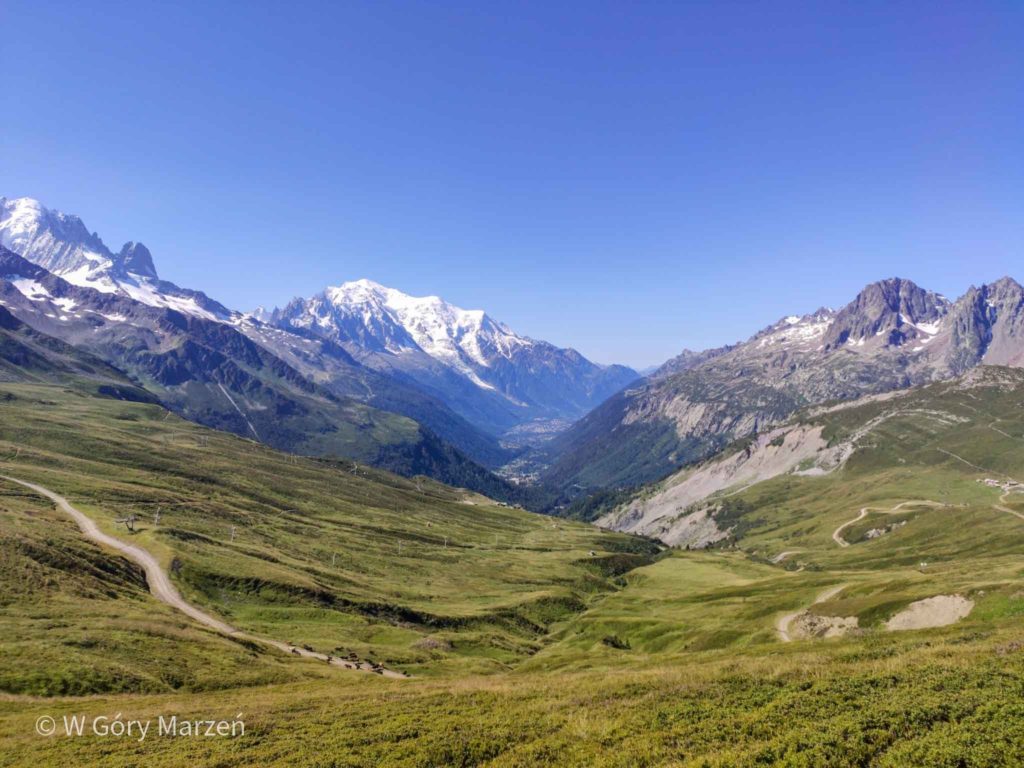
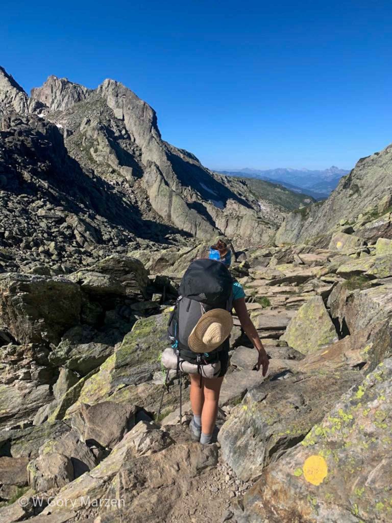
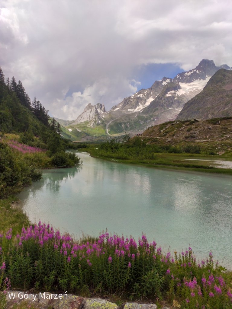
Already on the first day we cross the border with Switzerland. The route begins with a 3-kilometer asphalt road, from which we enter the approach through the pastures of cows. The route is quite gentle, but we are affected by heavy backpacks (mine weighs about 12-13 kilograms). On this day we approach the Grand Col Ferret pass (2537m above sea.c. However, the descent is already very gentle, the end is passed by asphalt. The lower we are, the more clouds appear in the sky.
In the town of La Fouly there is a Camping des Glaciers,where we spend the night and a shop located on the main road. The campsite is very well equipped. It also has a common room with a kettle, TV and computer, where we hide from the rain.
Day 1 TMB: camping and information
Route: Camping Grandes Jorasses –> Grand Col Ferret Pass –> La Fouly
Distance: 20km
Elevation: 946m
Time: 7h
Accommodation: Camping des Glaciers
Price: 34 francs
Shop: well-equipped shop 5 min from the campsite

Day 2: La Fouly –> Champex
On the second day, we are awakened by announcements of rain, so we are not in too much of a hurry to leave the campsite. We take advantage of the convenience of the common room and leave the campsite only before 10 o’clock. This is one of the shortest and easiest sections of trekking, because the route leads mainly through the forest and several towns.
The biggest approach awaits us only at the end of the route. However, just before Champex it starts to rain, which quickly turns into a downpour. We seek refuge in the garage in the first house we see after leaving the forest. Unfortunately, it does not promise to improve the weather, so we move towards the campsite in a constant downal. On the way, we also go to the store to replenish supplies. We already know that there will be no shop in the town the next day.
We come to Camping Rocailles. This is one of the more expensive campsites on the route (ah these Swiss prices). On the spot there is a carport under which we are looking for shelter (several tables, a kettle and a microwave, there is also a small shop at the reception) and we wait for a moment without rain to set up a tent.
Day 2 TMB: camping and information
Route: La Fouly –> Champex
Distance: 15km
Elevation: 552m
Time: 5h
Accommodation: Camping Rocailles
Price: 33,20 francs
Shop: in Champex, on the way to the campsite
Day 3: Champex –> Le Peuta
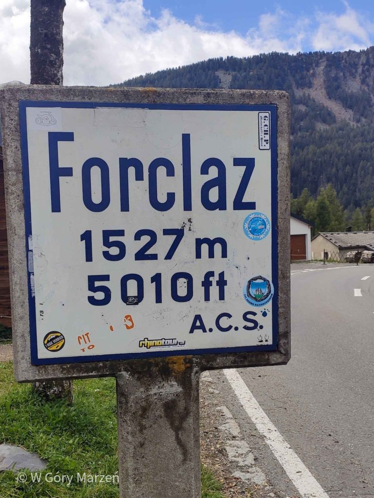
The weather the next day does not promise to be better, so we give up the alternative route through the highest point of TMB Fenetre d’Arpette (2665m above sea level). This variant is best chosen only in nice weather. Our classic route leads through the forest, fortunately it does not rain anymore. On the way we pass through several streams, strongly fed with water from rainfall. The highest point of our route is located at the Bovine restaurant. Further descent is very gentle and does not cause problems. We come to the town of Forclaz from where we go to the campsite in Le Peuty. From here the descent is already quite sharp, but the weather is starting to improve and we see the first peaks in the area.
Le Peuty is really a camping field,with a toilet and shower in a converted toi toju. Around 6 p.m., a lady arrives collecting a fee for the possibility of setting up a tent. It is the weakest and at the same time the coldest accommodation on the route. The temperature has dropped even to 2 degrees above zero, a strong wind is blowing, so we go to bed early with the hope of surviving that night.
Day 3 TMB: camping and information
Route: Champex –> Le Peuty
Distance : 15km
Elevation: 738m
Time: 6h
Accommodation: Camping Le peuty
Price: 12 euro / 12 francs
Shop: self-service with pasta, eggs, cheese in the fridge
Day 4: Le Peuty –> Tre Le Champ
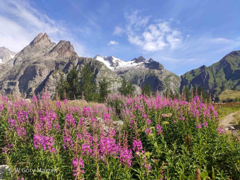
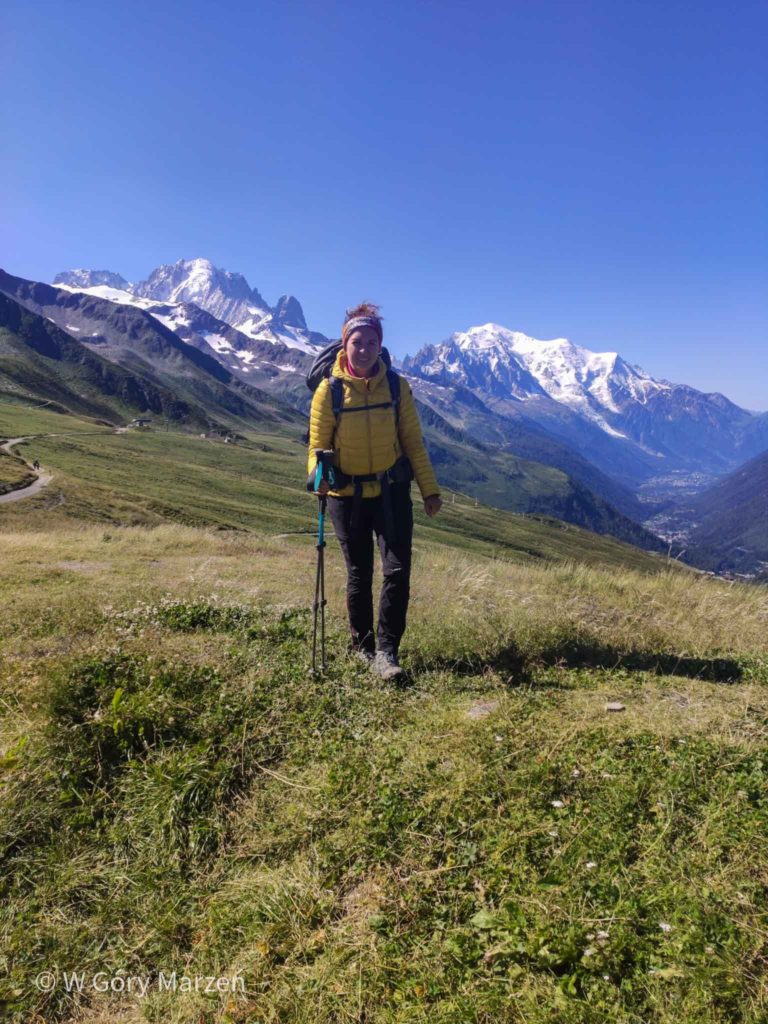
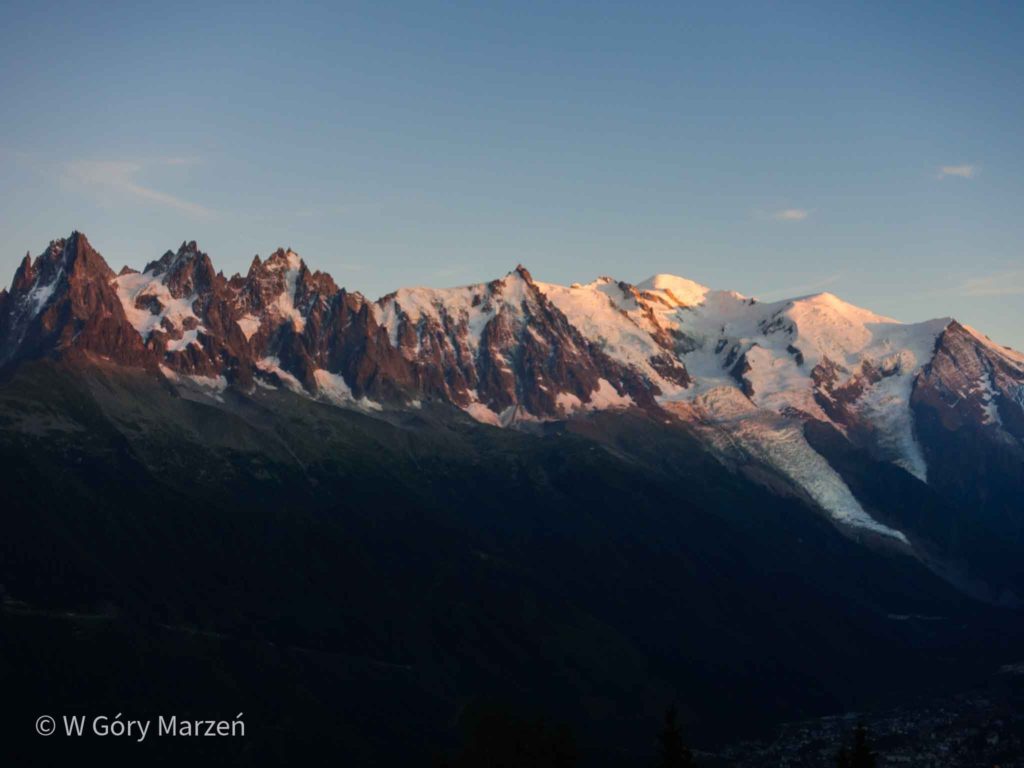
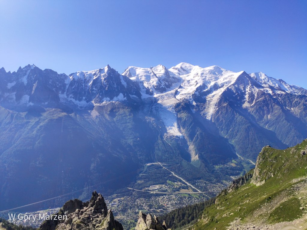
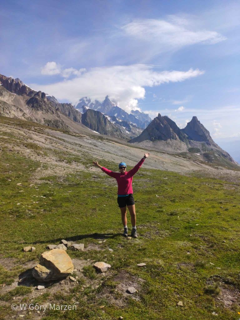
That night was extremely cold. We get up early in the morning hoping to warm up on the approach. Today we go to France through the Col de Balme pass (2 195m). The approach starts just after leaving the campsite and most of the route runs through the forest. At the top there is a very atmospheric hostel serving delicious pancakes. In France, we are greeted by a cloudless sky and the first view of Mont Blanc from the north,which will accompany us for the next few days. We choose a longer variant of the route through the Aiguillette des Posettes to enjoy the sun and views.
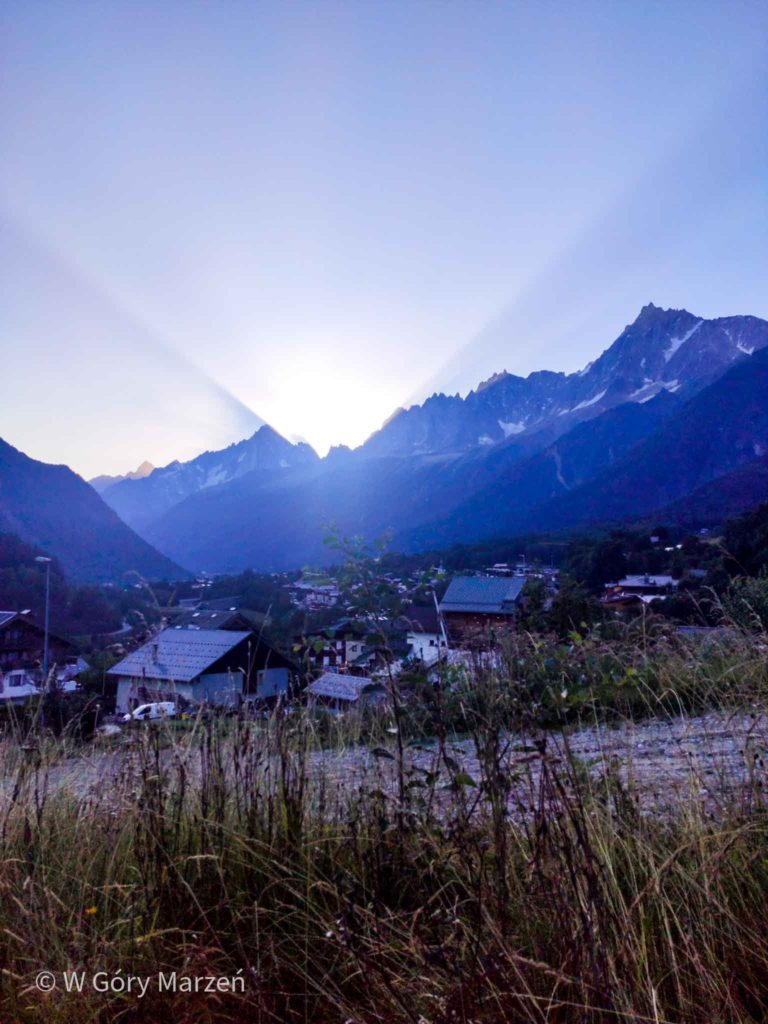
We go down to Tre Le Champ with the intention of sleeping at the Tre Le Champ campsite, but on the spot it turns out that in 2020 it was closed. In this moment w decide to search for a nearby alternative campsite at the Boerne hut. It is a very charming, small hostel with a restaurant and the possibility of setting up a tent. There is also a kettle and microwave inside. We can also load the electronic equipment and sit in the canteen. After replenishing supplies, we go to the town of Argentiere, located 2 kilometers from the hostel. We can do more shopping there, because the next day we sleep in the mountains. The town has sports shops, restaurants and a bakery.
Day 4 TMB: camping and information
Route: Le Peuty –> Col de Balme –> Aiguillette des Posettes –> Tre Le Champ
Distance: 13km
Elevation: 876m
Time: 7h
Accommodation: Camping Boerne
Price: 16 euro
Shop: in the town of Argentiere, large selection plus sports shops, bakery
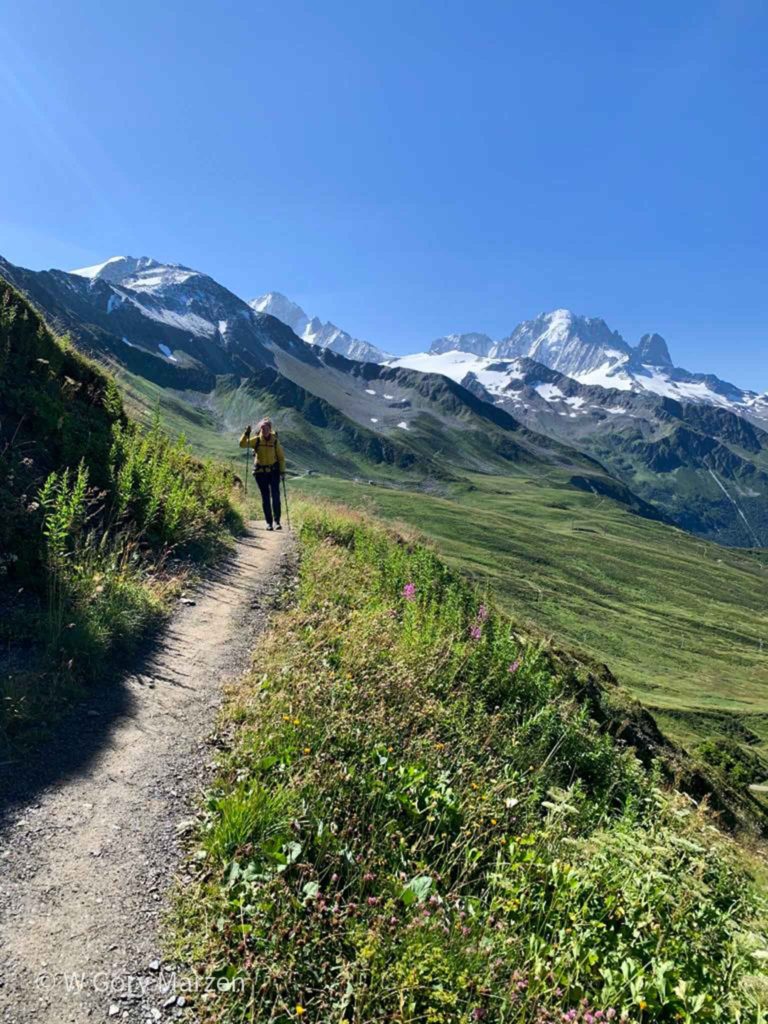
Day 5: Tre Le Champ –> La Flegere
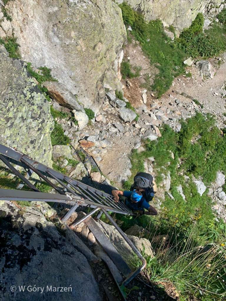
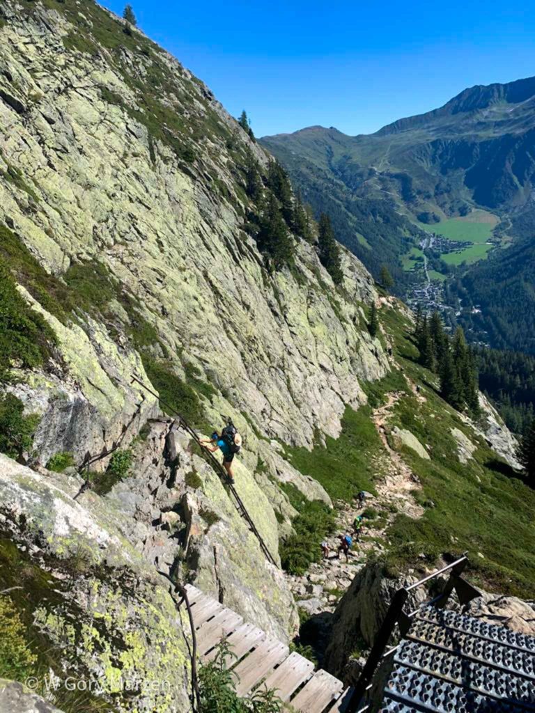
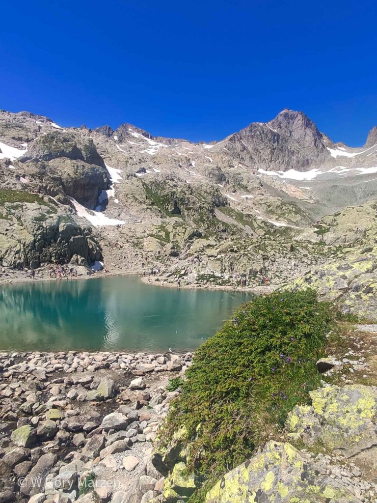
The next day is quite short, but more demanding. This is the first completely nice weather day on TMB. Accustomed to the clouds and cold of the previous days, we leave only before 9 o’clock. We aim at the La Flegere shelter,which we reach through the Lake Lac Blanc (2352m a.s.c.).On the route to the lake, ladders and chains are waiting for us.
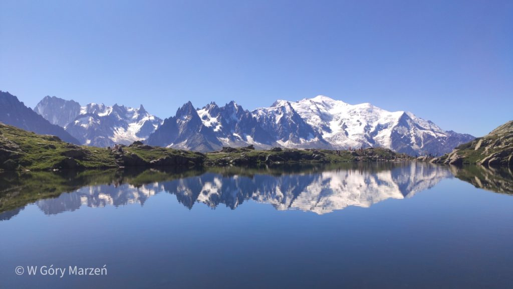
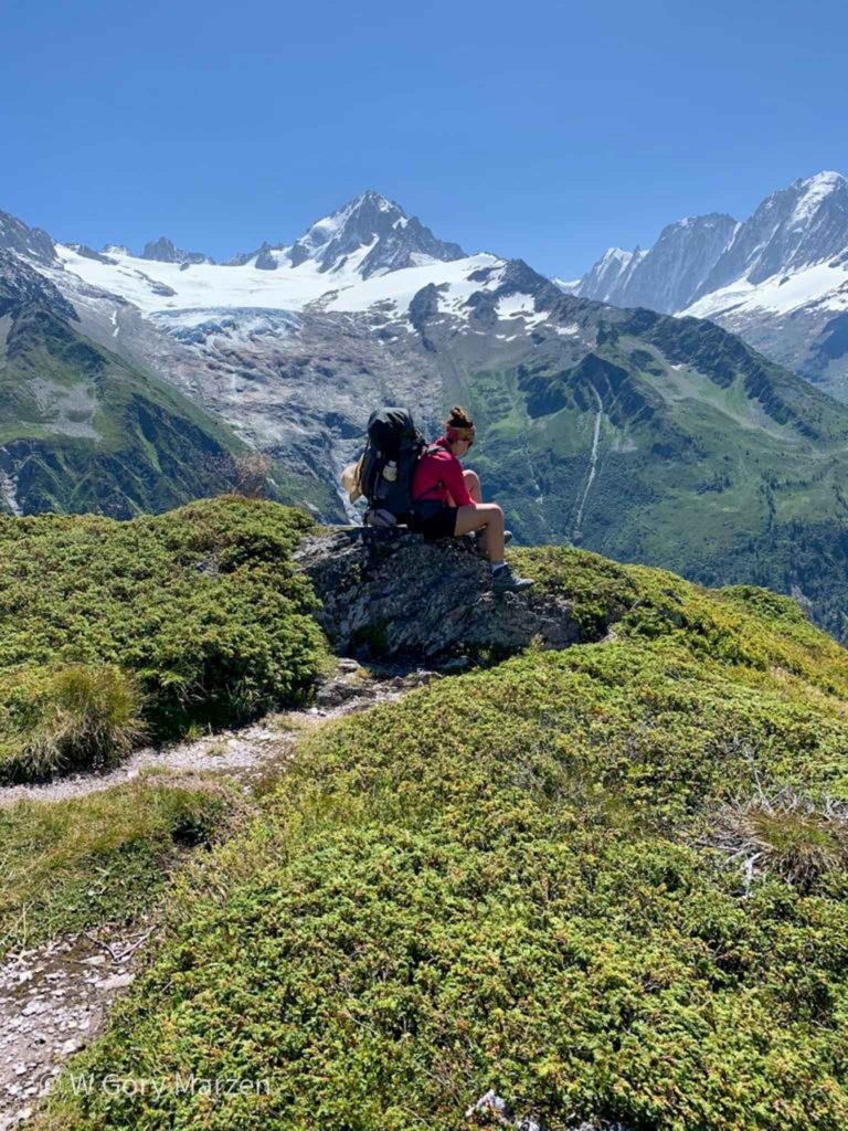
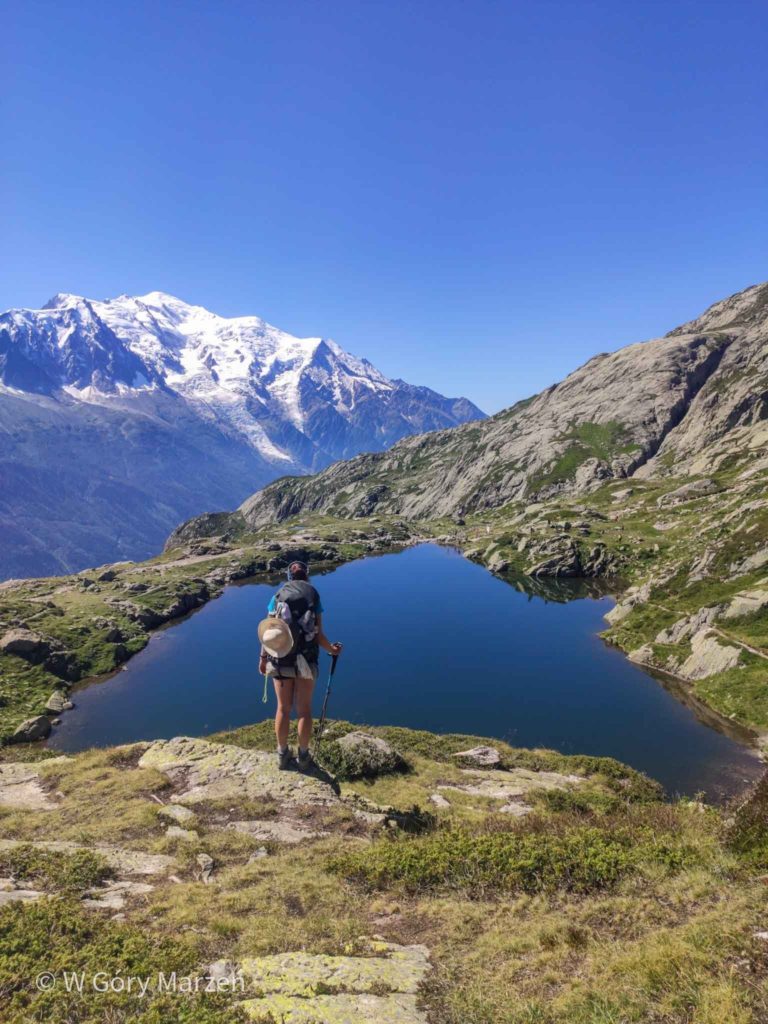
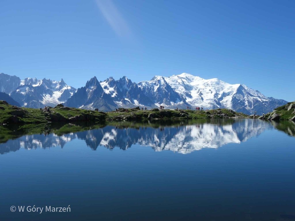
Without a doubt, it is worth stopping at the lacs de Cheserys lake from where we have an amazing view of Mont Blanc reflected in the surface of the water. After a long moment of rest by the water, we go to Lac Blanc, and there the atmosphere is more like Morskie Oko. First of all, there are a lot of people who drive up to the area by train. The sun at the zenith catches up with us, which makes us very lazy and we are desperately looking for a shadow. After a dozen or so minutes, we decide to go down and look for a place to pitch a tent. The descent to La Flegere is very loose and you have to be very careful with both stones and people. Most of the time we walk in a crowd.
In La Flegere, with the permission of the shelter staff, we pitch a tent by the water reservoir. On this day, only a beautiful sunset with a view of Mont Blanc awaits us.
Day 5 TMB: camping and information
Route: Tre Le Champ –> Lac Blanc –> La Flegere
Distance: 8,3 km
Elevation: 958mDust time: 6h
Accommodation: at the La Flegere hostel
Price: 0 pln
Shop: no
Day 6: La Flegere –> Les Houches
The next day we change tactics and move after 7 to avoid the scorching sun. The first stop is the peak of Brevent (2525m above sea above sea). As it is early on the route we meet quite fewpeople, there are also no points with drinking water. Near the top we have to overcome several ladders. Brevent has a cable car station and a restaurant. However, we do not take a long break and start the long and arduous descent to Les Houches. We have about 1500 meters down to overcome.
The first part of the route to the Refuge de Bellachat is quite pleasant and gentle. Unfortunately, the sun is already starting to heat up strongly, and behind the shelter the time is incredibly long and we have the impression of standing still. The first part leads quite sharply down. Finally, we descend to the border of the forest, where the desired shade awaits us and still over 900m down. Undoubtedly, the route stretches and lengths. It is only after a few long hours that we reach Les Houches.
Initially, we planned to sleep at the Bellevue campsite, but it was also closed in 2020. That’s why we only shop in Les Houches and in a moment we set off on a free bus in the direction of Chamonix to the Grand Champ campsite. We are lucky and get the last free place to set up a tent.
Day 6 TMB: camping and information
Route: La Flegere –> Brevent –> Les Houches
Distance: 21km
Elevation: 1511m
Time: 7,5h
Accommodation: camping Grand Champ
Price: 16,4 euro
Shop: Carrefour in Les Houches
Day 7: Les Houches –> Les Contamines
The next day is one of the most demanding on the route. We get up in the morning and take the bus to the place where we finished the hike the previous day. The beginning of the route is a arduous, steep and long ascent by a dirt road. At the railway station there is a camping field. From this point until Les Chapieux there will be several such places where you can pitch a tent for free.
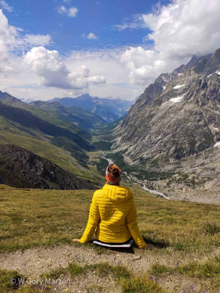
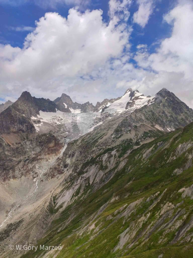
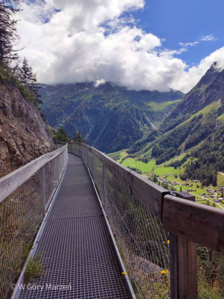
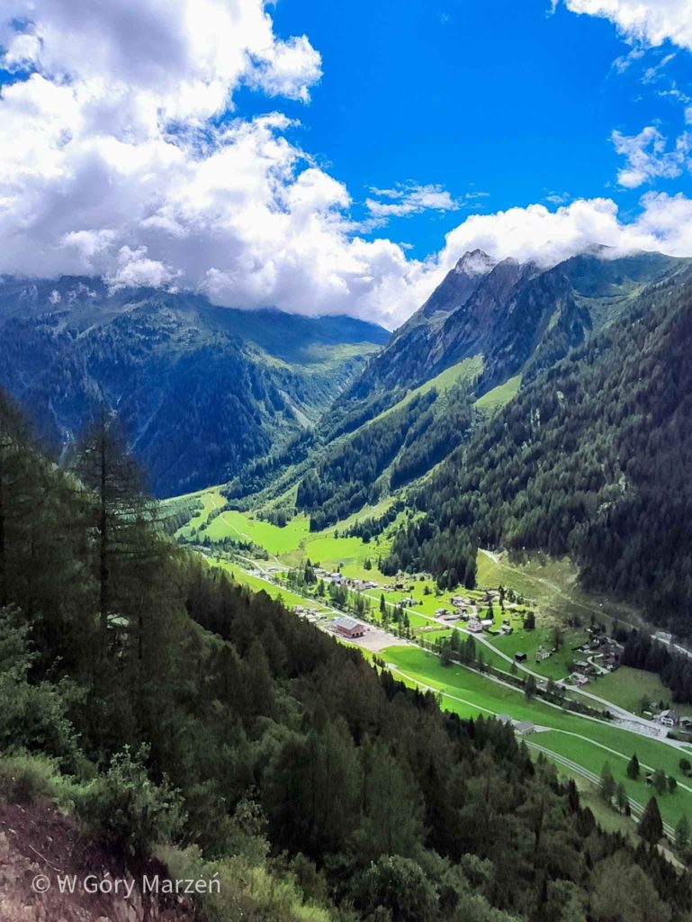
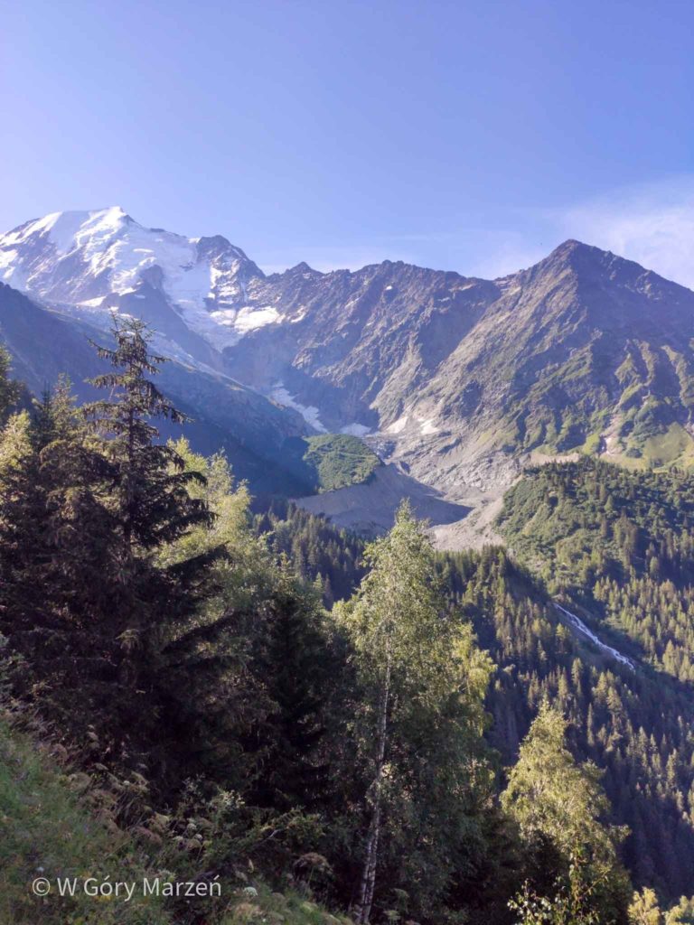
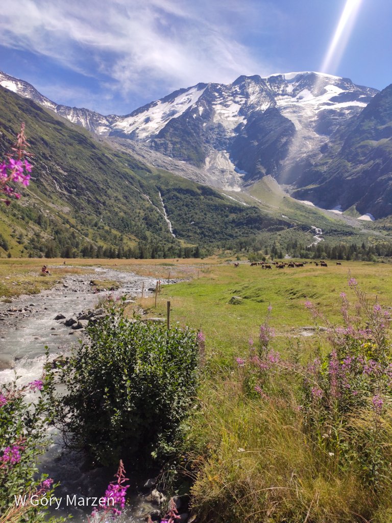
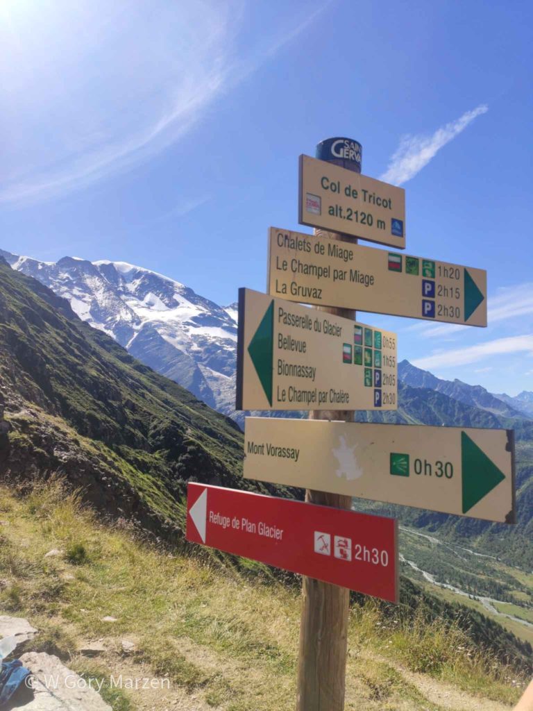
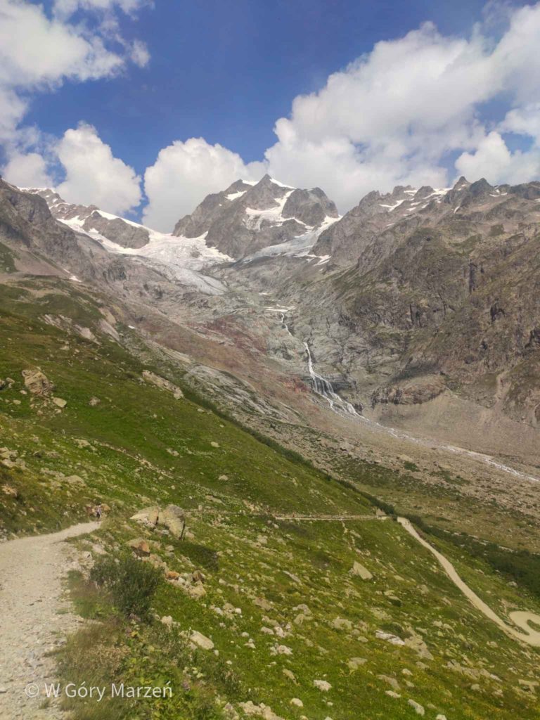
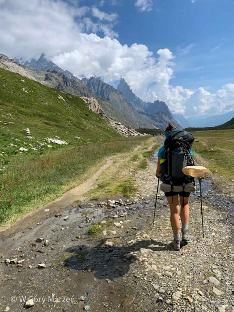
Here we choose a variant through the Col de Tricot pass (2120m above sea through). Initially, this variant of the route runs a fairly flat terrain through the forest. We have a beautiful view of the mountains and the glacier, so we decide to reduce the weight of backpacks a little and drink coffee in this beautiful environment. The stop is a little longer for us and we move on after 10. We come to the suspension bridge and from this point the uphill entrance begins. We quickly go beyond the border of the forest, where there is no longer a slight hint of shade.
Finally, we reach the pass from where a rather sharp descent down to the village of Chalet de Miage awaits us. There is a hostel, a restaurant, a camping field and a stream where we cool our feet. After another break we go to Les Contamines. To get there we have to go about 180 meters up, and then go down a long way to Les Contamines.
In the city there is Carrefour, several shops and restaurants. After shopping, we go to the camping Le Pontet located 3 kilometers outside the town.
Day 7 TMB: camping and information
Route: Les Houches –> Col de Tricot –> Les Contamines
Distance: 21km
Elevation: 1478m
Time: 7h
Accommodation: Le Pontet
Price: 17 euro
Shop: on the way in Les Contamines
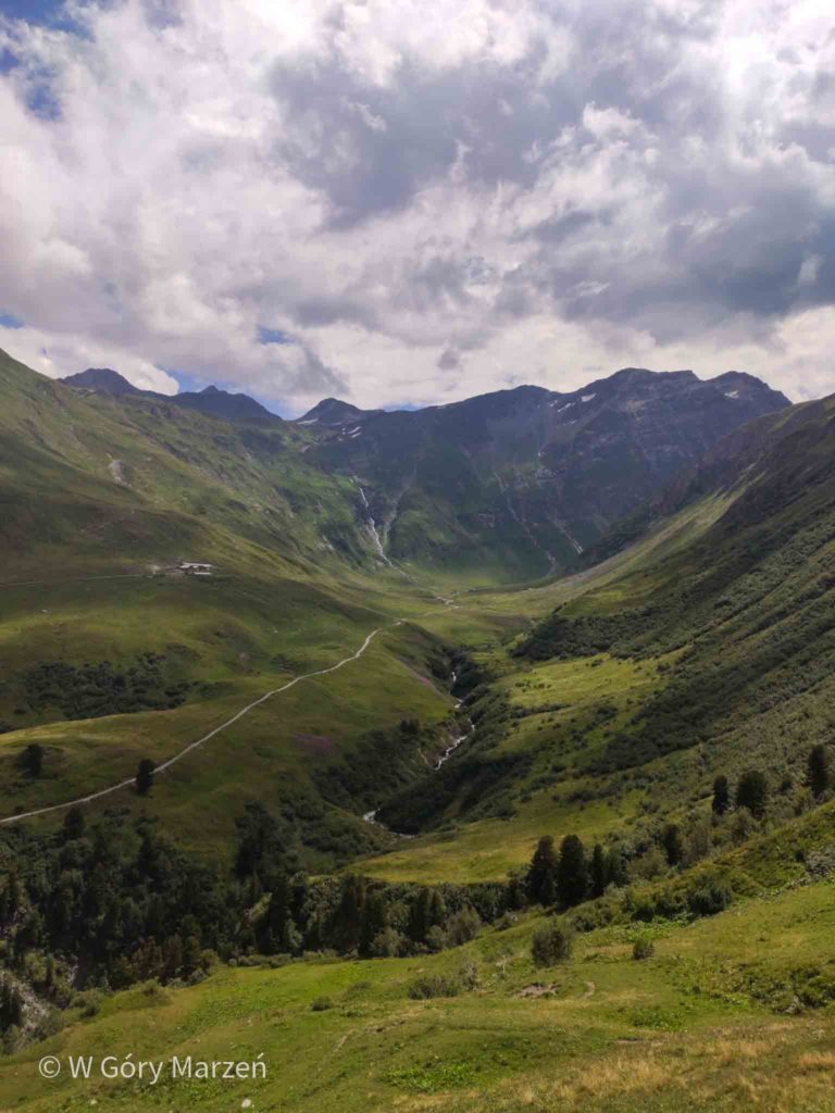
Day 8: Les Contamines –> Les Chapieux
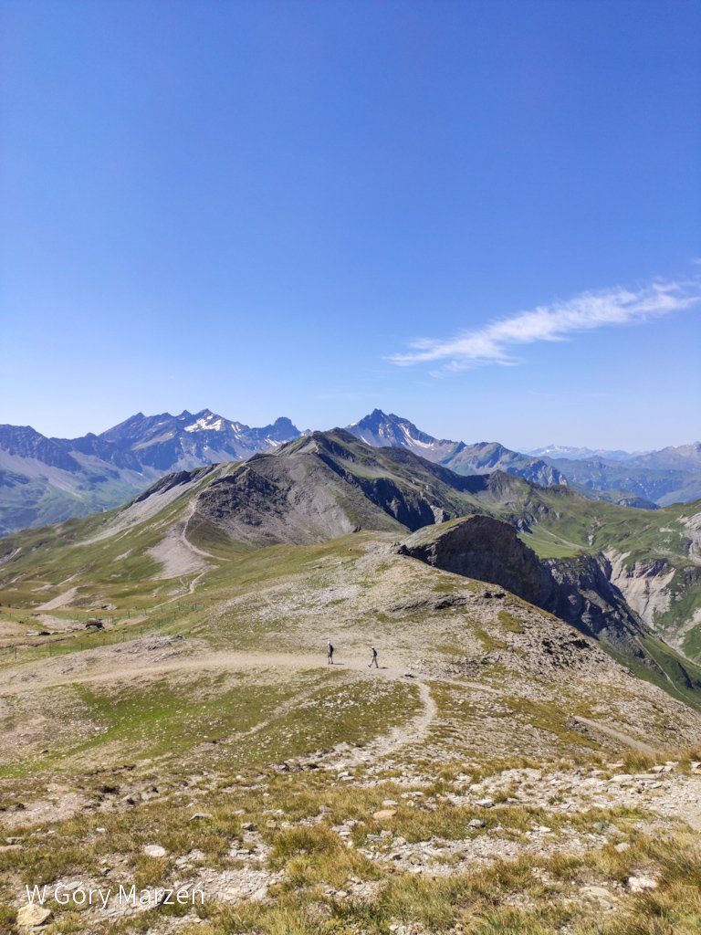
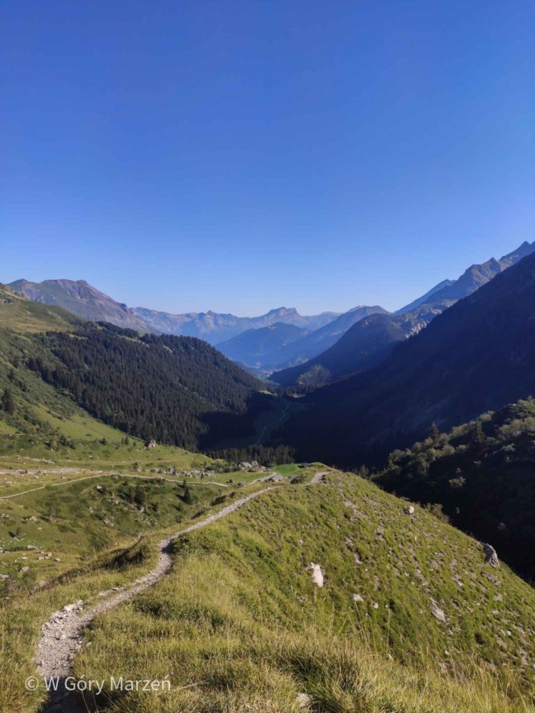
The next day we get up with the sun and leave the campsite around 7. There are no special difficulties on the route. Initially, the route leads for quite a long time through flat terrain, we pass a lot of taps with drinking water and camping fields. We approach the Col de Bonhomme pass (2340m above sea above sea) from where we have a beautiful view of the north and south sides. After the break we set off towards the Croix du Bonhomme shelter (2442m above sea above sea). At the hostel you can choose an alternative route through the Col des Fours pass. However, we set off to the camping field in Les Chapieux. On the route down once again we do not find a shadow.
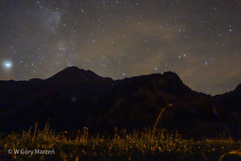
In Les Chapieux we find an information point with a toilet and drinking water open 24 hours. There is also a hostel, a restaurant and a shop with cheese and baguettes. We can take a shower in the hostel for 5 euros.There is absolutely no coverage, if we really want contact with the world, we can buy access to WiFi – 30 minutes for 2 euros. We are lucky because on this day in Les Chapieux there is a concert that makes it more pleasant for us to rest under the trees. In addition, thanks to being cut off from civilization, we can admire the wonderfully starry sky, even without leaving the tent.
Day 8 TMB: camping and information
Route: Les Contamines –> Col de Bonhomme –> Les Chapieux
Distance: 17km
Elevation: 1300mTime: 7h
Accommodation: Les Chamieux camping field
Price: 0 pln
Shop: small cheese and baguette shop
Day 9: Les Champieux –> Courmayeur
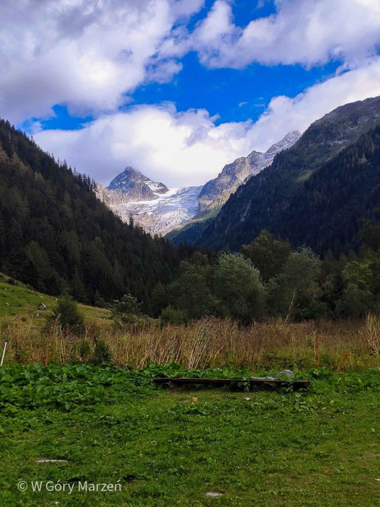
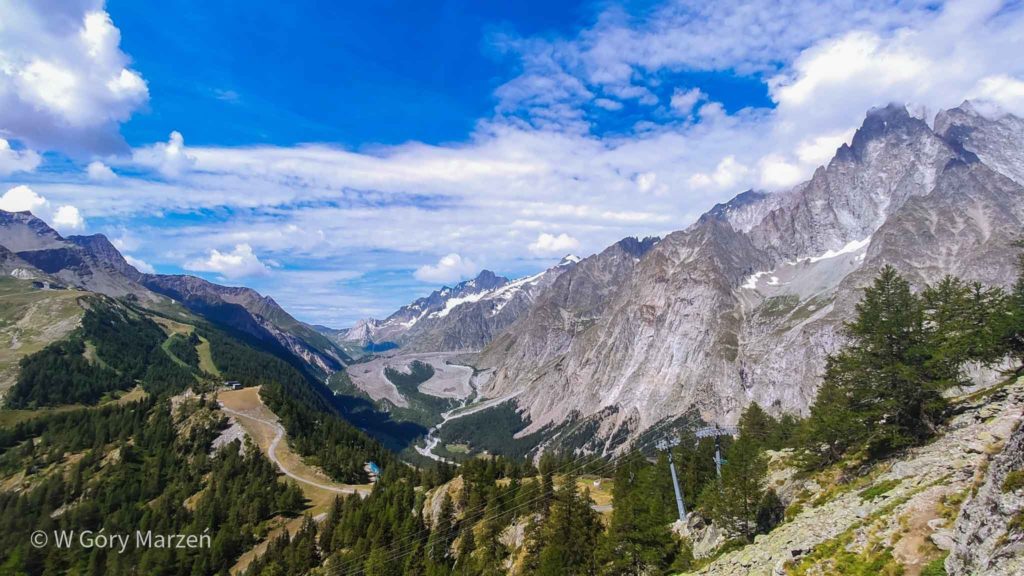
This is our last day at TMB and that day we are back in Italy. We set off from the campsite on a little inclined road. It is only at the Refuge des Mottets that the route begins to be steep. In the area we also see several people sleeping in the wild. We continue to the Col de la Seigne pass (2520m above sea above sea) on which the French-Italian border is located. Once again we have an amazing view of Mont Blanc. The environment here changes significantly to a more rocky and harsh one.
Now we are waiting for a calm descent down a wide valley. On the way we pass the Rifugio Elisabetta hut and Cabane du Combal where the trail leading to Mont Blanc from the Italian side begins. On each side we are surrounded by a beautiful view. During the descent we are caught by a light rain, as a harbinger of the evening storm.
This night and the next we stay at the La Sorgente campsite near Courmayeur. The campsite is located at the foot of the mountains. To get down to it we have to bounce back a bit from the main TMB route. There is also a free shuttle bus from the centre of Courmayeur. At the campsite we will find a mini market, where we can order fresh bread for the morning, a canteen, a barbecue area and a lot of attractions (mainly for children ?). This is our last stage of the journey and we also rest with joy.
Day 9 TMB: camping and information
Route: Les Champieux –> Col de la Seigne –> Rifugio Elisabetta –> Courmayeur
Distance: 23km
Elevation: 1000m
Time: 7,5h
Accommodation: Camping la Sorgente
Price: 22,8 euro
Shop: small camping market or shops in Courmayeur
TMB End of trekking
As we had a trekking planned for 10 days, and we reached Courmayeur the day before, on the last day we made an ascent to the Mont Chetif mountain in Courmayeur. Without a doubt, there is a beautiful view of the Italian town and the surrounding mountains.
And so summing up the Tour du Mont Blanc behind us. The route offers plenty of beautiful views and daily contact with nature. Before leaving, it is worth looking for trekking maps, although we can get them at any information point or buy more detailed maps in the store. The trail in Italy and Switzerland is very well marked, in France you can only see the marking on the information bars (such as the beginning of the route or the pass). TMB is a great trekking route, especially if this year we do not have the opportunity to further travel outside Europe.
If you find this post useful and feel like supporting my activities, you can give me a coffee by clicking on the link below. Thank you!

Zuzanna
Hi! My name is Zuzanna, I am from Poland. I love traveling, hiking and doing yoga. Spain is my favorite destination, I walked several Camino de Santiago roads there. I created this blog to share my travel experiences.
You May Also Like
Fisterra y Muxía – extension of the Camino de Santiago
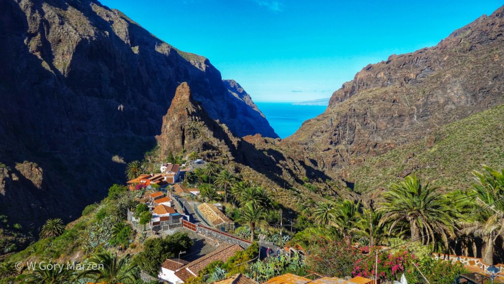
Tenerife – what to see, practical information